 |
|
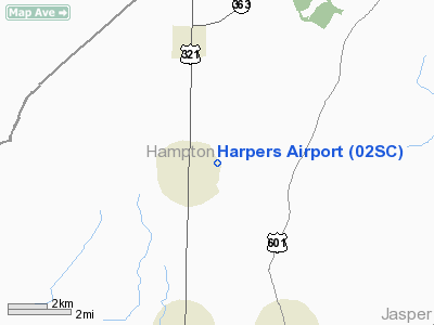
Location & QuickFacts
| FAA Information Effective: | 2008-09-25 |
| Airport Identifier: | 02SC |
| Airport Status: | Operational |
| Longitude/Latitude: | 081-13-29.3690W/32-45-30.6070N
-81.224825/32.758502 (Estimated) |
| Elevation: | 111 ft / 33.83 m (Estimated) |
| Land: | 8 acres |
| From nearest city: | 1 nautical miles NE of Estill, SC |
| Location: | Hampton County, SC |
| Magnetic Variation: | 04W (1985) |
Owner & Manager
| Ownership: | Privately owned |
| Owner: | Bill Harper |
| Address: | Box 788
Estill, SC 29918 |
| Phone number: | 803-625-0111 |
| Manager: | Bill Harper |
| Address: | Box 788
Estill, SC 29918 |
| Phone number: | 803-942-0633 |
Airport Operations and Facilities
| Airport Use: | Private |
| Wind indicator: | Yes |
| Segmented Circle: | No |
| Control Tower: | No |
| Landing fee charge: | No |
| Sectional chart: | Atlanta |
| Region: | ASO - Southern |
| Boundary ARTCC: | ZJX - Jacksonville |
| Tie-in FSS: | AND - Anderson |
| FSS on Airport: | No |
| FSS Toll Free: | 1-800-WX-BRIEF |
| NOTAMs Facility: | AND |
Airport Services
| Airframe Repair: | NONE |
| Power Plant Repair: | NONE |
| Bottled Oxygen: | NONE |
Runway Information
Runway 04/22
| Dimension: | 3600 x 150 ft / 1097.3 x 45.7 m |
| Surface: | TURF, Good Condition |
| |
Runway 04 |
Runway 22 |
| Traffic Pattern: | Left | Left |
| Runway End Identifier: | No | No |
| Centerline Lights: | No | No |
| Touchdown Lights: | No | No |
| Obstruction: | 65 ft trees, 270.0 ft from runway, 40 ft right of centerline, 3:1 slope to clear
PLINE 90' LEFT OF EXTNDD CNTRLN. | 37 ft trees |
|
Radio Navigation Aids
| ID |
Type |
Name |
Ch |
Freq |
Var |
Dist |
| JYL | NDB | Sylvania | | 245.00 | 04W | 19.8 nm |
| BZ | NDB | Bullo | | 407.00 | 05W | 30.3 nm |
| RBW | NDB | Walterboro | | 221.00 | 05W | 31.2 nm |
| BKO | NDB | Barnwell | | 392.00 | 06W | 36.8 nm |
| LNH | NDB | Millen | | 205.00 | 05W | 38.4 nm |
| OYI | NDB | Orangeburg | | 226.00 | 05W | 42.8 nm |
| BXG | NDB | Burke County | | 356.00 | 04W | 42.9 nm |
| CWV | NDB | Claxton | | 395.50 | 04W | 47.4 nm |
| MHP | NDB | Metter | | 432.00 | 03W | 49.3 nm |
| NBC | TACAN | Beaufort | 042X | | 05W | 30.7 nm |
| ALD | VOR | Allendale | | 116.70 | 01W | 15.6 nm |
| SVN | VOR/DME | Hunter | 53X | 111.60 | 02W | 45.1 nm |
| EDS | VOR/DME | Edisto | 051X | 111.40 | 05W | 45.8 nm |
| SAV | VORTAC | Savannah | 106Y | 115.95 | 06W | 36.8 nm |
| SAV | VOT | Savannah Travis Fld | | 111.00 | | 38.0 nm |
Remarks
- 7-1 VIOLATIONS ALONG RWY 04/22.
Images and information placed above are from
http://www.airport-data.com/airport/02SC/
We thank them for the data!
| General Info
|
| Country |
United States
|
| State |
SOUTH CAROLINA
|
| FAA ID |
02SC
|
| Latitude |
32-45-30.607N
|
| Longitude |
081-13-29.369W
|
| Elevation |
111 feet
|
| Near City |
ESTILL
|
We don't guarantee the information is fresh and accurate. The data may
be wrong or outdated.
For more up-to-date information please refer to other sources.
|
|


