 |
|
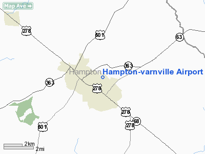
Hampton-varnville Airport |
Location & QuickFacts
| FAA Information Effective: | 2008-09-25 |
| Airport Identifier: | 3J0 |
| Airport Status: | Operational |
| Longitude/Latitude: | 081-04-59.3790W/32-52-03.5970N
-81.083161/32.867666 (Estimated) |
| Elevation: | 113 ft / 34.44 m (Estimated) |
| Land: | 50 acres |
| From nearest city: | 1 nautical miles E of Hampton, SC |
| Location: | Hampton County, SC |
| Magnetic Variation: | 04W (1985) |
Owner & Manager
| Ownership: | Publicly owned |
| Owner: | Hampton County |
| Address: | 201 Jackson Street West
Hampton, SC 29924 |
| Phone number: | 803-943-7500 |
| Manager: | Lee Ellis
CHAIRMAN HAMPTON COUNTY AIRPORT COMMISSION |
| Address: | 701 Jackson Street West
Hampton, SC 29924 |
| Phone number: | 803-943-2911 |
Airport Operations and Facilities
| Airport Use: | Open to public |
| Wind indicator: | Yes |
| Segmented Circle: | No |
| Control Tower: | No |
| Landing fee charge: | No |
| Sectional chart: | Atlanta |
| Region: | ASO - Southern |
| Boundary ARTCC: | ZJX - Jacksonville |
| Tie-in FSS: | AND - Anderson |
| FSS on Airport: | No |
| FSS Toll Free: | 1-800-WX-BRIEF |
| NOTAMs Facility: | AND (NOTAM-d service avaliable) |
Airport Communications
Airport Services
| Airframe Repair: | NONE |
| Power Plant Repair: | NONE |
| Bottled Oxygen: | NONE |
| Bulk Oxygen: | NONE |
Runway Information
Runway 11/29
| Dimension: | 3580 x 60 ft / 1091.2 x 18.3 m |
| Surface: | ASPH, Fair Condition |
| Weight Limit: | Single wheel: 8000 lbs. |
| |
Runway 11 |
Runway 29 |
| Traffic Pattern: | Left | Left |
| Markings: | Basic, Poor Condition
RWY. MARKINGS FADED BOTH ENDS. | Basic, Poor Condition
RWY. MARKINGS FADED BOTH ENDS. |
| Obstruction: | 75 ft tree, 1124.0 ft from runway, 157 ft left of centerline, 12:1 slope to clear | 93 ft tree, 1136.0 ft from runway, 62 ft left of centerline, 10:1 slope to clear
OFF RWY 29, A YELLOW PROPERTY POST 100' FM. THLD. AND 35' LEFT OF CNTRL. ALSO A 20' POWER POLE 145' FM. THLD. AND 75' LEFT OF CNTRL. |
|
Radio Navigation Aids
| ID |
Type |
Name |
Ch |
Freq |
Var |
Dist |
| RBW | NDB | Walterboro | | 221.00 | 05W | 22.6 nm |
| JYL | NDB | Sylvania | | 245.00 | 04W | 29.0 nm |
| BKO | NDB | Barnwell | | 392.00 | 06W | 33.5 nm |
| OYI | NDB | Orangeburg | | 226.00 | 05W | 34.3 nm |
| BZ | NDB | Bullo | | 407.00 | 05W | 40.0 nm |
| DYB | NDB | Dorchester County | | 365.00 | 05W | 42.3 nm |
| LNH | NDB | Millen | | 205.00 | 05W | 44.6 nm |
| BXG | NDB | Burke County | | 356.00 | 04W | 47.7 nm |
| NBC | TACAN | Beaufort | 042X | | 05W | 29.8 nm |
| ALD | VOR | Allendale | | 116.70 | 01W | 13.7 nm |
| EDS | VOR/DME | Edisto | 051X | 111.40 | 05W | 37.1 nm |
| SAV | VORTAC | Savannah | 106Y | 115.95 | 06W | 43.8 nm |
| VAN | VORTAC | Vance | 041X | 110.40 | 06W | 48.5 nm |
| SAV | VOT | Savannah Travis Fld | | 111.00 | | 44.9 nm |
Remarks
- MARKED WATER TANK APRXLY 680 FT FROM RY 29.
- ARPT EXISTED PRIOR TO 1958.
Images and information placed above are from
http://www.airport-data.com/airport/3J0/
We thank them for the data!
| General Info
|
| Country |
United States
|
| State |
SOUTH CAROLINA
|
| FAA ID |
3J0
|
| Latitude |
32-52-03.597N
|
| Longitude |
081-04-59.379W
|
| Elevation |
113 feet
|
| Near City |
HAMPTON
|
We don't guarantee the information is fresh and accurate. The data may
be wrong or outdated.
For more up-to-date information please refer to other sources.
|
|


