|
|
| Greenwood County Airport |
 |
| IATA: GRD – ICAO: KGRD |
| Summary |
| Airport type |
Public |
| Owner |
Public |
| Operator |
Greenwood County |
| Serves |
Greenwood, South Carolina |
| Location |
Greenwood County, near Greenwood, South Carolina |
| Elevation AMSL |
631 ft / 192 m |
| Coordinates |
34°14′55.40″N 082°09′32.70″W / 34.248722°N 82.159083°W / 34.248722; -82.159083Coordinates: 34°14′55.40″N 082°09′32.70″W / 34.248722°N 82.159083°W / 34.248722; -82.159083 |
| Runways |
| Direction |
Length |
Surface |
| ft |
m |
| 09/27 |
5,003 |
1,525 |
Asphalt |
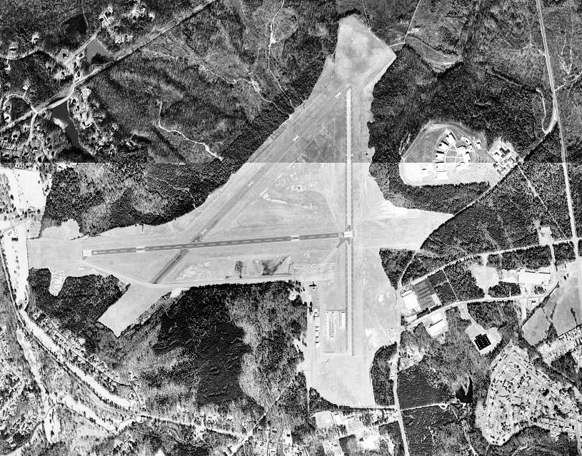
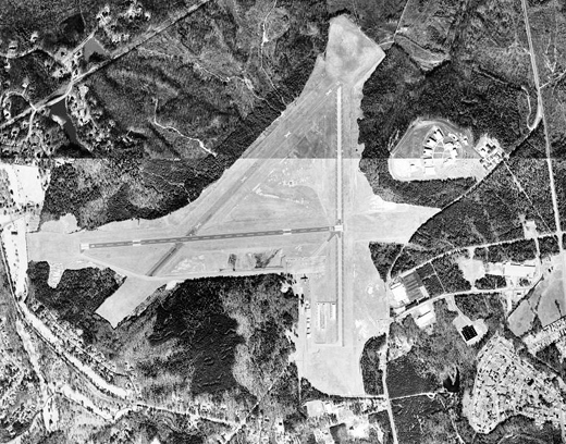
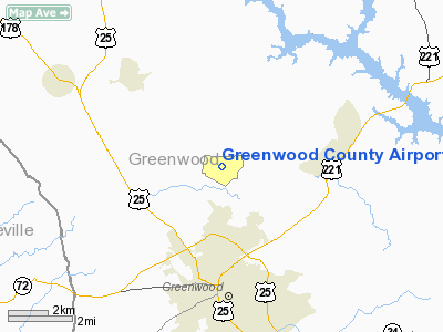
Greenwood County Airport (IATA: GRD, ICAO: KGRD) is a public airport located 3 miles north of Greenwood, South Carolina. The airport serves the general aviation community, with no scheduled commercial airline service. History
Greenwood County Airport opened in November 1943 as a United States Army Air Force military airfield called Coronaca Army Airfield. It was a sub-base of Greenville Army Air Base, supporting B-25 Mitchell medium bomber training for Third Air Force. Training was accomplished by the 50th Station Compliment Squadron.
The military use of the airport ended on 31 December 1945 and the airfield was turned over to civil authorities and converted into a civil airport.
The above content comes from Wikipedia and is published under free licenses – click here to read more.
Location & QuickFacts
| FAA Information Effective: | 2008-09-25 |
| Airport Identifier: | GRD |
| Airport Status: | Operational |
| Longitude/Latitude: | 082-09-32.7000W/34-14-55.4000N
-82.159083/34.248722 (Estimated) |
| Elevation: | 631 ft / 192.33 m (Surveyed) |
| Land: | 1380 acres |
| From nearest city: | 3 nautical miles N of Greenwood, SC |
| Location: | Greenwood County, SC |
| Magnetic Variation: | 04W (1985) |
Owner & Manager
| Ownership: | Publicly owned |
| Owner: | Greenwood County |
| Address: | 600 Monument Street
Greenwood, SC 29646 |
| Phone number: | 864-942-8502 |
| Manager: | Larry Smith
FBO PHONE 864-942-9634 |
| Address: | County Courthouse
Greenwood, SC 29649 |
| Phone number: | 864-942-8556 |
Airport Operations and Facilities
| Airport Use: | Open to public |
| Wind indicator: | Yes |
| Segmented Circle: | Yes |
| Control Tower: | No |
| Lighting Schedule: | DUSK-DAWN
MIRL RY 09/27 PRESET ON MED INTST DUSK-2300; TO INCR INTST & ACTVT REIL RYS 09 & 27 - CTAF. AFTER 2300, ACTVT MIRL RY 09/27 AND REIL RYS 09 & 27 AND ODALS RY 27 - CTAF. |
| Beacon Color: | Clear-Green (lighted land airport) |
| Landing fee charge: | No |
| Sectional chart: | Atlanta |
| Region: | ASO - Southern |
| Boundary ARTCC: | ZTL - Atlanta |
| Tie-in FSS: | AND - Anderson |
| FSS on Airport: | No |
| FSS Toll Free: | 1-800-WX-BRIEF |
| NOTAMs Facility: | GRD (NOTAM-d service avaliable) |
| Federal Agreements: | NGPRY |
Airport Communications
| CTAF: | 122.800 |
| Unicom: | 122.800 |
Airport Services
| Fuel available: | 100LLA |
| Airframe Repair: | NONE |
| Power Plant Repair: | MINOR |
| Bottled Oxygen: | NONE |
| Bulk Oxygen: | NONE |
Runway Information
Runway 09/27
| Dimension: | 5003 x 100 ft / 1524.9 x 30.5 m |
| Surface: | ASPH, Good Condition |
| Weight Limit: | Single wheel: 30000 lbs.
Dual wheel: 57500 lbs. |
| Edge Lights: | Medium |
| |
Runway 09 |
Runway 27 |
| Longitude: | 082-10-02.3570W | 082-09-02.9690W |
| Latitude: | 34-14-53.3690N | 34-14-57.5080N |
| Elevation: | 629.00 ft | 620.00 ft |
| Alignment: | 85 | 127 |
| Traffic Pattern: | Left | Left |
| Markings: | Non-precision instrument, Good Condition | Non-precision instrument, Good Condition |
| Crossing Height: | 52.00 ft | 52.00 ft |
| VASI: | 2-light PAPI on left side | 2-light PAPI on left side |
| Visual Glide Angle: | 3.00° | 3.00° |
| Approach lights: | | ODALS |
| Runway End Identifier: | Yes | Yes |
| Centerline Lights: | No | No |
| Touchdown Lights: | No | No |
| Obstruction: | 55 ft tree, 1456.0 ft from runway, 216 ft right of centerline, 22:1 slope to clear | , 50:1 slope to clear |
|
Radio Navigation Aids
| ID |
Type |
Name |
Ch |
Freq |
Var |
Dist |
| GIW | NDB | Coronaca | | 239.00 | 04W | 3.6 nm |
| LUX | NDB | Laurens | | 307.00 | 04W | 18.7 nm |
| EOE | NDB | Enoree | | 278.00 | 05W | 26.3 nm |
| GY | NDB | Dyana | | 338.00 | 03W | 30.1 nm |
| AND | NDB | Anderson County | | 230.00 | 04W | 31.1 nm |
| UOT | NDB | Union County | | 326.00 | 04W | 36.6 nm |
| FRT | NDB | Fairmont | | 248.00 | 05W | 40.2 nm |
| AIK | NDB | Aiken | | 347.00 | 04W | 43.2 nm |
| LQK | NDB | Lake Keowee | | 408.00 | 04W | 43.2 nm |
| IIY | NDB | Washington/wilkes County | | 435.00 | 03W | 43.3 nm |
| CEU | NDB | Clemson | | 257.00 | 05W | 44.2 nm |
| HQU | NDB | Thomson-mcduffie | | 333.00 | 04W | 46.9 nm |
| EMR | NDB | Emory | | 385.00 | 04W | 47.9 nm |
| AA | NDB | Cedar | | 341.00 | 04W | 48.6 nm |
| GRD | VORTAC | Greenwood | 102X | 115.50 | 01W | 0.3 nm |
| IRQ | VORTAC | Colliers | 086X | 113.90 | 04W | 32.5 nm |
| ELW | VORTAC | Electric City | 023X | 108.60 | 00E | 32.7 nm |
| SPA | VORTAC | Spartanburg | 104X | 115.70 | 02W | 48.6 nm |
Remarks
- TWY A PARALLEL TO RY 09/27; GRADE EXTREME WITH DROPOFFS EACH SIDE OF TWY.
- ARPT EXISTED PRIOR 1958
Images and information placed above are from
http://www.airport-data.com/airport/GRD/
We thank them for the data!
| General Info
|
| Country |
United States
|
| State |
SOUTH CAROLINA
|
| FAA ID |
GRD
|
| Latitude |
34-14-55.400N
|
| Longitude |
082-09-32.700W
|
| Elevation |
631 feet
|
| Near City |
GREENWOOD
|
We don't guarantee the information is fresh and accurate. The data may
be wrong or outdated.
For more up-to-date information please refer to other sources.
|
|