|
|
| Grand Strand Airport |
| IATA: CRE – ICAO: KCRE – FAA LID: CRE |
| Summary |
| Airport type |
Public |
| Owner |
Horry County |
| Serves |
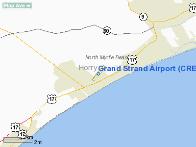
North Myrtle Beach, South Carolina |
| Elevation AMSL |
32 ft / 10 m |
| Coordinates |
33°48′42″N 078°43′26″W / 33.81167°N 78.72389°W / 33.81167; -78.72389 |
| Runways |
| Direction |
Length |
Surface |
| ft |
m |
| 5/23 |
5,997 |
1,828 |
Asphalt |
| Statistics (2008) |
| Aircraft operations |
46,670 |
| Based aircraft |
47 |
| Source: Federal Aviation Administration |
Grand Strand Airport (IATA: CRE, ICAO: KCRE, FAA LID: CRE) is a county-owned, public-use airport located one nautical mile (1.85 km) northwest of the central business district of North Myrtle Beach, in Horry County, South Carolina, United States. The name Grand Strand refers to a nearby 60-mile stretch of beach (strand in German).
This airport is included in the FAA's National Plan of Integrated Airport Systems (2009–2013), which categorizes it as a general aviation airport. Facilities and aircraft
Grand Strand Airport covers an area of 427 acres (173 ha) at an elevation of 32 feet (10 m) above mean sea level. It has one runway designated 5/23 with an asphalt surface measuring 5,997 by 100 feet (1,828 x 30 m).
For the 12-month period ending October 30, 2008, the airport had 46,670 aircraft operations, an average of 127 per day: 96% general aviation, 2% air taxi, and 2% military. At that time there were 47 aircraft based at this airport: 81% single-engine, 15% multi-engine, 2% jet and 2% helicopter.
History
During World War II, the airport was built by the United States Army Air Force about 1942. Known as Wampee Flight Strip, it was used as an auxiliary landing airfield for Myrtle Beach Army Airfield. It was closed after World War II, and was turned over for local government use by the War Assets Administration (WAA). Reopened as a civil airport, until the opening of Myrtle Beach International Airport in 1976, this was the commercial airport for Myrtle Beach, primarily being serviced by Piedmont Airlines.
The above content comes from Wikipedia and is published under free licenses – click here to read more.
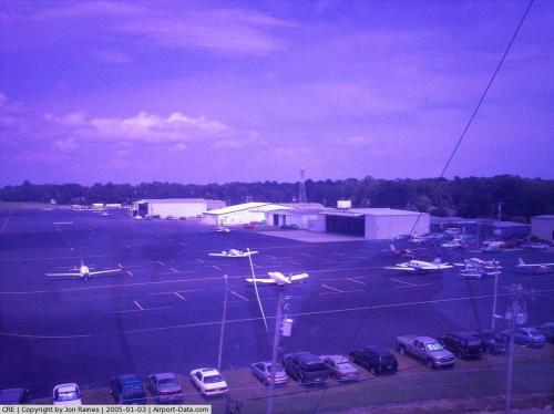 |
(Click on the photo to enlarge) |
 |
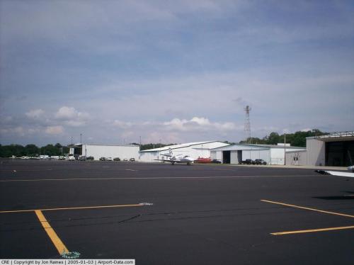
(Click on the photo to enlarge) |
 |
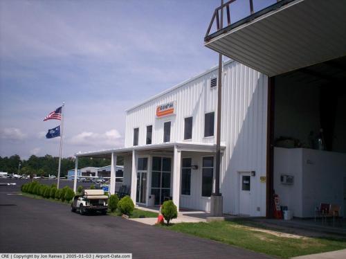
(Click on the photo to enlarge) |
 |
(Click on the photo to enlarge) |
 |
(Click on the photo to enlarge) |
Location & QuickFacts
| FAA Information Effective: | 2008-09-25 |
| Airport Identifier: | CRE |
| Airport Status: | Operational |
| Longitude/Latitude: | 078-43-26.2000W/33-48-42.3000N
-78.723944/33.811750 (Estimated) |
| Elevation: | 32 ft / 9.75 m (Surveyed) |
| Land: | 427 acres |
| From nearest city: | 1 nautical miles NW of North Myrtle Beach, SC |
| Location: | Horry County, SC |
| Magnetic Variation: | 06W (1985) |
Owner & Manager
| Ownership: | Publicly owned |
| Owner: | Horry County |
| Address: | Po Box 1236
Conway, SC 29526 |
| Phone number: | 843-248-1201 |
| Manager: | Bob Kemp |
| Address: | 100 Jetport Road
Myrtle Beach, SC 29577 |
| Phone number: | 843-448-1580
FBO FRANK GOGGINS; BOB MC GROARTY - 843-272-5337. |
Airport Operations and Facilities
| Airport Use: | Open to public |
| Wind indicator: | Yes |
| Segmented Circle: | Yes |
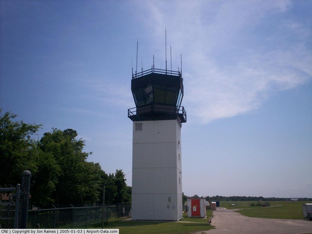
| Control Tower: | Yes |
| Lighting Schedule: | DUSK-DAWN
AFTER 0000 ACTVT HIRL RY 05/23; REIL RY 05 AND MALSR RY 23 - CTAF. |
| Beacon Color: | Clear-Green (lighted land airport) |
| Landing fee charge: | No |
| Sectional chart: | Charlotte |
| Region: | ASO - Southern |
| Boundary ARTCC: | ZJX - Jacksonville |
| Tie-in FSS: | AND - Anderson |
| FSS Toll Free: | 1-800-WX-BRIEF |
| NOTAMs Facility: | AND (NOTAM-d service avaliable) |
| Federal Agreements: | NGY |
Airport Communications
| CTAF: | 124.600 |
| Unicom: | 122.950 |
Airport Services
| Fuel available: | 100LLA |
| Airframe Repair: | MAJOR |
| Power Plant Repair: | MAJOR |
| Bottled Oxygen: | NONE |
| Bulk Oxygen: | NONE |
Runway Information
Runway 05/23
| Dimension: | 5997 x 100 ft / 1827.9 x 30.5 m |
| Surface: | ASPH, Good Condition |
| Weight Limit: | Single wheel: 30000 lbs.
Dual wheel: 60000 lbs. |
| Edge Lights: | High |
| |
Runway 05 |
Runway 23 |
| Longitude: | 078-43-51.7881W | 078-43-00.5979W |
| Latitude: | 33-48-21.7195N | 33-49-02.8760N |
| Elevation: | 31.00 ft | 29.00 ft |
| Alignment: | 46 | 127 |
| ILS Type: | | ILS
|
| Traffic Pattern: | Left | Right |
| Markings: | Precision instrument, Good Condition | Precision instrument, Good Condition |
| Crossing Height: | 40.00 ft | 55.00 ft |
| VASI: | 2-light PAPI on left side | 2-light PAPI on left side |
| Visual Glide Angle: | 3.00° | 2.98° |
| Approach lights: | | MALSR |
| Runway End Identifier: | Yes | |
| Obstruction: | 57 ft tree, 2073.0 ft from runway, 396 ft right of centerline, 32:1 slope to clear | 94 ft tree, 4476.0 ft from runway, 461 ft left of centerline, 45:1 slope to clear |
|
Radio Navigation Aids
| ID |
Type |
Name |
Ch |
Freq |
Var |
Dist |
| HYW | NDB | Horry | | 370.00 | 08W | 20.2 nm |
| CPC | NDB | Camp | | 227.00 | 07W | 27.7 nm |
| SUT | NDB | Yaupon | | 233.00 | 08W | 33.2 nm |
| MAO | NDB | Marion | | 388.00 | 06W | 37.8 nm |
| HEK | NDB | Stuckey | | 236.00 | 06W | 40.3 nm |
| CLB | NDB | Carolina Beach | | 216.00 | 04W | 41.9 nm |
| GGE | NDB | Georgetown | | 242.00 | 06W | 42.4 nm |
| TGQ | NDB | Elizabethtown | | 398.00 | 08W | 44.3 nm |
| PHH | NDB | Andrews | | 255.00 | 06W | 45.7 nm |
| JB | NDB | Jigel | | 384.00 | 08W | 48.7 nm |
| CRE | VORTAC | Grand Strand | 123X | 117.60 | 03W | 0.1 nm |
Remarks
- EXTENSIVE BANNER TOW OPERATIONS FM ARPT ALONG COAST LINE 10 NM NE TO 20 NM SW.
- GULLS ON & INVOF ARPT.
- EXISTED PRIOR TO 1958.
Images and information placed above are from
http://www.airport-data.com/airport/CRE/
We thank them for the data!
| General Info
|
| Country |
United States
|
| State |
SOUTH CAROLINA
|
| FAA ID |
CRE
|
| Latitude |
33-48-42.300N
|
| Longitude |
078-43-26.200W
|
| Elevation |
32 feet
|
| Near City |
NORTH MYRTLE BEACH
|
We don't guarantee the information is fresh and accurate. The data may
be wrong or outdated.
For more up-to-date information please refer to other sources.
|
|