 |
|
Location & QuickFacts
| FAA Information Effective: | 2008-09-25 |
| Airport Identifier: | SC45 |
| Airport Status: | Operational |
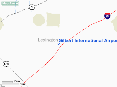
| Longitude/Latitude: | 081-22-54.3660W/33-53-02.5270N
-81.381768/33.884035 (Estimated) |
| Elevation: | 551 ft / 167.94 m (Estimated) |
| Land: | 20 acres |
| From nearest city: | 2 nautical miles S of Gilbert, SC |
| Location: | Lexington County, SC |
| Magnetic Variation: | 04W (1985) |
Owner & Manager
| Ownership: | Privately owned |
| Owner: | Thomas L. Sanders, Jr |
| Address: | Box 1759
Lexington, SC 29071 |
| Phone number: | 803-657-5990 |
| Manager: | Thomas L. Sanders, Jr |
| Address: | Po Box 367
Leesville, SC 29070 |
| Phone number: | 803-532-5388 |
Airport Operations and Facilities
| Airport Use: | Private |
| Wind indicator: | Yes |
| Segmented Circle: | No |
| Control Tower: | No |
| Sectional chart: | Atlanta |
| Region: | ASO - Southern |
| Boundary ARTCC: | ZJX - Jacksonville |
| Tie-in FSS: | AND - Anderson |
| FSS Toll Free: | 1-800-WX-BRIEF |
Runway Information
Runway 09/27
| Dimension: | 3500 x 100 ft / 1066.8 x 30.5 m |
| Surface: | TURF, Fair Condition |
| |
Runway 09 |
Runway 27 |
| Traffic Pattern: | Left | Left |
| Obstruction: | 30 ft trees, 100.0 ft from runway | 30 ft trees, 300.0 ft from runway |
|
Radio Navigation Aids
| ID |
Type |
Name |
Ch |
Freq |
Var |
Dist |
| AIK | NDB | Aiken | | 347.00 | 04W | 20.3 nm |
| EOE | NDB | Enoree | | 278.00 | 05W | 28.6 nm |
| FDW | NDB | Winnsboro | | 414.00 | 05W | 29.1 nm |
| MMT | NDB | Mc Entire | | 427.00 | 05W | 29.2 nm |
| BKO | NDB | Barnwell | | 392.00 | 06W | 32.4 nm |
| OYI | NDB | Orangeburg | | 226.00 | 05W | 36.8 nm |
| EMR | NDB | Emory | | 385.00 | 04W | 39.8 nm |
| GIW | NDB | Coronaca | | 239.00 | 04W | 41.5 nm |
| LUX | NDB | Laurens | | 307.00 | 04W | 47.0 nm |
| CDN | NDB | Camden | | 263.00 | 05W | 47.4 nm |
| UOT | NDB | Union County | | 326.00 | 04W | 49.8 nm |
| SSC | TACAN | Shaw | 038X | | 05W | 46.0 nm |
| EDS | VOR/DME | Edisto | 051X | 111.40 | 05W | 36.7 nm |
| CAE | VORTAC | Columbia | 094X | 114.70 | 02W | 16.4 nm |
| MMT | VORTAC | Mc Entire | 079X | 113.20 | 05W | 29.0 nm |
| IRQ | VORTAC | Colliers | 086X | 113.90 | 04W | 40.4 nm |
| GRD | VORTAC | Greenwood | 102X | 115.50 | 01W | 44.4 nm |
Remarks
- PRVDD VFR/PR USE; ALL TFC PATS AT RAWLS ARPT, SUMMIT, SC ARE ESTABLISHED ON WEST SIDE OF ARPT; EXECUTE & MAINTAIN LETTER OF AGREEMENT WITH OWNER OF RAWLS ARPT TO ENSURE COMPATIBLE TFC PAT OPNS.
Images and information placed above are from
http://www.airport-data.com/airport/SC45/
We thank them for the data!
| General Info
|
| Country |
United States
|
| State |
SOUTH CAROLINA
|
| FAA ID |
SC45
|
| Latitude |
33-53-02.527N
|
| Longitude |
081-22-54.366W
|
| Elevation |
551 feet
|
| Near City |
GILBERT
|
We don't guarantee the information is fresh and accurate. The data may
be wrong or outdated.
For more up-to-date information please refer to other sources.
|
|


