|
|
Georgetown County Airport |
| Georgetown County Airport |
 |
| IATA: GGE – ICAO: KGGE |
| Summary |
| Airport type |
Public |
| Owner |
Public |
| Operator |
Georgetown County |
| Serves |
Georgetown, South Carolina |
| Location |
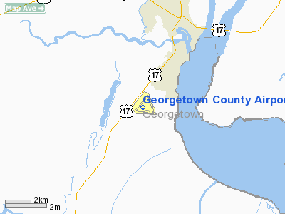
Georgetown County, near Georgetown, South Carolina |
| Elevation AMSL |
39 ft / 11.9 m |
| Coordinates |
33°18′42.10″N 079°19′10.50″W / 33.311694°N 79.319583°W / 33.311694; -79.319583Coordinates: 33°18′42.10″N 079°19′10.50″W / 33.311694°N 79.319583°W / 33.311694; -79.319583 |
| Runways |
| Direction |
Length |
Surface |
| ft |
m |
| 5/23 |
5,000 |
1,524 |
Asphalt |
| 11/29 |
4,539 |
1,383 |
Asphalt |
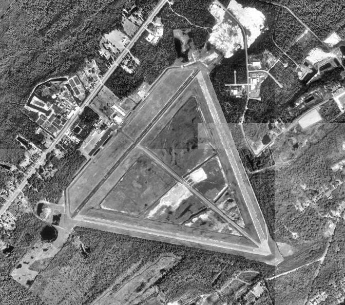
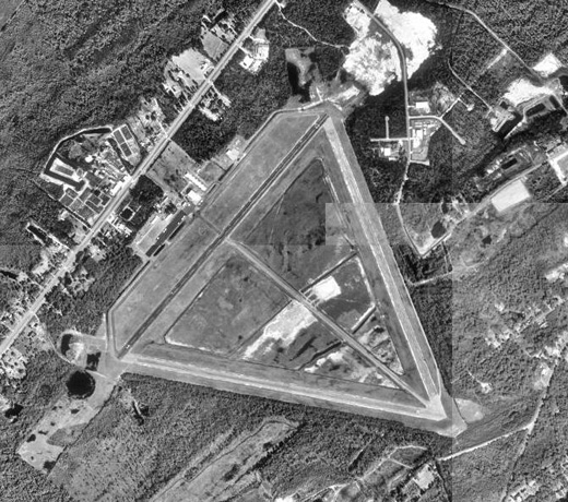
Georgetown County Airport (IATA: GGE, ICAO: KGGE) is a public airport located 6 miles southwest of Georgetown, South Carolina. The airport serves the general aviation community, with no scheduled commercial airline service. History
Georgetown airport was built in 1941 by the United States Navy and was used by the United States Marine Corps during World War II as an axillary airfield assigned to Parris Island Airfield. Georgetown Marine Corps Airfield (OLF) was also used by the by United States Army Air Force light observation squadrons (105th, 112th) flying antisubmarine patrols over the Atlantic from May 1942 until August 1942.
The airport was turned over to civil authorities in June 1944, and it was developed into a public airport
The above content comes from Wikipedia and is published under free licenses – click here to read more.
Location & QuickFacts
| FAA Information Effective: | 2008-09-25 |
| Airport Identifier: | GGE |
| Airport Status: | Operational |
| Longitude/Latitude: | 079-19-10.5000W/33-18-42.1000N
-79.319583/33.311694 (Estimated) |
| Elevation: | 39 ft / 11.89 m (Surveyed) |
| Land: | 735 acres |
| From nearest city: | 3 nautical miles S of Georgetown, SC |
| Location: | Georgetown County, SC |
| Magnetic Variation: | 06W (1985) |
Owner & Manager
| Ownership: | Publicly owned |
| Owner: | Georgetown County |
| Address: | Po Drawer 1270
Georgetown, SC 29440 |
| Phone number: | 843-546-4189 |
| Manager: | Ray Funnye
FBO - SEVEN RIVERS AVIATION, 843-527-7516. |
| Address: | Po Drawer 421270, 2236 Brown Ferry Rd.
Georgetown, SC 29442 |
| Phone number: | 843-545-3438 |
Airport Operations and Facilities
| Airport Use: | Open to public |
| Wind indicator: | Yes |
| Segmented Circle: | Yes |
| Control Tower: | No |
| Lighting Schedule: | DUSK-DAWN |
| Beacon Color: | Clear-Green (lighted land airport) |
| Landing fee charge: | No |
| Sectional chart: | Charlotte |
| Region: | ASO - Southern |
| Boundary ARTCC: | ZJX - Jacksonville |
| Tie-in FSS: | AND - Anderson |
| FSS on Airport: | No |
| FSS Toll Free: | 1-800-WX-BRIEF |
| NOTAMs Facility: | AND (NOTAM-d service avaliable) |
| Federal Agreements: | NGRY3 |
Airport Communications
| CTAF: | 123.000 |
| Unicom: | 123.000 |
Airport Services
| Fuel available: | 100LLA |
| Airframe Repair: | MAJOR |
| Power Plant Repair: | MAJOR |
Runway Information
Runway 05/23
| Dimension: | 5000 x 100 ft / 1524.0 x 30.5 m |
| Surface: | ASPH, Good Condition
ENTIRE RUNWAY IS SEVERLY CRACKING AND GRASS IS GROWING THROUGH CRACKS. RUNWAY MARKINGS ARE NOT VISIBLE BECAUSE OF THE EXCESSIVE AMOUNT OF GRASS. |
| Weight Limit: | Single wheel: 30000 lbs.
Dual wheel: 60000 lbs. |
| Edge Lights: | Medium |
| |
Runway 05 |
Runway 23 |
| Longitude: | 079-19-34.4926W | 079-18-55.5263W |
| Latitude: | 33-18-34.5628N | 33-19-11.6730N |
| Elevation: | 39.00 ft | 33.00 ft |
| Alignment: | 41 | 127 |
| Traffic Pattern: | Left | Left |
| Markings: | Non-precision instrument, Good Condition | Non-precision instrument, Good Condition |
| Crossing Height: | 31.00 ft | 32.00 ft |
| VASI: | 2-light PAPI on left side | 2-light PAPI on left side |
| Visual Glide Angle: | 3.00° | 3.00° |
| Obstruction: | 76 ft tree, 2817.0 ft from runway, 38 ft right of centerline, 34:1 slope to clear | 90 ft tree, 2358.0 ft from runway, 261 ft right of centerline, 24:1 slope to clear |
|
Runway 11/29
| Dimension: | 4539 x 150 ft / 1383.5 x 45.7 m |
| Surface: | ASPH, Poor Condition
ENTIRE RUNWAY IS SEVERLY CRACKING AND GRASS IS GROWING THROUGH CRACKS. RUNWAY MARKINGS ARE NOT VISIBLE BECAUSE OF THE EXCESSIVE AMOUNT OF GRASS. |
| Weight Limit: | Single wheel: 20000 lbs.
Dual wheel: 30000 lbs. |
| Edge Lights: | Medium |
| |
Runway 11 |
Runway 29 |
| Longitude: | 079-19-31.6900W | 079-18-39.2700W |
| Latitude: | 33-18-34.4600N | 33-18-25.5600N |
| Elevation: | 37.00 ft | 23.00 ft |
| Alignment: | 101 | 127 |
| Traffic Pattern: | Left | Left |
| Markings: | Basic, Poor Condition
ALL MARKINGS ON THIS RY ARE FADED OUT AND CAN HARDLY BE SEEN. | Basic, Poor Condition
ALL MARKINGS ON THIS RY ARE FADED OUT AND CAN HARDLY BE SEEN. |
| Obstruction: | 79 ft tree, 1510.0 ft from runway, 278 ft left of centerline, 16:1 slope to clear | 42 ft tree, 768.0 ft from runway, 32 ft right of centerline, 13:1 slope to clear |
|
Radio Navigation Aids
| ID |
Type |
Name |
Ch |
Freq |
Var |
Dist |
| GGE | NDB | Georgetown | | 242.00 | 06W | 0.3 nm |
| PHH | NDB | Andrews | | 255.00 | 06W | 13.4 nm |
| HEK | NDB | Stuckey | | 236.00 | 06W | 27.1 nm |
| HYW | NDB | Horry | | 370.00 | 08W | 32.2 nm |
| CKI | NDB | Kingstree | | 404.00 | 06W | 36.3 nm |
| MKS | NDB | Moncks Corner | | 354.00 | 05W | 36.6 nm |
| CFY | NDB | Evans | | 420.00 | 06W | 39.6 nm |
| CH | NDB | Ashly | | 329.00 | 05W | 44.0 nm |
| MNI | NDB | Manning | | 381.00 | 06W | 47.5 nm |
| CRE | VORTAC | Grand Strand | 123X | 117.60 | 03W | 42.4 nm |
| CHS | VORTAC | Charleston | 082X | 113.50 | 05W | 44.0 nm |
| CHS | VOT | Charleston | | 111.00 | | 43.8 nm |
Remarks
- GCO AVBL ON FREQ 119.700 THRU MYR CLEARANCE DELIVERY.
- RY 11/29 CLSD TO ACFT 12,500 LBS & OVR.
- EXISTED PRIOR TO 1958.
Images and information placed above are from
http://www.airport-data.com/airport/GGE/
We thank them for the data!
| General Info
|
| Country |
United States
|
| State |
SOUTH CAROLINA
|
| FAA ID |
GGE
|
| Latitude |
33-18-42.100N
|
| Longitude |
079-19-10.500W
|
| Elevation |
39 feet
|
| Near City |
GEORGETOWN
|
We don't guarantee the information is fresh and accurate. The data may
be wrong or outdated.
For more up-to-date information please refer to other sources.
|
|