 |
|
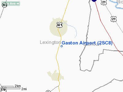
Location & QuickFacts
| FAA Information Effective: | 2008-09-25 |
| Airport Identifier: | 2SC8 |
| Airport Status: | Operational |
| Longitude/Latitude: | 081-05-41.3420W/33-47-12.5510N
-81.094817/33.786820 (Estimated) |
| Elevation: | 460 ft / 140.21 m (Estimated) |
| Land: | 16 acres |
| From nearest city: | 3 nautical miles SE of Gaston, SC |
| Location: | Lexington County, SC |
| Magnetic Variation: | 05W (1985) |
Owner & Manager
| Ownership: | Privately owned |
| Owner: | James D. Bledsoe & Joe M. Garner |
| Address: | 1021 Kenneth Dr
Lexington, SC 29073-9190 |
| Phone number: | 803-957-4647 |
| Manager: | Joe M. Garner |
| Address: | 1021 Kenneth Dr
Lexington, SC 29073-9190 |
| Phone number: | 803-957-4647 |
Airport Operations and Facilities
| Airport Use: | Private |
| Segmented Circle: | No |
| Control Tower: | No |
| Landing fee charge: | No |
| Sectional chart: | Atlanta |
| Region: | ASO - Southern |
| Boundary ARTCC: | ZJX - Jacksonville |
| Tie-in FSS: | AND - Anderson |
| FSS on Airport: | No |
| FSS Toll Free: | 1-800-WX-BRIEF |
Airport Services
| Bottled Oxygen: | NONE |
| Bulk Oxygen: | NONE |
Runway Information
Runway 11/29
| Dimension: | 3350 x 90 ft / 1021.1 x 27.4 m |
| Surface: | TURF, Fair Condition |
| |
Runway 11 |
Runway 29 |
| Traffic Pattern: | Left | Left |
| Markings: | None, | None, |
| Runway End Identifier: | No | No |
| Centerline Lights: | No | No |
| Touchdown Lights: | No | No |
| Obstruction: | 100 ft trees, 1200.0 ft from runway, 75 ft right of centerline, 12:1 slope to clear | 15 ft road, 0.0 ft from runway |
|
Radio Navigation Aids
| ID |
Type |
Name |
Ch |
Freq |
Var |
Dist |
| MMT | NDB | Mc Entire | | 427.00 | 05W | 17.3 nm |
| OYI | NDB | Orangeburg | | 226.00 | 05W | 24.1 nm |
| AIK | NDB | Aiken | | 347.00 | 04W | 30.2 nm |
| BKO | NDB | Barnwell | | 392.00 | 06W | 31.2 nm |
| FDW | NDB | Winnsboro | | 414.00 | 05W | 31.7 nm |
| SMS | NDB | Sumter | | 252.00 | 04W | 38.7 nm |
| CDN | NDB | Camden | | 263.00 | 05W | 40.0 nm |
| EOE | NDB | Enoree | | 278.00 | 05W | 41.5 nm |
| MNI | NDB | Manning | | 381.00 | 06W | 46.0 nm |
| EMR | NDB | Emory | | 385.00 | 04W | 49.2 nm |
| SSC | TACAN | Shaw | 038X | | 05W | 33.4 nm |
| ALD | VOR | Allendale | | 116.70 | 01W | 47.6 nm |
| EDS | VOR/DME | Edisto | 051X | 111.40 | 05W | 23.2 nm |
| CAE | VORTAC | Columbia | 094X | 114.70 | 02W | 4.7 nm |
| MMT | VORTAC | Mc Entire | 079X | 113.20 | 05W | 16.8 nm |
| VAN | VORTAC | Vance | 041X | 110.40 | 06W | 37.4 nm |
Remarks
- 150' TWR IN VICINITY OF ARPT.
- RY 11 PLINE 625' FM THR.
- ALL PILOTS ARE REQUESTED TO ANNOUNCE THEIR INTENTIONS ON 122.90.
- PROVIDED ALL OPERATIONS CONDUCTED IN VFR WX CONDITIONS.
Images and information placed above are from
http://www.airport-data.com/airport/2SC8/
We thank them for the data!
|
|


