 |
|
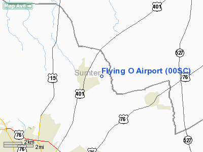
Location & QuickFacts
| FAA Information Effective: | 2008-09-25 |
| Airport Identifier: | 00SC |
| Airport Status: | Operational |
| Longitude/Latitude: | 080-16-02.0000W/34-00-34.0000N
-80.267222/34.009444 (Estimated) |
| Elevation: | 150 ft / 45.72 m (Estimated) |
| Land: | 40 acres |
| From nearest city: | 6 nautical miles SW of Sumter, SC |
| Location: | Abbeville County, SC |
| Magnetic Variation: | () |
Owner & Manager
| Ownership: | Privately owned |
| Owner: | Benjamin Oliver |
| Address: | 1625 Jessamyn Road
Sumter, SC 29153 |
| Phone number: | 803-469-0046 |
| Manager: | Benjamin Oliver |
| Address: | 1625 Jessamyn Road
Sumter, SC 29153 |
| Phone number: | 803-469-0046 |
Airport Operations and Facilities
| Airport Use: | Private |
| Wind indicator: | Yes |
| Segmented Circle: | No |
| Control Tower: | No |
| Sectional chart: | Charlotte |
| Region: | ASO - Southern |
| Boundary ARTCC: | ZJX - Jacksonville |
| Tie-in FSS: | AND - Anderson |
| FSS Toll Free: | 1-800-WX-BRIEF |
Runway Information
Runway 08/26
| Dimension: | 2900 x 100 ft / 883.9 x 30.5 m |
| Surface: | TURF, |
| |
Runway 08 |
Runway 26 |
| Traffic Pattern: | Left | Left |
| Obstruction: | 36 ft trees, 500.0 ft from runway | 36 ft trees |
|
Radio Navigation Aids
| ID |
Type |
Name |
Ch |
Freq |
Var |
Dist |
| SMS | NDB | Sumter | | 252.00 | 04W | 4.8 nm |
| CDN | NDB | Camden | | 263.00 | 05W | 22.0 nm |
| HVS | NDB | Hartsville | | 341.00 | 07W | 25.0 nm |
| MNI | NDB | Manning | | 381.00 | 06W | 25.5 nm |
| CFY | NDB | Evans | | 420.00 | 06W | 26.6 nm |
| MMT | NDB | Mc Entire | | 427.00 | 05W | 26.9 nm |
| CKI | NDB | Kingstree | | 404.00 | 06W | 27.0 nm |
| UDG | NDB | Darlington | | 245.00 | 06W | 32.2 nm |
| HEK | NDB | Stuckey | | 236.00 | 06W | 40.7 nm |
| PYG | NDB | Pageland | | 270.00 | 06W | 44.3 nm |
| BES | NDB | Bennettsville | | 230.00 | 07W | 45.3 nm |
| FDW | NDB | Winnsboro | | 414.00 | 05W | 45.9 nm |
| MAO | NDB | Marion | | 388.00 | 06W | 47.7 nm |
| OYI | NDB | Orangeburg | | 226.00 | 05W | 47.8 nm |
| CQW | NDB | Cheraw | | 409.00 | 05W | 48.3 nm |
| PHH | NDB | Andrews | | 255.00 | 06W | 49.9 nm |
| SSC | TACAN | Shaw | 038X | | 05W | 10.1 nm |
| CTF | VOR/DME | Chesterfield | 019X | 108.20 | 03W | 38.5 nm |
| EDS | VOR/DME | Edisto | 051X | 111.40 | 05W | 44.5 nm |
| MMT | VORTAC | Mc Entire | 079X | 113.20 | 05W | 27.2 nm |
| FLO | VORTAC | Florence | 099X | 115.20 | 03W | 33.2 nm |
| VAN | VORTAC | Vance | 041X | 110.40 | 06W | 33.4 nm |
| CAE | VORTAC | Columbia | 094X | 114.70 | 02W | 40.3 nm |
Remarks
- 100 FT WATER TANK .6 NM SW OF ARPT.
- PVDD VFR PVT USE.
Images and information placed above are from
http://www.airport-data.com/airport/00SC/
We thank them for the data!
|
|


