 |
|
Coordinates: 34°18′56″N 081°06′32″W / 34.31556°N 81.10889°W / 34.31556; -81.10889
| Fairfield County Airport |
| IATA: none – ICAO: KFDW – FAA LID: FDW |
| Summary |
| Airport type |
Public |
| Owner |
Fairfield County |
| Serves |
Winnsboro, South Carolina |
| Elevation AMSL |
577 ft / 176 m |
| Runways |
| Direction |
Length |
Surface |
| ft |
m |
| 4/22 |
5,003 |
1,525 |
Asphalt |
| Statistics (2007) |
| Aircraft operations |
17,000 |
| Based aircraft |
30 |
| Source: Federal Aviation Administration |
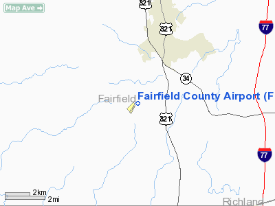
Fairfield County Airport (ICAO: KFDW, FAA LID: FDW) is a public airport located three miles (5 km) southwest of the central business district of Winnsboro, in Fairfield County, South Carolina, United States. It is owned by Fairfield County.
Although most U.S. airports use the same three-letter location identifier for the FAA and IATA, Fairfield County Airport is assigned FDW by the FAA but has no designation from the IATA.
Facilities and aircraft
Fairfield County Airport covers an area of 159 acres (64 ha) which contains one asphalt paved runway (4/22) measuring 5,003 x 100 ft (1,525 x 30 m).
For the 12-month period ending May 1, 2007, the airport had 17,000 aircraft operations, an average of 46 per day: 95% general aviation, 3% air taxi and 2% military. There are 30 aircraft based at this airport: 80% single engine and 20% multi-engine. By June 1, 2009 there will be 30 T-Hangers on base.
The on location fixed base operator is S&S Aviation.
The above content comes from Wikipedia and is published under free licenses – click here to read more.
Location & QuickFacts
| FAA Information Effective: | 2008-09-25 |
| Airport Identifier: | FDW |
| Airport Status: | Operational |
| Longitude/Latitude: | 081-06-31.7000W/34-18-55.7000N
-81.108806/34.315472 (Estimated) |
| Elevation: | 577 ft / 175.87 m (Surveyed) |
| Land: | 159 acres |
| From nearest city: | 3 nautical miles SW of Winnsboro, SC |
| Location: | Fairfield County, SC |
| Magnetic Variation: | 05W (1990) |
Owner & Manager
| Ownership: | Publicly owned |
| Owner: | Fairfield County |
| Address: | Po Box 216
Winnsboro, SC 29180 |
| Phone number: | 803-635-1415 |
| Manager: | Brian Steed |
| Address: | 1291 Runway Rd
Winnsboro, SC 29180 |
| Phone number: | 803-635-3086 |
Airport Operations and Facilities
| Airport Use: | Open to public |
| Wind indicator: | Yes |
| Segmented Circle: | Yes |
| Control Tower: | No |
| Lighting Schedule: | DUSK-DAWN
MIRL RY 04/22 PRESET LOW INTST AND PAPI RYS 04 & 22 OPER DUSK-2300. TO INCR INTST AND ACTVT MIRL RY 04/22 & PAPI RYS 04 & 22 AFT 2300 - CTAF. |
| Beacon Color: | Clear-Green (lighted land airport) |
| Landing fee charge: | No |
| Sectional chart: | Charlotte |
| Region: | ASO - Southern |
| Boundary ARTCC: | ZJX - Jacksonville |
| Tie-in FSS: | AND - Anderson |
| FSS on Airport: | No |
| FSS Toll Free: | 1-800-WX-BRIEF |
| NOTAMs Facility: | AND (NOTAM-d service avaliable) |
| Federal Agreements: | NGY |
Airport Communications
| CTAF: | 122.800 |
| Unicom: | 122.800 |
Airport Services
| Fuel available: | 100LLA |
| Airframe Repair: | MAJOR |
| Power Plant Repair: | MAJOR |
| Bottled Oxygen: | NONE |
| Bulk Oxygen: | NONE |
Runway Information
Runway 04/22
| Dimension: | 5003 x 100 ft / 1524.9 x 30.5 m |
| Surface: | ASPH, Good Condition |
| Weight Limit: | Single wheel: 42000 lbs.
Dual wheel: 60000 lbs. |
| Edge Lights: | Medium |
| |
Runway 04 |
Runway 22 |
| Longitude: | 081-06-50.1468W | 081-06-13.2194W |
| Latitude: | 34-18-36.2291N | 34-19-15.0923N |
| Elevation: | 577.00 ft | 561.00 ft |
| Alignment: | 38 | 127 |
| Traffic Pattern: | Left | Left |
| Markings: | Non-precision instrument, Fair Condition | Non-precision instrument, Fair Condition |
| Crossing Height: | 26.00 ft | 30.00 ft |
| VASI: | 2-light PAPI on left side | 2-light PAPI on left side |
| Visual Glide Angle: | 3.00° | 3.00° |
| Obstruction: | 29 ft tree, 379.0 ft from runway, 227 ft right of centerline, 6:1 slope to clear | 42 ft tree, 798.0 ft from runway, 159 ft left of centerline, 14:1 slope to clear |
|
Radio Navigation Aids
| ID |
Type |
Name |
Ch |
Freq |
Var |
Dist |
| FDW | NDB | Winnsboro | | 414.00 | 05W | 0.2 nm |
| EOE | NDB | Enoree | | 278.00 | 05W | 26.2 nm |
| CDN | NDB | Camden | | 263.00 | 05W | 27.2 nm |
| LKR | NDB | Lancaster | | 400.00 | 07W | 27.5 nm |
| MMT | NDB | Mc Entire | | 427.00 | 05W | 27.5 nm |
| DCM | NDB | Chester | | 220.00 | 06W | 28.7 nm |
| UOT | NDB | Union County | | 326.00 | 04W | 34.5 nm |
| UZ | NDB | Rally | | 227.00 | 05W | 34.6 nm |
| SMS | NDB | Sumter | | 252.00 | 04W | 42.0 nm |
| TWL | NDB | Wesley | | 204.00 | 06W | 43.2 nm |
| LUX | NDB | Laurens | | 307.00 | 04W | 43.3 nm |
| PYG | NDB | Pageland | | 270.00 | 06W | 46.1 nm |
| GIW | NDB | Coronaca | | 239.00 | 04W | 48.7 nm |
| AIK | NDB | Aiken | | 347.00 | 04W | 48.9 nm |
| HVS | NDB | Hartsville | | 341.00 | 07W | 49.4 nm |
| SSC | TACAN | Shaw | 038X | | 05W | 37.9 nm |
| CTF | VOR/DME | Chesterfield | 019X | 108.20 | 03W | 46.0 nm |
| CAE | VORTAC | Columbia | 094X | 114.70 | 02W | 27.7 nm |
| MMT | VORTAC | Mc Entire | 079X | 113.20 | 05W | 28.0 nm |
| FML | VORTAC | Fort Mill | 071X | 112.40 | 02W | 41.2 nm |
Remarks
- FOR FBO CALL (803) 635-3086.
Images and information placed above are from
http://www.airport-data.com/airport/FDW/
We thank them for the data!
| General Info
|
| Country |
United States
|
| State |
SOUTH CAROLINA
|
| FAA ID |
FDW
|
| Latitude |
34-18-55.700N
|
| Longitude |
081-06-31.700W
|
| Elevation |
577 feet
|
| Near City |
WINNSBORO
|
We don't guarantee the information is fresh and accurate. The data may
be wrong or outdated.
For more up-to-date information please refer to other sources.
|
|


