 |
|
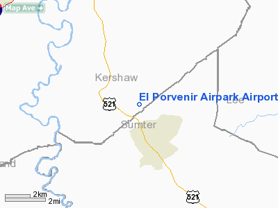
El Porvenir Airpark Airport |
Location & QuickFacts
| FAA Information Effective: | 2008-09-25 |
| Airport Identifier: | SC44 |
| Airport Status: | Operational |
| Longitude/Latitude: | 080-32-50.2910W/34-07-43.5490N
-80.547303/34.128764 (Estimated) |
| Elevation: | 220 ft / 67.06 m (Surveyed) |
| Land: | 120 acres |
| From nearest city: | 2 nautical miles NE of Boykin, SC |
| Location: | Kershaw County, SC |
| Magnetic Variation: | 05W (1985) |
Owner & Manager
| Ownership: | Privately owned |
| Owner: | Santos Pantoja |
| Address: | 475 Swift Creek Road
Rembert, SC 29128 |
| Phone number: | 803-425-1111 |
| Manager: | Santos Pantoja |
| Address: | 475 Swift Creek Road
Rembert, SC 29128 |
| Phone number: | 803-425-1111 |
Airport Operations and Facilities
| Airport Use: | Private |
| Wind indicator: | Yes |
| Segmented Circle: | No |
| Control Tower: | No |
| Landing fee charge: | No |
| Sectional chart: | Charlotte |
| Region: | ASO - Southern |
| Boundary ARTCC: | ZJX - Jacksonville |
| Tie-in FSS: | AND - Anderson |
| FSS on Airport: | No |
| FSS Toll Free: | 1-800-WX-BRIEF |
Runway Information
Runway 08/26
| Dimension: | 3000 x 100 ft / 914.4 x 30.5 m |
| Surface: | TURF, |
| |
Runway 08 |
Runway 26 |
| Traffic Pattern: | Left | Left |
|
Radio Navigation Aids
| ID |
Type |
Name |
Ch |
Freq |
Var |
Dist |
| CDN | NDB | Camden | | 263.00 | 05W | 9.3 nm |
| SMS | NDB | Sumter | | 252.00 | 04W | 12.5 nm |
| MMT | NDB | Mc Entire | | 427.00 | 05W | 17.1 nm |
| HVS | NDB | Hartsville | | 341.00 | 07W | 27.0 nm |
| FDW | NDB | Winnsboro | | 414.00 | 05W | 30.2 nm |
| MNI | NDB | Manning | | 381.00 | 06W | 36.7 nm |
| UDG | NDB | Darlington | | 245.00 | 06W | 37.8 nm |
| PYG | NDB | Pageland | | 270.00 | 06W | 38.5 nm |
| LKR | NDB | Lancaster | | 400.00 | 07W | 38.9 nm |
| CFY | NDB | Evans | | 420.00 | 06W | 42.3 nm |
| CKI | NDB | Kingstree | | 404.00 | 06W | 42.5 nm |
| OYI | NDB | Orangeburg | | 226.00 | 05W | 46.3 nm |
| CQW | NDB | Cheraw | | 409.00 | 05W | 50.0 nm |
| SSC | TACAN | Shaw | 038X | | 05W | 9.9 nm |
| CTF | VOR/DME | Chesterfield | 019X | 108.20 | 03W | 34.1 nm |
| EDS | VOR/DME | Edisto | 051X | 111.40 | 05W | 43.3 nm |
| MMT | VORTAC | Mc Entire | 079X | 113.20 | 05W | 17.7 nm |
| CAE | VORTAC | Columbia | 094X | 114.70 | 02W | 30.1 nm |
| VAN | VORTAC | Vance | 041X | 110.40 | 06W | 39.6 nm |
| FLO | VORTAC | Florence | 099X | 115.20 | 03W | 44.7 nm |
Remarks
- E111: PRVDD ALL OPNS ARE CONDUCTED IN VFR WEATHER CONDS; THE LNDG AREA IS LIMITED TO PRIVATE USE.
Images and information placed above are from
http://www.airport-data.com/airport/SC44/
We thank them for the data!
| General Info
|
| Country |
United States
|
| State |
SOUTH CAROLINA
|
| FAA ID |
SC44
|
| Latitude |
34-07-43.549N
|
| Longitude |
080-32-50.291W
|
| Elevation |
220 feet
|
| Near City |
BOYKIN
|
We don't guarantee the information is fresh and accurate. The data may
be wrong or outdated.
For more up-to-date information please refer to other sources.
|
|


