 |
|
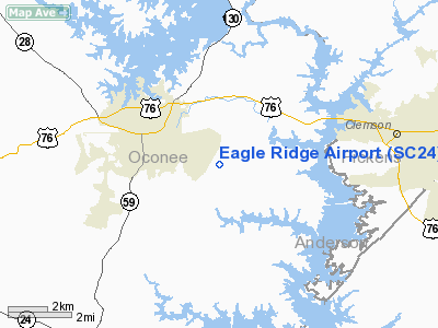
Location & QuickFacts
| FAA Information Effective: | 2008-09-25 |
| Airport Identifier: | SC24 |
| Airport Status: | Operational |
| Longitude/Latitude: | 082-54-49.0000W/34-40-18.0000N
-82.913611/34.671667 (Estimated) |
| Elevation: | 850 ft / 259.08 m (Estimated) |
| Land: | 11 acres |
| From nearest city: | 3 nautical miles SE of Seneca, SC |
| Location: | Oconee County, SC |
| Magnetic Variation: | 05W (2000) |
Owner & Manager
| Ownership: | Privately owned |
| Owner: | Eagle Ridge Property Owners Assoc |
| Address: | 400 Rudder Ridge
Seneca, SC 29678 |
| Phone number: | 864-882-0085 |
| Address: |
|
Airport Operations and Facilities
| Airport Use: | Private |
| Segmented Circle: | No |
| Control Tower: | No |
| Sectional chart: | Atlanta |
| Region: | ASO - Southern |
| Boundary ARTCC: | ZTL - Atlanta |
| Tie-in FSS: | AND - Anderson |
| FSS Toll Free: | 1-800-WX-BRIEF |
Runway Information
Runway 05/23
| Dimension: | 2100 x 80 ft / 640.1 x 24.4 m |
| Surface: | ASPH-TURF, |
| |
Runway 05 |
Runway 23 |
| Traffic Pattern: | Left | Right |
|
Radio Navigation Aids
| ID |
Type |
Name |
Ch |
Freq |
Var |
Dist |
| CEU | NDB | Clemson | | 257.00 | 05W | 1.3 nm |
| LQK | NDB | Lake Keowee | | 408.00 | 04W | 13.3 nm |
| AND | NDB | Anderson County | | 230.00 | 04W | 14.6 nm |
| GY | NDB | Dyana | | 338.00 | 03W | 23.3 nm |
| AJR | NDB | Habersham | | 347.00 | 03W | 33.1 nm |
| BRA | NDB | Broad River | | 379.00 | 04W | 42.2 nm |
| BJT | NDB | Bulldog | | 221.00 | 03W | 45.9 nm |
| DDA | NDB | Commerce | | 244.00 | 03W | 47.4 nm |
| FRT | NDB | Fairmont | | 248.00 | 05W | 47.9 nm |
| GIW | NDB | Coronaca | | 239.00 | 04W | 48.1 nm |
| LUX | NDB | Laurens | | 307.00 | 04W | 48.7 nm |
| ELW | VORTAC | Electric City | 023X | 108.60 | 00E | 16.5 nm |
| ODF | VORTAC | Foothills | 081X | 113.40 | 00E | 19.0 nm |
| GRD | VORTAC | Greenwood | 102X | 115.50 | 01W | 45.3 nm |
| AHN | VORTAC | Athens | 33 | 109.60 | 00E | 48.1 nm |
Remarks
- SEE AIRSPACE CASE #92-ATL-034-NRA.
Images and information placed above are from
http://www.airport-data.com/airport/SC24/
We thank them for the data!
| General Info
|
| Country |
United States
|
| State |
SOUTH CAROLINA
|
| FAA ID |
SC24
|
| Latitude |
34-40-18.000N
|
| Longitude |
082-54-49.000W
|
| Elevation |
850 feet
|
| Near City |
SENECA
|
We don't guarantee the information is fresh and accurate. The data may
be wrong or outdated.
For more up-to-date information please refer to other sources.
|
|


