 |
|
Location & QuickFacts
| FAA Information Effective: | 2008-09-25 |
| Airport Identifier: | SC66 |
| Airport Status: | Operational |
| Longitude/Latitude: | 081-44-00.3660W/34-41-05.4790N
-81.733435/34.684855 (Estimated) |
| Elevation: | 580 ft / 176.78 m (Estimated) |
| Land: | 0 acres |
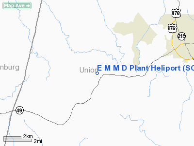
| From nearest city: | 7 nautical miles SW of Union, SC |
| Location: | Union County, SC |
| Magnetic Variation: | 04W (1985) |
Owner & Manager
| Ownership: | Privately owned |
| Owner: | Milliken & Company |
| Address: |
Union, SC 29379 |
| Phone number: | 803-573-2341 |
| Address: |
|
Airport Operations and Facilities
| Airport Use: | Private |
| Segmented Circle: | No |
| Control Tower: | No |
| Sectional chart: | Charlotte |
| Region: | ASO - Southern |
| Boundary ARTCC: | ZTL - Atlanta |
| Tie-in FSS: | AND - Anderson |
| FSS on Airport: | No |
| FSS Toll Free: | 1-800-WX-BRIEF |
Runway Information
Helipad H1
| Dimension: | 25 x 25 ft / 7.6 x 7.6 m |
| Surface: | CONC, |
| |
Runway H1 |
Runway |
| Traffic Pattern: | Left | Left |
|
Radio Navigation Aids
| ID |
Type |
Name |
Ch |
Freq |
Var |
Dist |
| UOT | NDB | Union County | | 326.00 | 04W | 4.5 nm |
| LUX | NDB | Laurens | | 307.00 | 04W | 15.1 nm |
| FRT | NDB | Fairmont | | 248.00 | 05W | 18.0 nm |
| EOE | NDB | Enoree | | 278.00 | 05W | 23.0 nm |
| DCM | NDB | Chester | | 220.00 | 06W | 27.0 nm |
| GIW | NDB | Coronaca | | 239.00 | 04W | 31.3 nm |
| UZ | NDB | Rally | | 227.00 | 05W | 34.5 nm |
| SLP | NDB | First River | | 417.00 | 06W | 34.8 nm |
| GY | NDB | Dyana | | 338.00 | 03W | 35.1 nm |
| FDW | NDB | Winnsboro | | 414.00 | 05W | 38.0 nm |
| RFE | NDB | Rutherford | | 344.00 | 05W | 41.4 nm |
| GHJ | NDB | Stonia | | 260.00 | 06W | 41.6 nm |
| LKR | NDB | Lancaster | | 400.00 | 07W | 43.3 nm |
| LQK | NDB | Lake Keowee | | 408.00 | 04W | 48.5 nm |
| AND | NDB | Anderson County | | 230.00 | 04W | 49.5 nm |
| CLT | VOR/DME | Charlotte | 097X | 115.00 | 05W | 49.1 nm |
| SPA | VORTAC | Spartanburg | 104X | 115.70 | 02W | 23.0 nm |
| GRD | VORTAC | Greenwood | 102X | 115.50 | 01W | 33.4 nm |
| FML | VORTAC | Fort Mill | 071X | 112.40 | 02W | 42.5 nm |
Remarks
Images and information placed above are from
http://www.airport-data.com/airport/SC66/
We thank them for the data!
| General Info
|
| Country |
United States
|
| State |
SOUTH CAROLINA
|
| FAA ID |
SC66
|
| Latitude |
34-41-05.479N
|
| Longitude |
081-44-00.366W
|
| Elevation |
580 feet
|
| Near City |
UNION
|
We don't guarantee the information is fresh and accurate. The data may
be wrong or outdated.
For more up-to-date information please refer to other sources.
|
|


