 |
|
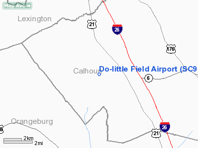
Location & QuickFacts
| FAA Information Effective: | 2008-09-25 |
| Airport Identifier: | SC90 |
| Airport Status: | Operational |
| Longitude/Latitude: | 080-56-54.0000W/33-40-34.0000N
-80.948333/33.676111 (Estimated) |
| Elevation: | 369 ft / 112.47 m (Estimated) |
| Land: | 7 acres |
| From nearest city: | 9 nautical miles W of St. Matthews, SC |
| Location: | Calhoun County, SC |
| Magnetic Variation: | 05W (1990) |
Owner & Manager
| Ownership: | Privately owned |
| Owner: | Do-little Field Inc |
| Address: | 160 Do Little Lane
St Matthews, SC 29135 |
| Phone number: | 803-874-4281 |
| Manager: | James J. Howell |
| Address: | 144 Do Little Lane
St Matthews, SC 29135 |
| Phone number: | 803-874-4491 |
Airport Operations and Facilities
| Airport Use: | Private |
| Wind indicator: | Yes |
| Segmented Circle: | No |
| Control Tower: | No |
| Sectional chart: | Charlotte |
| Region: | ASO - Southern |
| Boundary ARTCC: | ZJX - Jacksonville |
| Tie-in FSS: | AND - Anderson |
| FSS on Airport: | No |
| FSS Toll Free: | 1-800-WX-BRIEF |
Runway Information
Runway 14/32
| Dimension: | 3200 x 100 ft / 975.4 x 30.5 m |
| Surface: | TURF, |
| |
Runway 14 |
Runway 32 |
| Traffic Pattern: | Left | Right |
|
Radio Navigation Aids
| ID |
Type |
Name |
Ch |
Freq |
Var |
Dist |
| OYI | NDB | Orangeburg | | 226.00 | 05W | 15.7 nm |
| MMT | NDB | Mc Entire | | 427.00 | 05W | 17.3 nm |
| BKO | NDB | Barnwell | | 392.00 | 06W | 31.0 nm |
| SMS | NDB | Sumter | | 252.00 | 04W | 34.9 nm |
| AIK | NDB | Aiken | | 347.00 | 04W | 36.5 nm |
| MNI | NDB | Manning | | 381.00 | 06W | 37.5 nm |
| FDW | NDB | Winnsboro | | 414.00 | 05W | 39.2 nm |
| CDN | NDB | Camden | | 263.00 | 05W | 41.3 nm |
| RBW | NDB | Walterboro | | 221.00 | 05W | 47.7 nm |
| SSC | TACAN | Shaw | 038X | | 05W | 30.1 nm |
| ALD | VOR | Allendale | | 116.70 | 01W | 43.5 nm |
| EDS | VOR/DME | Edisto | 051X | 111.40 | 05W | 14.0 nm |
| CAE | VORTAC | Columbia | 094X | 114.70 | 02W | 12.1 nm |
| MMT | VORTAC | Mc Entire | 079X | 113.20 | 05W | 16.6 nm |
| VAN | VORTAC | Vance | 041X | 110.40 | 06W | 27.8 nm |
Remarks
- PRVDD VFR/PR USE; RY IS ALIGNED PARALLEL WITH RY AT ALAN ARPT; LOA WITH ALAN ARPT.
Images and information placed above are from
http://www.airport-data.com/airport/SC90/
We thank them for the data!
| General Info
|
| Country |
United States
|
| State |
SOUTH CAROLINA
|
| FAA ID |
SC90
|
| Latitude |
33-40-34.000N
|
| Longitude |
080-56-54.000W
|
| Elevation |
369 feet
|
| Near City |
ST. MATTHEWS
|
We don't guarantee the information is fresh and accurate. The data may
be wrong or outdated.
For more up-to-date information please refer to other sources.
|
|


