 |
|
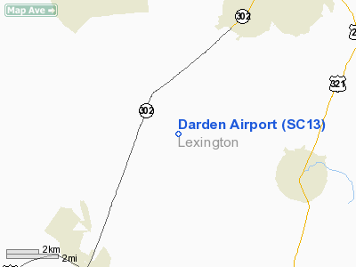
Location & QuickFacts
| FAA Information Effective: | 2008-09-25 |
| Airport Identifier: | SC13 |
| Airport Status: | Operational |
| Longitude/Latitude: | 081-11-01.3530W/33-50-26.5430N
-81.183709/33.840706 (Estimated) |
| Elevation: | 450 ft / 137.16 m (Estimated) |
| Land: | 0 acres |
| From nearest city: | 5 nautical miles NW of Gaston, SC |
| Location: | Lexington County, SC |
| Magnetic Variation: | 04W (1985) |
Owner & Manager
| Ownership: | Privately owned |
| Owner: | C. W. Darden |
| Address: | 487 Peachtree Rd
Lexington, SC 29073-7932 |
| Phone number: | 803-755-2655 |
| Manager: | Mark A. Phillips |
| Address: | 481 Peachtree Rock Rd
Lexington, SC 29073 |
| Phone number: | 803-755-2655 |
Airport Operations and Facilities
| Airport Use: | Private |
| Wind indicator: | Yes |
| Segmented Circle: | No |
| Control Tower: | No |
| Landing fee charge: | No |
| Sectional chart: | Atlanta |
| Region: | ASO - Southern |
| Boundary ARTCC: | ZJX - Jacksonville |
| Tie-in FSS: | AND - Anderson |
| FSS on Airport: | No |
| FSS Toll Free: | 1-800-WX-BRIEF |
Runway Information
Runway 12/30
| Dimension: | 3300 x 200 ft / 1005.8 x 61.0 m |
| Surface: | TURF, |
| |
Runway 12 |
Runway 30 |
| Traffic Pattern: | Left | Left |
| Obstruction: | | 35 ft trees, 0.0 ft from runway |
|
Radio Navigation Aids
| ID |
Type |
Name |
Ch |
Freq |
Var |
Dist |
| MMT | NDB | Mc Entire | | 427.00 | 05W | 20.0 nm |
| AIK | NDB | Aiken | | 347.00 | 04W | 27.1 nm |
| FDW | NDB | Winnsboro | | 414.00 | 05W | 28.7 nm |
| OYI | NDB | Orangeburg | | 226.00 | 05W | 29.0 nm |
| BKO | NDB | Barnwell | | 392.00 | 06W | 32.0 nm |
| EOE | NDB | Enoree | | 278.00 | 05W | 36.2 nm |
| CDN | NDB | Camden | | 263.00 | 05W | 40.8 nm |
| SMS | NDB | Sumter | | 252.00 | 04W | 42.1 nm |
| EMR | NDB | Emory | | 385.00 | 04W | 46.6 nm |
| SSC | TACAN | Shaw | 038X | | 05W | 36.7 nm |
| EDS | VOR/DME | Edisto | 051X | 111.40 | 05W | 28.3 nm |
| CAE | VORTAC | Columbia | 094X | 114.70 | 02W | 6.6 nm |
| MMT | VORTAC | Mc Entire | 079X | 113.20 | 05W | 19.7 nm |
| VAN | VORTAC | Vance | 041X | 110.40 | 06W | 42.9 nm |
| IRQ | VORTAC | Colliers | 086X | 113.90 | 04W | 49.5 nm |
Remarks
Images and information placed above are from
http://www.airport-data.com/airport/SC13/
We thank them for the data!
| General Info
|
| Country |
United States
|
| State |
SOUTH CAROLINA
|
| FAA ID |
SC13
|
| Latitude |
33-50-26.543N
|
| Longitude |
081-11-01.353W
|
| Elevation |
450 feet
|
| Near City |
GASTON
|
We don't guarantee the information is fresh and accurate. The data may
be wrong or outdated.
For more up-to-date information please refer to other sources.
|
|


