 |
|
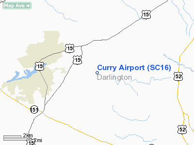
Location & QuickFacts
| FAA Information Effective: | 2008-09-25 |
| Airport Identifier: | SC16 |
| Airport Status: | Operational |
| Longitude/Latitude: | 080-00-19.2370W/34-22-40.5560N
-80.005344/34.377932 (Estimated) |
| Elevation: | 199 ft / 60.66 m (Surveyed) |
| Land: | 6 acres |
| From nearest city: | 3 nautical miles E of Hartsville, SC |
| Location: | Darlington County, SC |
| Magnetic Variation: | 06W (1985) |
Owner & Manager
| Ownership: | Privately owned |
| Owner: | B. W. Curry |
| Address: | Po Box 294
Hartsville, SC 29550 |
| Phone number: | 803-332-9351 |
| Manager: | B. W. Curry |
| Address: | Po Box 294
Hartsville, SC 29550 |
| Phone number: | 803-332-9351 |
Airport Operations and Facilities
| Airport Use: | Private |
| Wind indicator: | Yes |
| Segmented Circle: | No |
| Control Tower: | No |
| Landing fee charge: | No |
| Sectional chart: | Charlotte |
| Region: | ASO - Southern |
| Boundary ARTCC: | ZJX - Jacksonville |
| Tie-in FSS: | AND - Anderson |
| FSS on Airport: | No |
| FSS Toll Free: | 1-800-WX-BRIEF |
Airport Services
| Airframe Repair: | NONE |
| Power Plant Repair: | NONE |
Runway Information
Runway 01/19
| Dimension: | 2600 x 200 ft / 792.5 x 61.0 m |
| Surface: | TURF, |
| |
Runway 01 |
Runway 19 |
| Traffic Pattern: | Left | Left |
| Obstruction: | | 50 ft trees, 100.0 ft from runway |
|
Radio Navigation Aids
| ID |
Type |
Name |
Ch |
Freq |
Var |
Dist |
| HVS | NDB | Hartsville | | 341.00 | 07W | 5.9 nm |
| UDG | NDB | Darlington | | 245.00 | 06W | 7.0 nm |
| BES | NDB | Bennettsville | | 230.00 | 07W | 19.8 nm |
| CQW | NDB | Cheraw | | 409.00 | 05W | 22.9 nm |
| PYG | NDB | Pageland | | 270.00 | 06W | 27.5 nm |
| CDN | NDB | Camden | | 263.00 | 05W | 28.2 nm |
| SMS | NDB | Sumter | | 252.00 | 04W | 29.2 nm |
| DLC | NDB | Dillon | | 274.00 | 05W | 31.9 nm |
| RCZ | NDB | Roscoe | | 375.00 | 07W | 32.4 nm |
| CFY | NDB | Evans | | 420.00 | 06W | 33.6 nm |
| ME | NDB | Maxtn | | 257.00 | 08W | 35.1 nm |
| MAO | NDB | Marion | | 388.00 | 06W | 35.3 nm |
| AFP | NDB | Anson County | | 283.00 | 07W | 39.0 nm |
| CKI | NDB | Kingstree | | 404.00 | 06W | 40.4 nm |
| JB | NDB | Jigel | | 384.00 | 08W | 44.1 nm |
| HEK | NDB | Stuckey | | 236.00 | 06W | 45.8 nm |
| HFF | NDB | Mackall | | 278.00 | 06W | 46.8 nm |
| LKR | NDB | Lancaster | | 400.00 | 07W | 47.1 nm |
| MMT | NDB | Mc Entire | | 427.00 | 05W | 47.6 nm |
| MNI | NDB | Manning | | 381.00 | 06W | 48.5 nm |
| TWL | NDB | Wesley | | 204.00 | 06W | 48.9 nm |
| RSY | NDB | Robeson | | 359.00 | 08W | 48.9 nm |
| SSC | TACAN | Shaw | 038X | | 05W | 33.2 nm |
| LBT | VOR | Lumberton | | 110.00 | 08W | 49.1 nm |
| CTF | VOR/DME | Chesterfield | 019X | 108.20 | 03W | 21.1 nm |
| FLO | VORTAC | Florence | 099X | 115.20 | 03W | 19.4 nm |
| MMT | VORTAC | Mc Entire | 079X | 113.20 | 05W | 48.1 nm |
Remarks
Images and information placed above are from
http://www.airport-data.com/airport/SC16/
We thank them for the data!
| General Info
|
| Country |
United States
|
| State |
SOUTH CAROLINA
|
| FAA ID |
SC16
|
| Latitude |
34-22-40.556N
|
| Longitude |
080-00-19.237W
|
| Elevation |
199 feet
|
| Near City |
HARTSVILLE
|
We don't guarantee the information is fresh and accurate. The data may
be wrong or outdated.
For more up-to-date information please refer to other sources.
|
|


