 |
|
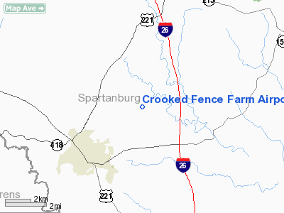
Crooked Fence Farm Airport |
Location & QuickFacts
| FAA Information Effective: | 2008-09-25 |
| Airport Identifier: | 3SC4 |
| Airport Status: | Operational |
| Longitude/Latitude: | 081-59-11.0000W/34-46-25.0000N
-81.986389/34.773611 (Estimated) |
| Elevation: | 645 ft / 196.60 m (Estimated) |
| Land: | 0 acres |
| From nearest city: | 2 nautical miles E of Woodruff, SC |
| Location: | Spartanburg County, SC |
| Magnetic Variation: | 05W (1995) |
Owner & Manager
| Ownership: | Privately owned |
| Owner: | Stacey Jackson |
| Address: | 14100 E. Wade Hampton Blvd
Greer, SC 29651 |
| Phone number: | 864-877-9090 |
| Manager: | Stacey Jackson |
| Address: | 14100 E. Wade Hampton Blvd.
Greer, SC 29651 |
| Phone number: | 864-877-9090 |
Airport Operations and Facilities
| Airport Use: | Private |
| Wind indicator: | Yes |
| Segmented Circle: | No |
| Control Tower: | No |
| Sectional chart: | Atlanta |
| Region: | ASO - Southern |
| Boundary ARTCC: | ZTL - Atlanta |
| Tie-in FSS: | AND - Anderson |
| FSS Toll Free: | 1-800-WX-BRIEF |
Runway Information
Runway 08/26
| Dimension: | 3033 x 50 ft / 924.5 x 15.2 m |
| Surface: | ASPH, |
| |
Runway 08 |
Runway 26 |
| Traffic Pattern: | Left | Left |
|
Radio Navigation Aids
| ID |
Type |
Name |
Ch |
Freq |
Var |
Dist |
| FRT | NDB | Fairmont | | 248.00 | 05W | 7.7 nm |
| LUX | NDB | Laurens | | 307.00 | 04W | 16.1 nm |
| UOT | NDB | Union County | | 326.00 | 04W | 17.8 nm |
| GY | NDB | Dyana | | 338.00 | 03W | 23.1 nm |
| GIW | NDB | Coronaca | | 239.00 | 04W | 31.6 nm |
| EOE | NDB | Enoree | | 278.00 | 05W | 32.7 nm |
| SLP | NDB | First River | | 417.00 | 06W | 34.5 nm |
| RFE | NDB | Rutherford | | 344.00 | 05W | 34.6 nm |
| LQK | NDB | Lake Keowee | | 408.00 | 04W | 35.5 nm |
| BRA | NDB | Broad River | | 379.00 | 04W | 38.3 nm |
| DCM | NDB | Chester | | 220.00 | 06W | 38.8 nm |
| AND | NDB | Anderson County | | 230.00 | 04W | 39.4 nm |
| CEU | NDB | Clemson | | 257.00 | 05W | 44.9 nm |
| UZ | NDB | Rally | | 227.00 | 05W | 45.2 nm |
| GHJ | NDB | Stonia | | 260.00 | 06W | 47.9 nm |
| SPA | VORTAC | Spartanburg | 104X | 115.70 | 02W | 15.9 nm |
| GRD | VORTAC | Greenwood | 102X | 115.50 | 01W | 32.5 nm |
| SUG | VORTAC | Sugarloaf Mountain | 059X | 112.20 | 02W | 40.5 nm |
| ELW | VORTAC | Electric City | 023X | 108.60 | 00E | 44.9 nm |
Remarks
- 150 FT RADIO TOWER 2 NM EAST OF ARPT.
- PRVDD VFR, PVT USE.
Images and information placed above are from
http://www.airport-data.com/airport/3SC4/
We thank them for the data!
| General Info
|
| Country |
United States
|
| State |
SOUTH CAROLINA
|
| FAA ID |
3SC4
|
| Latitude |
34-46-25.000N
|
| Longitude |
081-59-11.000W
|
| Elevation |
645 feet
|
| Near City |
WOODRUFF
|
We don't guarantee the information is fresh and accurate. The data may
be wrong or outdated.
For more up-to-date information please refer to other sources.
|
|


