 |
|
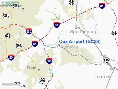
Location & QuickFacts
| FAA Information Effective: | 2008-09-25 |
| Airport Identifier: | SC33 |
| Airport Status: | Operational |
| Longitude/Latitude: | 082-15-35.4160W/34-49-27.4260N
-82.259838/34.824285 (Estimated) |
| Elevation: | 1000 ft / 304.80 m (Estimated) |
| Land: | 0 acres |
| From nearest city: | 4 nautical miles NW of Simpsonville, SC |
| Location: | Greenville County, SC |
| Magnetic Variation: | 04W (1985) |
Owner & Manager
| Ownership: | Privately owned |
| Owner: | Richard Cox |
| Address: | 3818 Highway 14
Greenville, SC 29615 |
| Phone number: | 803-288-1888 |
| Address: |
|
Airport Operations and Facilities
| Airport Use: | Private |
| Wind indicator: | No |
| Segmented Circle: | No |
| Control Tower: | No |
| Landing fee charge: | No |
| Sectional chart: | Atlanta |
| Region: | ASO - Southern |
| Boundary ARTCC: | ZTL - Atlanta |
| Tie-in FSS: | AND - Anderson |
| FSS on Airport: | No |
| FSS Toll Free: | 1-800-WX-BRIEF |
Airport Services
| Airframe Repair: | NONE |
| Power Plant Repair: | NONE |
Runway Information
Runway 10/28
| Dimension: | 1600 x 50 ft / 487.7 x 15.2 m |
| Surface: | TURF, |
| |
Runway 10 |
Runway 28 |
| Traffic Pattern: | Right | Left |
| Obstruction: | | 20 ft pline |
|
Radio Navigation Aids
| ID |
Type |
Name |
Ch |
Freq |
Var |
Dist |
| GY | NDB | Dyana | | 338.00 | 03W | 12.1 nm |
| FRT | NDB | Fairmont | | 248.00 | 05W | 14.4 nm |
| LQK | NDB | Lake Keowee | | 408.00 | 04W | 21.9 nm |
| LUX | NDB | Laurens | | 307.00 | 04W | 24.4 nm |
| BRA | NDB | Broad River | | 379.00 | 04W | 28.9 nm |
| AND | NDB | Anderson County | | 230.00 | 04W | 29.6 nm |
| UOT | NDB | Union County | | 326.00 | 04W | 31.6 nm |
| CEU | NDB | Clemson | | 257.00 | 05W | 32.3 nm |
| RFE | NDB | Rutherford | | 344.00 | 05W | 35.0 nm |
| GIW | NDB | Coronaca | | 239.00 | 04W | 35.4 nm |
| SLP | NDB | First River | | 417.00 | 06W | 41.5 nm |
| EOE | NDB | Enoree | | 278.00 | 05W | 43.6 nm |
| SPA | VORTAC | Spartanburg | 104X | 115.70 | 02W | 20.7 nm |
| GRD | VORTAC | Greenwood | 102X | 115.50 | 01W | 34.8 nm |
| SUG | VORTAC | Sugarloaf Mountain | 059X | 112.20 | 02W | 35.0 nm |
| ELW | VORTAC | Electric City | 023X | 108.60 | 00E | 35.6 nm |
Remarks
Images and information placed above are from
http://www.airport-data.com/airport/SC33/
We thank them for the data!
| General Info
|
| Country |
United States
|
| State |
SOUTH CAROLINA
|
| FAA ID |
SC33
|
| Latitude |
34-49-27.426N
|
| Longitude |
082-15-35.416W
|
| Elevation |
1000 feet
|
| Near City |
SIMPSONVILLE
|
We don't guarantee the information is fresh and accurate. The data may
be wrong or outdated.
For more up-to-date information please refer to other sources.
|
|


