 |
|
Conway-horry County Airport |
| Conway-Horry County Airport |
| IATA: none – ICAO: KHYW – FAA LID: HYW |
| Summary |
| Airport type |
Public |
| Owner |
Horry County Department of Airports |
| Serves |
Conway, South Carolina |
| Location |
U.S. Route 378 |
| Elevation AMSL |
35 ft / 11 m |
| Coordinates |
33°49′43″N 079°07′20″W / 33.82861°N 79.12222°W / 33.82861; -79.12222 |
| Runways |
| Direction |
Length |
Surface |
| ft |
m |
| 4/22 |
4,401 |
1,341 |
Asphalt |
| Statistics (2007) |
| Aircraft operations |
43,050 |
| Based aircraft |
39 |
| Source: Federal Aviation Administration |
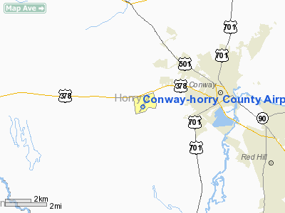
Conway-Horry County Airport (ICAO: KHYW, FAA LID: HYW) is a county-owned public-use airport located three nautical miles (6 km) west of the central business district of Conway, a city in Horry County, South Carolina, United States.
Conway-Horry County airport serves mostly general aviation with maintenance and refueling of aircraft. The airport is located off of U.S. Route 378 west of the city of Conway. The airport has 2 runways and covers 265 acres (1.07 km) of land.
Although most U.S. airports use the same three-letter location identifier for the FAA and IATA, this airport is assigned HYW by the FAA but has no designation from the IATA. Facilities and aircraft
Conway-Horry County Airport covers an area of 265 acres (107 ha) at an elevation of 35 feet (11 m) above mean sea level. It has one runway designated 4/22 with a 4,401 by 75 ft (1,341 x 23 m) asphalt surface.
For the 12-month period ending September 11, 2007, the airport had 43,050 aircraft operations, an average of 117 per day: ~99% general aviation, <1% air charter and <1% military. At that time there were 39 aircraft based at this airport: 90% single-engine and 10% multi-engine.
The above content comes from Wikipedia and is published under free licenses – click here to read more.
Location & QuickFacts
| FAA Information Effective: | 2008-09-25 |
| Airport Identifier: | HYW |
| Airport Status: | Operational |
| Longitude/Latitude: | 079-07-19.8348W/33-49-42.5550N
-79.122176/33.828488 (Estimated) |
| Elevation: | 35 ft / 10.67 m (Surveyed) |
| Land: | 265 acres |
| From nearest city: | 3 nautical miles W of Conway, SC |
| Location: | Horry County, SC |
| Magnetic Variation: | 08W (2000) |
Owner & Manager
| Ownership: | Publicly owned |
| Owner: | Horry County |
| Address: | Po Box 1236
Conway, SC 29526 |
| Phone number: | 843-248-1201 |
| Manager: | Bob Kemp |
| Address: | 1100 Jetport Road
Myrtle Beach, SC 29577 |
| Phone number: | 843-448-1580
FBO - BENJAMIN CREEL 843-397-9111. |
Airport Operations and Facilities
| Airport Use: | Open to public |
| Wind indicator: | Yes |
| Segmented Circle: | Yes |
| Control Tower: | No |
| Lighting Schedule: | DUSK-DAWN
MIRL RY 04/22; PAPI RYS 04 AND 22 OPER DUSK - 0000; AFT 0000 ACTVT - CTAF. |
| Beacon Color: | Clear-Green (lighted land airport) |
| Landing fee charge: | No |
| Sectional chart: | Charlotte |
| Region: | ASO - Southern |
| Traffic Pattern Alt: | 1000 ft |
| Boundary ARTCC: | ZJX - Jacksonville |
| Tie-in FSS: | AND - Anderson |
| FSS on Airport: | No |
| FSS Toll Free: | 1-800-WX-BRIEF |
| NOTAMs Facility: | AND (NOTAM-d service avaliable) |
| Federal Agreements: | NGY |
Airport Communications
| CTAF: | 122.700 |
| Unicom: | 122.700 |
Airport Services
| Fuel available: | 100LLA A+ |
| Airframe Repair: | MAJOR |
| Power Plant Repair: | MAJOR |
| Bottled Oxygen: | NONE |
| Bulk Oxygen: | NONE |
Runway Information
Runway 04/22
| Dimension: | 4401 x 75 ft / 1341.4 x 22.9 m |
| Surface: | ASPH, Good Condition |
| Weight Limit: | Single wheel: 12500 lbs.
Dual wheel: 20000 lbs. |
| Edge Lights: | Medium |
| |
Runway 04 |
Runway 22 |
| Longitude: | 079-07-33.5893W | 079-07-06.0802W |
| Latitude: | 33-49-24.0586N | 33-50-01.0513N |
| Elevation: | 33.00 ft | 34.00 ft |
| Alignment: | 32 | 127 |
| Traffic Pattern: | Right | Left |
| Markings: | Non-precision instrument, Good Condition
RY 04/22 MARKINGS AND NUMBERS FADED. | Non-precision instrument, Good Condition |
| Crossing Height: | 39.00 ft | 36.00 ft |
| VASI: | 2-light PAPI on left side | 2-light PAPI on left side |
| Visual Glide Angle: | 4.00° | 4.00° |
| Obstruction: | 60 ft tree, 1776.0 ft from runway, 217 ft left of centerline, 26:1 slope to clear | 76 ft tree, 2371.0 ft from runway, 197 ft right of centerline, 28:1 slope to clear |
|
Radio Navigation Aids
| ID |
Type |
Name |
Ch |
Freq |
Var |
Dist |
| HYW | NDB | Horry | | 370.00 | 08W | 0.4 nm |
| HEK | NDB | Stuckey | | 236.00 | 06W | 21.0 nm |
| MAO | NDB | Marion | | 388.00 | 06W | 23.9 nm |
| PHH | NDB | Andrews | | 255.00 | 06W | 30.4 nm |
| CFY | NDB | Evans | | 420.00 | 06W | 32.2 nm |
| GGE | NDB | Georgetown | | 242.00 | 06W | 32.5 nm |
| CPC | NDB | Camp | | 227.00 | 07W | 33.5 nm |
| CKI | NDB | Kingstree | | 404.00 | 06W | 37.2 nm |
| DLC | NDB | Dillon | | 274.00 | 05W | 39.3 nm |
| JB | NDB | Jigel | | 384.00 | 08W | 43.1 nm |
| RSY | NDB | Robeson | | 359.00 | 08W | 47.3 nm |
| LBT | VOR | Lumberton | | 110.00 | 08W | 47.1 nm |
| CRE | VORTAC | Grand Strand | 123X | 117.60 | 03W | 19.9 nm |
| FLO | VORTAC | Florence | 099X | 115.20 | 03W | 36.1 nm |
Remarks
Images and information placed above are from
http://www.airport-data.com/airport/HYW/
We thank them for the data!
| General Info
|
| Country |
United States
|
| State |
SOUTH CAROLINA
|
| FAA ID |
HYW
|
| Latitude |
33-49-42.600N
|
| Longitude |
079-07-19.800W
|
| Elevation |
34 feet
|
| Near City |
CONWAY
|
We don't guarantee the information is fresh and accurate. The data may
be wrong or outdated.
For more up-to-date information please refer to other sources.
|
|


