 |
|
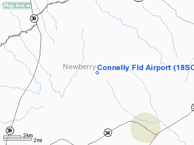
Location & QuickFacts
| FAA Information Effective: | 2008-09-25 |
| Airport Identifier: | 18SC |
| Airport Status: | Operational |
| Longitude/Latitude: | 081-46-24.3980W/34-16-26.4830N
-81.773444/34.274023 (Estimated) |
| Elevation: | 570 ft / 173.74 m (Estimated) |
| Land: | 0 acres |
| From nearest city: | 4 nautical miles SW of Silverstreet, SC |
| Location: | Newberry County, SC |
| Magnetic Variation: | 04W (1985) |
Owner & Manager
| Ownership: | Privately owned |
| Owner: | James S. Connelly |
| Address: | Rfd 1, Box 22
Silverstreet, SC 29145 |
| Phone number: | 803-276-2278 |
| Address: |
|
Airport Operations and Facilities
| Airport Use: | Private |
| Wind indicator: | Yes |
| Segmented Circle: | No |
| Control Tower: | No |
| Sectional chart: | Atlanta |
| Region: | ASO - Southern |
| Boundary ARTCC: | ZTL - Atlanta |
| Tie-in FSS: | AND - Anderson |
| FSS on Airport: | No |
| FSS Toll Free: | 1-800-WX-BRIEF |
Airport Services
| Airframe Repair: | NONE |
| Power Plant Repair: | NONE |
Runway Information
Runway 05/23
| Dimension: | 2000 x 60 ft / 609.6 x 18.3 m |
| Surface: | TURF, |
| |
Runway 05 |
Runway 23 |
| Traffic Pattern: | Left | Left |
|
Radio Navigation Aids
| ID |
Type |
Name |
Ch |
Freq |
Var |
Dist |
| EOE | NDB | Enoree | | 278.00 | 05W | 7.2 nm |
| GIW | NDB | Coronaca | | 239.00 | 04W | 15.6 nm |
| LUX | NDB | Laurens | | 307.00 | 04W | 16.6 nm |
| UOT | NDB | Union County | | 326.00 | 04W | 25.5 nm |
| FDW | NDB | Winnsboro | | 414.00 | 05W | 32.9 nm |
| AIK | NDB | Aiken | | 347.00 | 04W | 37.7 nm |
| FRT | NDB | Fairmont | | 248.00 | 05W | 39.2 nm |
| GY | NDB | Dyana | | 338.00 | 03W | 41.6 nm |
| DCM | NDB | Chester | | 220.00 | 06W | 41.9 nm |
| AND | NDB | Anderson County | | 230.00 | 04W | 48.3 nm |
| GRD | VORTAC | Greenwood | 102X | 115.50 | 01W | 19.0 nm |
| IRQ | VORTAC | Colliers | 086X | 113.90 | 04W | 39.2 nm |
| CAE | VORTAC | Columbia | 094X | 114.70 | 02W | 43.7 nm |
| SPA | VORTAC | Spartanburg | 104X | 115.70 | 02W | 46.3 nm |
Images and information placed above are from
http://www.airport-data.com/airport/18SC/
We thank them for the data!
| General Info
|
| Country |
United States
|
| State |
SOUTH CAROLINA
|
| FAA ID |
18SC
|
| Latitude |
34-16-26.483N
|
| Longitude |
081-46-24.398W
|
| Elevation |
570 feet
|
| Near City |
SILVERSTREET
|
We don't guarantee the information is fresh and accurate. The data may
be wrong or outdated.
For more up-to-date information please refer to other sources.
|
|


