 |
|
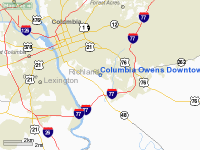
Columbia Owens Downtown Airport |
| Jim Hamilton - L.B. Owens Airport |
 |
| IATA: CUB – ICAO: KCUB – FAA LID: CUB |
| Summary |
| Airport type |
Public |
| Owner |
County of Richland |
| Serves |
Columbia, South Carolina |
| Elevation AMSL |
194 ft / 59 m |
| Coordinates |
33°58′14″N 080°59′43″W / 33.97056°N 80.99528°W / 33.97056; -80.99528 |
| Website |
RichlandOnline.com/... |
| Runways |
| Direction |
Length |
Surface |
| ft |
m |
| 13/31 |
5,011 |
1,527 |
Asphalt |
| Statistics (2009) |
| Aircraft operations |
56,000 |
| Based aircraft |
126 |
| Source: Federal Aviation Administration |
Jim Hamilton - L.B. Owens Airport (IATA: CUB, ICAO: KCUB, FAA LID: CUB) is a county-owned public-use airport located two nautical miles (3.7 km) south of the central business district of Columbia, in Richland County, South Carolina, United States. In 2008, the airport was renamed in honor of former airport manager Jim Hamilton. It was formerly known as Columbia Owens Downtown Airport. History
Owens Field was the main municipal airport serving Columbia, South Carolina prior to World War II. It was named for Columbia Mayor Lawrence B. Owens, who was one of the most ardent supporters of a municipal airport. On April 24, 1930, the new municipal airport was dedicated. In celebration, an airshow with more than 15,000 people attending saw notable aviators like the President of the Curtiss Flying Service, Casey Jones, Bill Winston (the flying instructor of Charles Lindbergh), and Elliot White Springs.
Eastern Air Transport began passenger and airmail service to Owens Field in 1932. Delta Air Lines began its first scheduled services out of Columbia's new airport in 1934. Just prior to World War II, some Air Corps light observation squadrons flew observation flights from Owens Field, until Columbia Army Air Base opened in 1941. During the war, President Franklin D. Roosevelt landed at Owens Field during a visit to Columbia.
Owens Field remained the commercial airport for Columbia until airline service was relocated to the larger Columbia Metropolitan Airport near Cayce in 1947. Since then Owens Downtown Airport has served the general aviation community of Columbia and the midlands.
Facilities and aircraft
Jim Hamilton - L.B. Owens Airport covers an area of 182 acres (74 ha) at an elevation of 194 feet (59 m) above mean sea level. It has one runway designated 13/31 with an asphalt surface measuring 5,011 by 75 feet (1,527 x 23 m).
For the 12-month period ending November 19, 2009, the airport had 56,000 aircraft operations, an average of 153 per day: 92% general aviation, 6% air taxi, and 2% military. At that time there were 126 aircraft based at this airport: 81% single-engine, 15% multi-engine, 1% jet and 3% helicopter.
The above content comes from Wikipedia and is published under free licenses – click here to read more.
Location & QuickFacts
| FAA Information Effective: | 2008-09-25 |
| Airport Identifier: | CUB |
| Airport Status: | Operational |
| Longitude/Latitude: | 080-59-42.9000W/33-58-13.7000N
-80.995250/33.970472 (Estimated) |
| Elevation: | 193 ft / 58.83 m (Surveyed) |
| Land: | 182 acres |
| From nearest city: | 2 nautical miles S of Columbia, SC |
| Location: | Richland County, SC |
| Magnetic Variation: | 06W (1995) |
Owner & Manager
| Ownership: | Publicly owned |
| Owner: | County Of Richland |
| Address: | Po Box 192
Columbia, SC 29202 |
| Phone number: | 803-748-4616 |
| Manager: | Jim Hamilton
FBO EAGLE AVIATION 803-771-7915. |
| Address: | 1400 Jim Hamilton Blvd
Columbia, SC 29205 |
| Phone number: | 803-771-7915 |
Airport Operations and Facilities
| Airport Use: | Open to public |
| Wind indicator: | Yes |
| Segmented Circle: | Yes |
| Control Tower: | No |
| Lighting Schedule: | DUSK-DAWN
ACTVT MIRL RY 13/31 AND REILS RYS 13 & 31 - CTAF. |
| Beacon Color: | Clear-Green (lighted land airport) |
| Landing fee charge: | No |
| Sectional chart: | Atlanta |
| Region: | ASO - Southern |
| Traffic Pattern Alt: | 807 ft |
| Boundary ARTCC: | ZJX - Jacksonville |
| Tie-in FSS: | AND - Anderson |
| FSS on Airport: | No |
| FSS Toll Free: | 1-800-WX-BRIEF |
| NOTAMs Facility: | CUB (NOTAM-d service avaliable) |
| Federal Agreements: | NGY |
Airport Communications
| CTAF: | 122.800 |
| Unicom: | 122.800 |
Airport Services
| Fuel available: | 100LLA
CONTRACT FUEL FOR MILITARY. |
| Airframe Repair: | MAJOR |
| Power Plant Repair: | MAJOR |
| Bottled Oxygen: | HIGH/LOW |
| Bulk Oxygen: | NONE |
Runway Information
Runway 13/31
| Dimension: | 5002 x 75 ft / 1524.6 x 22.9 m |
| Surface: | ASPH, Good Condition |
| Weight Limit: | Single wheel: 20000 lbs.
Dual wheel: 40000 lbs. |
| Edge Lights: | Medium |
| |
Runway 13 |
Runway 31 |
| Longitude: | 081-00-07.0768W | 080-59-18.6790W |
| Latitude: | 33-58-27.9851N | 33-57-59.3080N |
| Elevation: | 193.00 ft | 182.00 ft |
| Alignment: | 125 | 127 |
| ILS Type: | | LOC/DME
|
| Traffic Pattern: | Right | Left |
| Markings: | Non-precision instrument, Good Condition | Non-precision instrument, Good Condition |
| Crossing Height: | 70.00 ft | 45.00 ft |
| Displaced threshold: | 0.00 ft | 391.00 ft |
| VASI: | 2-light PAPI on left side | 2-light PAPI on right side |
| Visual Glide Angle: | 4.00° | 3.00° |
| Runway End Identifier: | Yes | Yes |
| Obstruction: | 54 ft tree, 785.0 ft from runway, 246 ft left of centerline, 10:1 slope to clear | 16 ft tree, 368.0 ft from runway, 37 ft left of centerline, 10:1 slope to clear
RY 31 APCH SLOPE 36:1 TO DSPLCD THLD.
17 FT TREES 160 FT FM THLD, 56 FT LEFT. |
| Decleard distances: | Take off run available 4999.00 ft
Take off distance available 4999.00 ft
Actual stop distance available 4999.00 ft
Landing distance available 4999.00 ft
400 FT STWY NW END OF RY. | Take off run available 4999.00 ft
Take off distance available 4999.00 ft
Actual stop distance available 4999.00 ft
Landing distance available 4599.00 ft
|
|
Radio Navigation Aids
| ID |
Type |
Name |
Ch |
Freq |
Var |
Dist |
| MMT | NDB | Mc Entire | | 427.00 | 05W | 10.0 nm |
| FDW | NDB | Winnsboro | | 414.00 | 05W | 21.5 nm |
| CDN | NDB | Camden | | 263.00 | 05W | 28.6 nm |
| SMS | NDB | Sumter | | 252.00 | 04W | 31.7 nm |
| OYI | NDB | Orangeburg | | 226.00 | 05W | 33.5 nm |
| EOE | NDB | Enoree | | 278.00 | 05W | 37.9 nm |
| AIK | NDB | Aiken | | 347.00 | 04W | 39.1 nm |
| BKO | NDB | Barnwell | | 392.00 | 06W | 43.2 nm |
| MNI | NDB | Manning | | 381.00 | 06W | 45.6 nm |
| LKR | NDB | Lancaster | | 400.00 | 07W | 45.8 nm |
| SSC | TACAN | Shaw | 038X | | 05W | 26.4 nm |
| EDS | VOR/DME | Edisto | 051X | 111.40 | 05W | 31.7 nm |
| CAE | VORTAC | Columbia | 094X | 114.70 | 02W | 7.4 nm |
| MMT | VORTAC | Mc Entire | 079X | 113.20 | 05W | 10.0 nm |
| VAN | VORTAC | Vance | 041X | 110.40 | 06W | 40.4 nm |
Remarks
- RR SWITCHING YARD PARALLEL TO RY 13/31.
- AVOID NOISE SENSITIVE AREA NORTH OF ARPT BLO 1500 FT.
- NO NORTHBOUND DEP TURNS EITHER RY BLO 1500 FT.
- EXISTED PRIOR TO 1958.
Images and information placed above are from
http://www.airport-data.com/airport/CUB/
We thank them for the data!
| General Info
|
| Country |
United States
|
| State |
SOUTH CAROLINA
|
| FAA ID |
CUB
|
| Latitude |
33-58-13.700N
|
| Longitude |
080-59-42.900W
|
| Elevation |
193 feet
|
| Near City |
COLUMBIA
|
We don't guarantee the information is fresh and accurate. The data may
be wrong or outdated.
For more up-to-date information please refer to other sources.
|
|


