 |
|
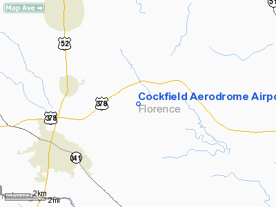
Cockfield Aerodrome Airport |
Location & QuickFacts
| FAA Information Effective: | 2008-09-25 |
| Airport Identifier: | SC60 |
| Airport Status: | Operational |
| Longitude/Latitude: | 079-41-02.2320W/33-54-14.5850N
-79.683953/33.904051 (Estimated) |
| Elevation: | 82 ft / 24.99 m (Estimated) |
| Land: | 0 acres |
| From nearest city: | 4 nautical miles SE of Scranton, SC |
| Location: | Florence County, SC |
| Magnetic Variation: | 06W (1985) |
Owner & Manager
| Ownership: | Privately owned |
| Owner: | Myrtle P. Cockfield |
| Address: | 1766 N. Old Georgetown Rd
Scranton, SC 29591 |
| Phone number: | 843-389-2318 |
| Manager: | Myrtle P. Cockfield |
| Address: | 1766 N. Old Georgetown Rd
Scranton, SC 29591 |
| Phone number: | 843-389-2318 |
Airport Operations and Facilities
| Airport Use: | Private |
| Wind indicator: | Yes |
| Segmented Circle: | No |
| Control Tower: | No |
| Sectional chart: | Charlotte |
| Region: | ASO - Southern |
| Boundary ARTCC: | ZJX - Jacksonville |
| Tie-in FSS: | AND - Anderson |
| FSS Toll Free: | 1-800-WX-BRIEF |
Runway Information
Runway 04/22
| Dimension: | 2800 x 66 ft / 853.4 x 20.1 m |
| Surface: | TURF, |
| |
Runway 04 |
Runway 22 |
| Traffic Pattern: | Left | Left |
|
Radio Navigation Aids
| ID |
Type |
Name |
Ch |
Freq |
Var |
Dist |
| CFY | NDB | Evans | | 420.00 | 06W | 5.0 nm |
| HEK | NDB | Stuckey | | 236.00 | 06W | 13.2 nm |
| CKI | NDB | Kingstree | | 404.00 | 06W | 14.1 nm |
| MAO | NDB | Marion | | 388.00 | 06W | 24.3 nm |
| HYW | NDB | Horry | | 370.00 | 08W | 28.2 nm |
| PHH | NDB | Andrews | | 255.00 | 06W | 28.3 nm |
| MNI | NDB | Manning | | 381.00 | 06W | 32.3 nm |
| UDG | NDB | Darlington | | 245.00 | 06W | 34.0 nm |
| SMS | NDB | Sumter | | 252.00 | 04W | 34.1 nm |
| DLC | NDB | Dillon | | 274.00 | 05W | 36.4 nm |
| HVS | NDB | Hartsville | | 341.00 | 07W | 37.2 nm |
| GGE | NDB | Georgetown | | 242.00 | 06W | 39.7 nm |
| BES | NDB | Bennettsville | | 230.00 | 07W | 43.1 nm |
| MKS | NDB | Moncks Corner | | 354.00 | 05W | 46.3 nm |
| JB | NDB | Jigel | | 384.00 | 08W | 47.2 nm |
| CDN | NDB | Camden | | 263.00 | 05W | 49.3 nm |
| SSC | TACAN | Shaw | 038X | | 05W | 39.3 nm |
| FLO | VORTAC | Florence | 099X | 115.20 | 03W | 19.8 nm |
| VAN | VORTAC | Vance | 041X | 110.40 | 06W | 46.1 nm |
| CRE | VORTAC | Grand Strand | 123X | 117.60 | 03W | 48.2 nm |
Remarks
Images and information placed above are from
http://www.airport-data.com/airport/SC60/
We thank them for the data!
| General Info
|
| Country |
United States
|
| State |
SOUTH CAROLINA
|
| FAA ID |
SC60
|
| Latitude |
33-54-14.585N
|
| Longitude |
079-41-02.232W
|
| Elevation |
82 feet
|
| Near City |
SCRANTON
|
We don't guarantee the information is fresh and accurate. The data may
be wrong or outdated.
For more up-to-date information please refer to other sources.
|
|


