 |
|
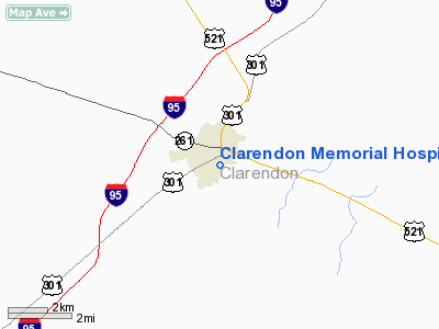
Clarendon Memorial Hospital Heliport |
Location & QuickFacts
| FAA Information Effective: | 2008-09-25 |
| Airport Identifier: | SC09 |
| Airport Status: | Operational |
| Longitude/Latitude: | 080-12-40.2880W/33-41-13.5850N
-80.211191/33.687107 (Estimated) |
| Elevation: | 190 ft / 57.91 m (Estimated) |
| Land: | 1 acres |
| From nearest city: | 0 nautical miles N of Manning, SC |
| Location: | Clarendon County, SC |
| Magnetic Variation: | 05W (1985) |
Owner & Manager
| Ownership: | Publicly owned |
| Owner: | Clarendon Memorial Hospital |
| Address: | 510 S Mill St
Manning, SC 29102 |
| Phone number: | 803-435-8463 |
| Manager: | Lin Rainey |
| Address: | 10 Hospital St
Manning, SC 29102 |
| Phone number: | 803-435-8463 |
Airport Operations and Facilities
| Airport Use: | Private
MEDICAL |
| Wind indicator: | Yes |
| Segmented Circle: | No |
| Control Tower: | No |
| Lighting Schedule: | PHONE REQ
FOR PERIMETER LGTS CALL 803-435-7463. |
| Sectional chart: | Charlotte |
| Region: | ASO - Southern |
| Boundary ARTCC: | ZJX - Jacksonville |
| Tie-in FSS: | AND - Anderson |
| FSS Toll Free: | 1-800-WX-BRIEF |
| NOTAMs Facility: | AND |
Runway Information
Helipad H1
| Dimension: | 40 x 40 ft / 12.2 x 12.2 m |
| Surface: | CONC, |
| |
Runway H1 |
Runway |
| Traffic Pattern: | Left | Left |
|
Radio Navigation Aids
| ID |
Type |
Name |
Ch |
Freq |
Var |
Dist |
| MNI | NDB | Manning | | 381.00 | 06W | 5.9 nm |
| CKI | NDB | Kingstree | | 404.00 | 06W | 17.9 nm |
| SMS | NDB | Sumter | | 252.00 | 04W | 19.7 nm |
| CFY | NDB | Evans | | 420.00 | 06W | 24.5 nm |
| MKS | NDB | Moncks Corner | | 354.00 | 05W | 31.1 nm |
| MMT | NDB | Mc Entire | | 427.00 | 05W | 32.9 nm |
| HEK | NDB | Stuckey | | 236.00 | 06W | 34.4 nm |
| PHH | NDB | Andrews | | 255.00 | 06W | 37.1 nm |
| DYB | NDB | Dorchester County | | 365.00 | 05W | 37.8 nm |
| OYI | NDB | Orangeburg | | 226.00 | 05W | 38.4 nm |
| CDN | NDB | Camden | | 263.00 | 05W | 39.9 nm |
| CH | NDB | Ashly | | 329.00 | 05W | 43.1 nm |
| HVS | NDB | Hartsville | | 341.00 | 07W | 43.5 nm |
| UDG | NDB | Darlington | | 245.00 | 06W | 48.2 nm |
| GGE | NDB | Georgetown | | 242.00 | 06W | 49.7 nm |
| SSC | TACAN | Shaw | 038X | | 05W | 21.6 nm |
| EDS | VOR/DME | Edisto | 051X | 111.40 | 05W | 35.3 nm |
| VAN | VORTAC | Vance | 041X | 110.40 | 06W | 17.4 nm |
| MMT | VORTAC | Mc Entire | 079X | 113.20 | 05W | 32.8 nm |
| FLO | VORTAC | Florence | 099X | 115.20 | 03W | 42.9 nm |
| CAE | VORTAC | Columbia | 094X | 114.70 | 02W | 43.3 nm |
| CHS | VORTAC | Charleston | 082X | 113.50 | 05W | 48.4 nm |
| CHS | VOT | Charleston | | 111.00 | | 47.7 nm |
Remarks
- FIRE EXTINGUISHER N & S END OF PAD.
- VFR PR USE 8:1 APCH SLOPE IS EST; TREES REMOVED; LGTD WIND INDICATOR MAINT; PAD IS MKD & LGTD; OBSTN LGTG AS NECESSARY.
Images and information placed above are from
http://www.airport-data.com/airport/SC09/
We thank them for the data!
| General Info
|
| Country |
United States
|
| State |
SOUTH CAROLINA
|
| FAA ID |
SC09
|
| Latitude |
33-41-13.585N
|
| Longitude |
080-12-40.288W
|
| Elevation |
190 feet
|
| Near City |
MANNING
|
We don't guarantee the information is fresh and accurate. The data may
be wrong or outdated.
For more up-to-date information please refer to other sources.
|
|


