 |
|
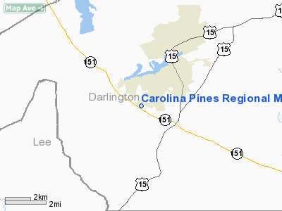
Carolina Pines Rgnl Medical Center Heliport |
Location & QuickFacts
| FAA Information Effective: | 2008-09-25 |
| Airport Identifier: | 3SC3 |
| Airport Status: | Operational |
| Longitude/Latitude: | 080-06-12.0000W/34-20-58.0000N
-80.103333/34.349444 (Estimated) |
| Elevation: | 228 ft / 69.49 m (Estimated) |
| Land: | 0 acres |
| From nearest city: | 1 nautical miles SW of Hartsville, SC |
| Location: | Darlington County, SC |
| Magnetic Variation: | 06W (1995) |
Owner & Manager
| Ownership: | Privately owned |
| Owner: | Carolina Pines Rgnl Medical Center
HEALTH MANAGEMENT ASSOCIATES. |
| Address: | 1304 West Bobo Newson Hwy
Hartsville, SC 29550 |
| Phone number: | 843-339-2100 |
| Manager: | Chip Mason |
| Address: | 1304 West Bobo Newson Hwy
Hartsville, SC 29550 |
| Phone number: | 843-339-2100 |
Airport Operations and Facilities
| Airport Use: | Private |
| Wind indicator: | Yes |
| Segmented Circle: | No |
| Control Tower: | No |
| Lighting Schedule: | PHONE REQ
FOR PERIMETER LGTS CALL 843-339-2100. |
| Sectional chart: | Charlotte |
| Region: | ASO - Southern |
| Boundary ARTCC: | ZJX - Jacksonville |
| Tie-in FSS: | AND - Anderson |
| FSS Toll Free: | 1-800-WX-BRIEF |
Runway Information
Helipad H1
| Dimension: | 40 x 40 ft / 12.2 x 12.2 m |
| Surface: | CONC, |
| |
Runway H1 |
Runway |
| Traffic Pattern: | Left | Left |
|
Radio Navigation Aids
| ID |
Type |
Name |
Ch |
Freq |
Var |
Dist |
| HVS | NDB | Hartsville | | 341.00 | 07W | 3.5 nm |
| UDG | NDB | Darlington | | 245.00 | 06W | 12.1 nm |
| CDN | NDB | Camden | | 263.00 | 05W | 23.1 nm |
| BES | NDB | Bennettsville | | 230.00 | 07W | 24.5 nm |
| SMS | NDB | Sumter | | 252.00 | 04W | 25.1 nm |
| CQW | NDB | Cheraw | | 409.00 | 05W | 26.4 nm |
| PYG | NDB | Pageland | | 270.00 | 06W | 26.5 nm |
| CFY | NDB | Evans | | 420.00 | 06W | 34.1 nm |
| RCZ | NDB | Roscoe | | 375.00 | 07W | 36.4 nm |
| DLC | NDB | Dillon | | 274.00 | 05W | 36.9 nm |
| MAO | NDB | Marion | | 388.00 | 06W | 39.5 nm |
| CKI | NDB | Kingstree | | 404.00 | 06W | 39.9 nm |
| ME | NDB | Maxtn | | 257.00 | 08W | 40.0 nm |
| AFP | NDB | Anson County | | 283.00 | 07W | 40.6 nm |
| MMT | NDB | Mc Entire | | 427.00 | 05W | 42.6 nm |
| LKR | NDB | Lancaster | | 400.00 | 07W | 43.6 nm |
| MNI | NDB | Manning | | 381.00 | 06W | 46.0 nm |
| TWL | NDB | Wesley | | 204.00 | 06W | 46.9 nm |
| HEK | NDB | Stuckey | | 236.00 | 06W | 47.1 nm |
| JB | NDB | Jigel | | 384.00 | 08W | 49.3 nm |
| SSC | TACAN | Shaw | 038X | | 05W | 28.7 nm |
| CTF | VOR/DME | Chesterfield | 019X | 108.20 | 03W | 20.0 nm |
| FLO | VORTAC | Florence | 099X | 115.20 | 03W | 23.2 nm |
| MMT | VORTAC | Mc Entire | 079X | 113.20 | 05W | 43.2 nm |
Remarks
- 600 FT & 500 FT TOWERS 0.25 NM EAST OF HELIPAD.
- SEE AIRSPACE CASE 98-ATL-083-NRA.
Images and information placed above are from
http://www.airport-data.com/airport/3SC3/
We thank them for the data!
| General Info
|
| Country |
United States
|
| State |
SOUTH CAROLINA
|
| FAA ID |
3SC3
|
| Latitude |
34-20-58.000N
|
| Longitude |
080-06-12.000W
|
| Elevation |
228 feet
|
| Near City |
HARTSVILLE
|
We don't guarantee the information is fresh and accurate. The data may
be wrong or outdated.
For more up-to-date information please refer to other sources.
|
|


