 |
|
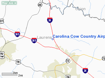
Carolina Cow Country Airport |
Location & QuickFacts
| FAA Information Effective: | 2008-09-25 |
| Airport Identifier: | 17SC |
| Airport Status: | Operational |
| Longitude/Latitude: | 081-53-10.3550W/34-31-57.4580N
-81.886210/34.532627 (Estimated) |
| Elevation: | 680 ft / 207.26 m (Estimated) |
| Land: | 0 acres |
| From nearest city: | 3 nautical miles N of Clinton, SC |
| Location: | Laurens County, SC |
| Magnetic Variation: | 04W (1985) |
Owner & Manager
| Ownership: | Privately owned |
| Owner: | C.m. Farms, Inc. |
| Address: | Po Box 346
Laurens, SC 29360 |
| Phone number: | 803-984-4444
ADDL PHONE 803-682-4444. |
| Manager: | Chester B. Aiken, Jr. |
| Address: | Po Box 346
Laurens, SC 29360 |
| Phone number: | 803-984-4521 |
Airport Operations and Facilities
| Airport Use: | Private |
| Wind indicator: | Yes |
| Segmented Circle: | No |
| Control Tower: | No |
| Landing fee charge: | No |
| Sectional chart: | Atlanta |
| Region: | ASO - Southern |
| Boundary ARTCC: | ZTL - Atlanta |
| Tie-in FSS: | AND - Anderson |
| FSS on Airport: | No |
| FSS Toll Free: | 1-800-WX-BRIEF |
Airport Services
| Airframe Repair: | NONE |
| Power Plant Repair: | NONE |
Runway Information
Runway 13/31
| Dimension: | 2400 x 55 ft / 731.5 x 16.8 m |
| Surface: | TURF, |
| |
Runway 13 |
Runway 31 |
| Traffic Pattern: | Left | Left |
|
Radio Navigation Aids
| ID |
Type |
Name |
Ch |
Freq |
Var |
Dist |
| LUX | NDB | Laurens | | 307.00 | 04W | 3.5 nm |
| UOT | NDB | Union County | | 326.00 | 04W | 15.1 nm |
| EOE | NDB | Enoree | | 278.00 | 05W | 18.2 nm |
| GIW | NDB | Coronaca | | 239.00 | 04W | 19.5 nm |
| FRT | NDB | Fairmont | | 248.00 | 05W | 22.8 nm |
| GY | NDB | Dyana | | 338.00 | 03W | 29.2 nm |
| DCM | NDB | Chester | | 220.00 | 06W | 37.2 nm |
| FDW | NDB | Winnsboro | | 414.00 | 05W | 40.5 nm |
| AND | NDB | Anderson County | | 230.00 | 04W | 40.8 nm |
| LQK | NDB | Lake Keowee | | 408.00 | 04W | 43.7 nm |
| UZ | NDB | Rally | | 227.00 | 05W | 45.2 nm |
| SLP | NDB | First River | | 417.00 | 06W | 45.5 nm |
| RFE | NDB | Rutherford | | 344.00 | 05W | 49.2 nm |
| GRD | VORTAC | Greenwood | 102X | 115.50 | 01W | 21.5 nm |
| SPA | VORTAC | Spartanburg | 104X | 115.70 | 02W | 30.2 nm |
| ELW | VORTAC | Electric City | 023X | 108.60 | 00E | 45.0 nm |
Remarks
Images and information placed above are from
http://www.airport-data.com/airport/17SC/
We thank them for the data!
| General Info
|
| Country |
United States
|
| State |
SOUTH CAROLINA
|
| FAA ID |
17SC
|
| Latitude |
34-31-57.458N
|
| Longitude |
081-53-10.355W
|
| Elevation |
680 feet
|
| Near City |
CLINTON
|
We don't guarantee the information is fresh and accurate. The data may
be wrong or outdated.
For more up-to-date information please refer to other sources.
|
|


