 |
|
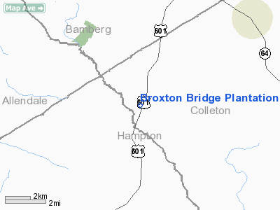
Broxton Bridge Plantation Airport |
Location & QuickFacts
| FAA Information Effective: | 2008-09-25 |
| Airport Identifier: | SC55 |
| Airport Status: | Operational |
| Longitude/Latitude: | 081-02-54.3740W/33-00-20.5760N
-81.048437/33.005716 (Estimated) |
| Elevation: | 120 ft / 36.58 m (Estimated) |
| Land: | 0 acres |
| From nearest city: | 5 nautical miles S of Ehrhardt, SC |
| Location: | Colleton County, SC |
| Magnetic Variation: | 04W (1985) |
Owner & Manager
| Ownership: | Privately owned |
| Owner: | G. D. Varn |
| Address: | Box 97
Ehrhardt, SC 29081 |
| Phone number: | 803-267-3882 |
| Manager: | G. D. Varn |
| Address: | Box 97
Ehrhardt, SC 29081 |
| Phone number: | 803-267-3882 |
Airport Operations and Facilities
| Airport Use: | Private |
| Wind indicator: | Yes |
| Segmented Circle: | Yes |
| Control Tower: | No |
| Landing fee charge: | No |
| Sectional chart: | Atlanta |
| Region: | ASO - Southern |
| Boundary ARTCC: | ZJX - Jacksonville |
| Tie-in FSS: | AND - Anderson |
| FSS on Airport: | No |
| FSS Toll Free: | 1-800-WX-BRIEF |
| NOTAMs Facility: | AND |
Runway Information
Runway 01/19
| Dimension: | 2600 x 150 ft / 792.5 x 45.7 m |
| Surface: | TURF, |
| |
Runway 01 |
Runway 19 |
| Traffic Pattern: | Left | Left |
|
Radio Navigation Aids
| ID |
Type |
Name |
Ch |
Freq |
Var |
Dist |
| RBW | NDB | Walterboro | | 221.00 | 05W | 21.1 nm |
| OYI | NDB | Orangeburg | | 226.00 | 05W | 25.8 nm |
| BKO | NDB | Barnwell | | 392.00 | 06W | 27.9 nm |
| JYL | NDB | Sylvania | | 245.00 | 04W | 34.9 nm |
| DYB | NDB | Dorchester County | | 365.00 | 05W | 39.0 nm |
| LNH | NDB | Millen | | 205.00 | 05W | 46.8 nm |
| BZ | NDB | Bullo | | 407.00 | 05W | 47.2 nm |
| CH | NDB | Ashly | | 329.00 | 05W | 48.0 nm |
| BXG | NDB | Burke County | | 356.00 | 04W | 48.3 nm |
| NBC | TACAN | Beaufort | 042X | | 05W | 35.8 nm |
| ALD | VOR | Allendale | | 116.70 | 01W | 12.3 nm |
| EDS | VOR/DME | Edisto | 051X | 111.40 | 05W | 28.7 nm |
| VAN | VORTAC | Vance | 041X | 110.40 | 06W | 41.3 nm |
Remarks
Images and information placed above are from
http://www.airport-data.com/airport/SC55/
We thank them for the data!
| General Info
|
| Country |
United States
|
| State |
SOUTH CAROLINA
|
| FAA ID |
SC55
|
| Latitude |
33-00-20.576N
|
| Longitude |
081-02-54.374W
|
| Elevation |
120 feet
|
| Near City |
EHRHARDT
|
We don't guarantee the information is fresh and accurate. The data may
be wrong or outdated.
For more up-to-date information please refer to other sources.
|
|


