 |
|
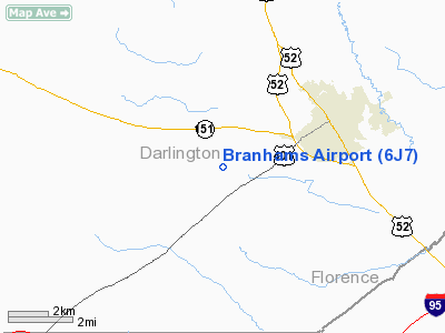
Location & QuickFacts
| FAA Information Effective: | 2008-09-25 |
| Airport Identifier: | 6J7 |
| Airport Status: | Operational |
| Longitude/Latitude: | 079-55-43.2280W/34-16-55.5520N
-79.928674/34.282098 (Estimated) |
| Elevation: | 165 ft / 50.29 m (Estimated) |
| Land: | 25 acres |
| From nearest city: | 3 nautical miles SW of Darlington, SC |
| Location: | Darlington County, SC |
| Magnetic Variation: | 06W (1985) |
Owner & Manager
| Ownership: | Privately owned |
| Owner: | Rudy Branham |
| Address: | Po Box 209
Darlington, SC 29532 |
| Phone number: | 843-393-1662 |
| Manager: | Rudy Branham |
| Address: | Po Box 209
Darlington, SC 29532 |
| Phone number: | 843-393-2387 |
Airport Operations and Facilities
| Airport Use: | Open to public |
| Wind indicator: | Yes |
| Segmented Circle: | No |
| Control Tower: | No |
| Lighting Schedule: | PHONE REQ
FOR ROTG BCN CALL 843-393-2387. |
| Beacon Color: | Clear-Green (lighted land airport) |
| Landing fee charge: | No |
| Sectional chart: | Charlotte |
| Region: | ASO - Southern |
| Boundary ARTCC: | ZJX - Jacksonville |
| Tie-in FSS: | AND - Anderson |
| FSS on Airport: | No |
| FSS Toll Free: | 1-800-WX-BRIEF |
| NOTAMs Facility: | AND (NOTAM-d service avaliable) |
Airport Communications
| CTAF: | 122.800 |
| Unicom: | 122.800 |
Airport Services
| Bottled Oxygen: | NONE |
| Bulk Oxygen: | NONE |
Runway Information
Runway 16/34
| Dimension: | 3200 x 100 ft / 975.4 x 30.5 m |
| Surface: | TURF, Fair Condition
SLIGHTLY BUMPY IN SOME AREAS. |
| Edge Lights: | Non-standard lighting system
NSTD LIRL ONLY CENTER 2112 FT OF RY LGTD. |
| |
Runway 16 |
Runway 34 |
| Traffic Pattern: | Right | Left |
| Obstruction: | 50 ft trees, 528.0 ft from runway, 100 ft right of centerline, 10:1 slope to clear | 15 ft road, 0.0 ft from runway |
|
Radio Navigation Aids
| ID |
Type |
Name |
Ch |
Freq |
Var |
Dist |
| UDG | NDB | Darlington | | 245.00 | 06W | 9.9 nm |
| HVS | NDB | Hartsville | | 341.00 | 07W | 12.1 nm |
| BES | NDB | Bennettsville | | 230.00 | 07W | 22.5 nm |
| CFY | NDB | Evans | | 420.00 | 06W | 26.9 nm |
| SMS | NDB | Sumter | | 252.00 | 04W | 27.7 nm |
| CQW | NDB | Cheraw | | 409.00 | 05W | 27.8 nm |
| DLC | NDB | Dillon | | 274.00 | 05W | 29.6 nm |
| MAO | NDB | Marion | | 388.00 | 06W | 30.2 nm |
| CDN | NDB | Camden | | 263.00 | 05W | 31.4 nm |
| CKI | NDB | Kingstree | | 404.00 | 06W | 34.1 nm |
| PYG | NDB | Pageland | | 270.00 | 06W | 34.4 nm |
| RCZ | NDB | Roscoe | | 375.00 | 07W | 36.2 nm |
| ME | NDB | Maxtn | | 257.00 | 08W | 36.2 nm |
| HEK | NDB | Stuckey | | 236.00 | 06W | 38.9 nm |
| JB | NDB | Jigel | | 384.00 | 08W | 42.3 nm |
| MNI | NDB | Manning | | 381.00 | 06W | 43.9 nm |
| AFP | NDB | Anson County | | 283.00 | 07W | 45.2 nm |
| RSY | NDB | Robeson | | 359.00 | 08W | 47.5 nm |
| MMT | NDB | Mc Entire | | 427.00 | 05W | 48.1 nm |
| HYW | NDB | Horry | | 370.00 | 08W | 48.5 nm |
| HFF | NDB | Mackall | | 278.00 | 06W | 49.9 nm |
| SSC | TACAN | Shaw | 038X | | 05W | 32.4 nm |
| LBT | VOR | Lumberton | | 110.00 | 08W | 47.6 nm |
| CTF | VOR/DME | Chesterfield | 019X | 108.20 | 03W | 28.0 nm |
| FLO | VORTAC | Florence | 099X | 115.20 | 03W | 13.8 nm |
| MMT | VORTAC | Mc Entire | 079X | 113.20 | 05W | 48.5 nm |
Remarks
- VFR OPNS ONLY; ALL TURNS TO BE MADE W OF ARPT.
Images and information placed above are from
http://www.airport-data.com/airport/6J7/
We thank them for the data!
| General Info
|
| Country |
United States
|
| State |
SOUTH CAROLINA
|
| FAA ID |
6J7
|
| Latitude |
34-16-55.552N
|
| Longitude |
079-55-43.228W
|
| Elevation |
165 feet
|
| Near City |
DARLINGTON
|
We don't guarantee the information is fresh and accurate. The data may
be wrong or outdated.
For more up-to-date information please refer to other sources.
|
|


