 |
|
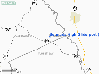
Bermuda High Gliderport Airport |
Location & QuickFacts
| FAA Information Effective: | 2008-09-25 |
| Airport Identifier: | SC79 |
| Airport Status: | Operational |
| Longitude/Latitude: | 080-26-59.2500W/34-36-40.5580N
-80.449792/34.611266 (Estimated) |
| Elevation: | 550 ft / 167.64 m (Estimated) |
| Land: | 100 acres |
| From nearest city: | 18 nautical miles SE of Lancaster, SC |
| Location: | Lancaster County, SC |
| Magnetic Variation: | 06W (1990) |
Owner & Manager
| Ownership: | Privately owned |
| Owner: | Jayne & Frank Reid |
| Address: | P.o. Box 1510
Lancaster, SC 29721-1510 |
| Phone number: | 803-475-7627 |
| Manager: | Jayne & Frank Reid |
| Address: | P.o. Box 1510
Lancaster, SC 29721-1510 |
| Phone number: | 803-475-7627 |
Airport Operations and Facilities
| Airport Use: | Private |
| Wind indicator: | Yes |
| Segmented Circle: | No |
| Control Tower: | No |
| Sectional chart: | Charlotte |
| Region: | ASO - Southern |
| Boundary ARTCC: | ZJX - Jacksonville |
| Tie-in FSS: | AND - Anderson |
| FSS on Airport: | No |
| FSS Toll Free: | 1-800-WX-BRIEF |
Runway Information
Runway 03/21
| Dimension: | 4000 x 200 ft / 1219.2 x 61.0 m |
| Surface: | TURF, |
| |
Runway 03 |
Runway 21 |
| Traffic Pattern: | Right | Left |
|
Radio Navigation Aids
| ID |
Type |
Name |
Ch |
Freq |
Var |
Dist |
| PYG | NDB | Pageland | | 270.00 | 06W | 9.8 nm |
| HVS | NDB | Hartsville | | 341.00 | 07W | 20.5 nm |
| CDN | NDB | Camden | | 263.00 | 05W | 20.5 nm |
| LKR | NDB | Lancaster | | 400.00 | 07W | 21.3 nm |
| TWL | NDB | Wesley | | 204.00 | 06W | 24.1 nm |
| UDG | NDB | Darlington | | 245.00 | 06W | 29.6 nm |
| CQW | NDB | Cheraw | | 409.00 | 05W | 29.9 nm |
| AFP | NDB | Anson County | | 283.00 | 07W | 30.7 nm |
| UZ | NDB | Rally | | 227.00 | 05W | 35.4 nm |
| BES | NDB | Bennettsville | | 230.00 | 07W | 35.5 nm |
| FDW | NDB | Winnsboro | | 414.00 | 05W | 37.4 nm |
| SMS | NDB | Sumter | | 252.00 | 04W | 37.6 nm |
| DCM | NDB | Chester | | 220.00 | 06W | 38.6 nm |
| RCZ | NDB | Roscoe | | 375.00 | 07W | 40.1 nm |
| MMT | NDB | Mc Entire | | 427.00 | 05W | 44.2 nm |
| GHJ | NDB | Stonia | | 260.00 | 06W | 49.3 nm |
| SSC | TACAN | Shaw | 038X | | 05W | 38.1 nm |
| CTF | VOR/DME | Chesterfield | 019X | 108.20 | 03W | 9.0 nm |
| CLT | VOR/DME | Charlotte | 097X | 115.00 | 05W | 42.7 nm |
| FML | VORTAC | Fort Mill | 071X | 112.40 | 02W | 33.7 nm |
| MMT | VORTAC | Mc Entire | 079X | 113.20 | 05W | 44.9 nm |
| FLO | VORTAC | Florence | 099X | 115.20 | 03W | 45.4 nm |
| CLT | VOT | Charlotte | | 112.00 | | 43.5 nm |
Remarks
- PRVDD ALL OPNS CONDUCTED IN VFR WX CONDITIONS; LANDING AREA LMTD TO PVT USE.
Images and information placed above are from
http://www.airport-data.com/airport/SC79/
We thank them for the data!
| General Info
|
| Country |
United States
|
| State |
SOUTH CAROLINA
|
| FAA ID |
SC79
|
| Latitude |
34-36-40.558N
|
| Longitude |
080-26-59.250W
|
| Elevation |
550 feet
|
| Near City |
LANCASTER
|
We don't guarantee the information is fresh and accurate. The data may
be wrong or outdated.
For more up-to-date information please refer to other sources.
|
|


