 |
|
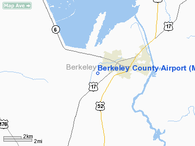
Location & QuickFacts
| FAA Information Effective: | 2008-09-25 |
| Airport Identifier: | MKS |
| Airport Status: | Operational |
| Longitude/Latitude: | 080-02-10.5000W/33-11-07.8000N
-80.036250/33.185500 (Estimated) |
| Elevation: | 73 ft / 22.25 m (Surveyed) |
| Land: | 236 acres |
| From nearest city: | 1 nautical miles SW of Moncks Corner, SC |
| Location: | Berkeley County, SC |
| Magnetic Variation: | 04W (1980) |
Owner & Manager
| Ownership: | Publicly owned |
| Owner: | County Of Berkeley |
| Address: | 223 N Live Oak Dr
Moncks Corner, SC 29461 |
| Phone number: | 843-761-6900 |
| Manager: | Stacy Thomas |
| Address: | 616 Whitesville Road
Moncks Corner, SC 29461 |
| Phone number: | 843-899-7711 |
Airport Operations and Facilities
| Airport Use: | Open to public |
| Wind indicator: | Yes |
| Segmented Circle: | Yes |
| Control Tower: | No |
| Lighting Schedule: | DUSK-DAWN
ACTVT MIRL RY 05/23 - CTAF. |
| Beacon Color: | Clear-Green (lighted land airport) |
| Landing fee charge: | No |
| Sectional chart: | Charlotte |
| Region: | ASO - Southern |
| Boundary ARTCC: | ZJX - Jacksonville |
| Tie-in FSS: | AND - Anderson |
| FSS on Airport: | No |
| FSS Toll Free: | 1-800-WX-BRIEF |
| NOTAMs Facility: | AND (NOTAM-d service avaliable) |
| Federal Agreements: | NGY |
Airport Communications
| CTAF: | 123.050 |
| Unicom: | 123.050 |
Airport Services
| Fuel available: | 100LLA |
| Airframe Repair: | MAJOR |
| Power Plant Repair: | MAJOR |
| Bottled Oxygen: | NONE |
| Bulk Oxygen: | NONE |
Runway Information
Runway 05/23
| Dimension: | 4351 x 75 ft / 1326.2 x 22.9 m |
| Surface: | ASPH, Good Condition |
| Weight Limit: | Single wheel: 26000 lbs.
Dual wheel: 38000 lbs. |
| Edge Lights: | Medium |
| |
Runway 05 |
Runway 23 |
| Longitude: | 080-02-27.9135W | 080-01-53.1083W |
| Latitude: | 33-10-51.9899N | 33-11-23.5569N |
| Elevation: | 73.00 ft | 68.00 ft |
| Alignment: | 43 | 127 |
| Traffic Pattern: | Left | Left |
| Markings: | Non-precision instrument, Good Condition | Non-precision instrument, Good Condition |
| Crossing Height: | 46.00 ft | 43.00 ft |
| VASI: | 2-light PAPI on left side | 2-light PAPI on left side |
| Visual Glide Angle: | 3.00° | 3.00° |
| Obstruction: | 87 ft tree, 2320.0 ft from runway, 511 ft right of centerline, 24:1 slope to clear | 70 ft tree, 1409.0 ft from runway, 182 ft left of centerline, 17:1 slope to clear |
|
Radio Navigation Aids
| ID |
Type |
Name |
Ch |
Freq |
Var |
Dist |
| MKS | NDB | Moncks Corner | | 354.00 | 05W | 0.4 nm |
| CH | NDB | Ashly | | 329.00 | 05W | 12.9 nm |
| DYB | NDB | Dorchester County | | 365.00 | 05W | 14.2 nm |
| MNI | NDB | Manning | | 381.00 | 06W | 25.7 nm |
| JZI | NDB | Johns Island | | 283.00 | 05W | 29.1 nm |
| PHH | NDB | Andrews | | 255.00 | 06W | 30.2 nm |
| CKI | NDB | Kingstree | | 404.00 | 06W | 33.3 nm |
| RBW | NDB | Walterboro | | 221.00 | 05W | 34.2 nm |
| GGE | NDB | Georgetown | | 242.00 | 06W | 36.6 nm |
| HEK | NDB | Stuckey | | 236.00 | 06W | 41.5 nm |
| CFY | NDB | Evans | | 420.00 | 06W | 42.5 nm |
| OYI | NDB | Orangeburg | | 226.00 | 05W | 45.9 nm |
| EDS | VOR/DME | Edisto | 051X | 111.40 | 05W | 44.4 nm |
| CHS | VORTAC | Charleston | 082X | 113.50 | 05W | 17.5 nm |
| VAN | VORTAC | Vance | 041X | 110.40 | 06W | 27.0 nm |
| CHS | VOT | Charleston | | 111.00 | | 16.8 nm |
Remarks
- FBO KIP PRATT 843-899-7711.
Images and information placed above are from
http://www.airport-data.com/airport/MKS/
We thank them for the data!
|
|


