|
|
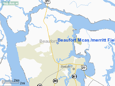
Beaufort Mcas /merritt Field/ Airport |
Coordinates: 32°28′38″N 080°43′23″W / 32.47722°N 80.72306°W / 32.47722; -80.72306
MCAS Beaufort
Merritt Field |
 |
| MCAS Beaufort insignia |
| IATA: BFT – ICAO: KNBC – FAA LID: NBC |
| Summary |
| Airport type |
Military |
| Operator |
United States Marine Corps |
| Location |
Beaufort, South Carolina |
| Built |
June 15, 1943 |
| In use |
1943 - present |
| Commander |
Colonel John R. Snider |
| Occupants |
Marine Aircraft Group 31 |
| Elevation AMSL |
37 ft / 11 m |
| Website |
www.beaufort.usmc.mil |
| Runways |
| Direction |
Length |
Surface |
| ft |
m |
| 5/23 |
12,202 |
3,719 |
PEM |
| 14/32 |
7,999 |
2,438 |
PEM |
| 18/36 |
3,941 |
1,201 |
Asphalt |
| Sources: Official website and FAA |
Marine Corps Air Station Beaufort or MCAS Beaufort (IATA: BFT, ICAO: KNBC, FAA LID: NBC) is a United States Marine Corps air base located three miles (5 km) northwest of the central business district of Beaufort, a city in Beaufort County, South Carolina, United States. About 4200 personnel serve at the station and it is home to six F/A-18 Hornet squadrons including one Navy F/A-18 squadron. Resident units
- Headquarters and Headquarters Squadron
- Marine Aircraft Group 31
- Marine Wing Support Squadron 273
- Marine Control Squadron 2 Detachment "A"
- Combat Logistics Company 23.
- Strike Fighter Squadron 86
History
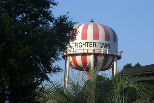 | |
The watertower on the Air Station emblazoned with the base nickname "Fightertown." |
Naval Air Station Beaufort was commissioned on June 15, 1943 for advanced training operations of anti-submarine patrols during World War II. It was then deactivated in 1946 and reactivated in 1956. On March 1, 1960, it was re-designated Marine Corps Air Station Beaufort. On September 19, 1975, the airfield was named Merritt Field in honor of Major General Lewie G. Merritt, USMCR of Ridge Spring, South Carolina.
The air station encompasses 6,900 acres (28 km²). It is also associated with a large air-to-air combat area off the coast of South Carolina and Georgia as well as a 5,200 acre (21 km²) air-to-ground combat and bombing range in McIntosh County, Georgia. Also attached to the base is the housing complex of Laurel Bay, just 3 miles (5 km) from the station, that provides family housing for area servicemembers.
MCAS Beaufort hosts all active duty USMC F/A-18 air operations on the East Coast, assigned to MAG-31. The mission of the Marine Corps Air Station Beaufort is to provide support as an operational base for MAG-31, and the support units. The mission of the Marine Aircraft Group (MAG-31) is to conduct anti-air-warfare and offensive air support operations in support of Fleet Marine Forces from advanced bases, expeditionary airfields, or aircraft carriers and conduct such other air operations as may be directed. The population of the on-base "city" includes nearly 4,000 active-duty servicemembers and more than 700 civilian workers.
As is the case with many air bases, MCAS Beaufort hosts a bi-annual air show open to the public, which in April 2007, was the site of a fatal crash involving an aircraft from the Blue Angels demonstration team.
MCAS-Beaufort's nickname is "Fightertown East"; MCAS Miramar is the more commonly known "Fightertown", also called "Fightertown USA".
The above content comes from Wikipedia and is published under free licenses – click here to read more.
Location & QuickFacts
| FAA Information Effective: | 2008-09-25 |
| Airport Identifier: | NBC |
| Airport Status: | Operational |
| Longitude/Latitude: | 080-43-23.4000W/32-28-38.4000N
-80.723167/32.477333 (Estimated) |
| Elevation: | 37 ft / 11.28 m (Estimated) |
| Land: | 0 acres |
| From nearest city: | 3 nautical miles NW of Beaufort, SC |
| Location: | Beaufort County, SC |
| Magnetic Variation: | 05W (1990) |
Owner & Manager
| Ownership: | Navy owned |
| Owner: | Us Navy |
| Address: | Oceanographic Ofc-code 3142
Washington, DC 20373 |
| Manager: | Commanding Officer |
| Address: | Marine Corps Air Station
Beaufort, SC 29902 |
Airport Operations and Facilities
| Airport Use: | Private |
| Wind indicator: | Yes |
| Segmented Circle: | No |
| Control Tower: | Yes |
| Lighting Schedule: | DUSK-DAWN |
| Beacon Color: | Split-Clear-Green (lighted military airport) |
| Sectional chart: | Charlotte |
| Region: | ASO - Southern |
| Boundary ARTCC: | ZJX - Jacksonville |
| Tie-in FSS: | NBC - Beaufort Mcas/merritt Fld
ANDERSON RADIO AND - NOTAM AND. |
| FSS on Airport: | No |
| FSS Toll Free: | 1-800-WX-BRIEF |
| NOTAMs Facility: | AND (NOTAM-d service avaliable) |
| Certification type/date: | I L U 08/1990 |
Airport Services
| Bottled Oxygen: | NONE |
| Bulk Oxygen: | HIGH/LOW |
Runway Information
Runway 05/23
| Dimension: | 12202 x 200 ft / 3719.2 x 61.0 m |
| Surface: | PEM, |
| Pavement Class: | 59 /R/C/W/T |
| Edge Lights: | High |
| |
Runway 05 |
Runway 23 |
| Longitude: | 080-43-49.6696W | 080-43-14.6161W |
| Latitude: | 32-28-14.0042N | 32-29-43.9302N |
| Elevation: | 37.00 ft | 13.00 ft |
| Traffic Pattern: | Left | Left |
| Arresting: | E28 | E28 |
| VASI: | 4-light PAPI on left side | 4-light PAPI on left side |
| Approach lights: | SALSF | ALSF1 |
| Touchdown Lights: | No | No |
|
Runway 14/32
| Dimension: | 7999 x 200 ft / 2438.1 x 61.0 m |
| Surface: | PEM, |
| Pavement Class: | 64 /R/D/W/T |
| Edge Lights: | High |
| |
Runway 14 |
Runway 32 |
| Longitude: | 080-43-52.9862W | 080-42-47.2017W |
| Latitude: | 32-29-04.5564N | 32-28-08.3840N |
| Elevation: | 32.00 ft | 22.00 ft |
| Traffic Pattern: | Left | Left |
| Arresting: | E28 | E28 |
| Crossing Height: | 40.00 ft | 40.00 ft |
| VASI: | 4-light PAPI on right side | 4-light PAPI on right side |
| Visual Glide Angle: | 3.00° | 3.00° |
|
Runway 18/36
| Dimension: | 3941 x 150 ft / 1201.2 x 45.7 m |
| Surface: | ASPH, |
| |
Runway 18 |
Runway 36 |
| Traffic Pattern: | Left | Left |
|
Radio Navigation Aids
| ID |
Type |
Name |
Ch |
Freq |
Var |
Dist |
| RBW | NDB | Walterboro | | 221.00 | 05W | 27.3 nm |
| JZI | NDB | Johns Island | | 283.00 | 05W | 38.7 nm |
| DYB | NDB | Dorchester County | | 365.00 | 05W | 41.7 nm |
| CH | NDB | Ashly | | 329.00 | 05W | 43.6 nm |
| JYL | NDB | Sylvania | | 245.00 | 04W | 45.3 nm |
| BZ | NDB | Bullo | | 407.00 | 05W | 47.9 nm |
| NBC | TACAN | Beaufort | 042X | | 05W | 0.3 nm |
| ALD | VOR | Allendale | | 116.70 | 01W | 43.2 nm |
| SVN | VOR/DME | Hunter | 53X | 111.60 | 02W | 35.1 nm |
| SAV | VORTAC | Savannah | 106Y | 115.95 | 06W | 31.3 nm |
| CHS | VORTAC | Charleston | 082X | 113.50 | 05W | 42.8 nm |
| SAV | VOT | Savannah Travis Fld | | 111.00 | | 32.2 nm |
| CHS | VOT | Charleston | | 111.00 | | 43.0 nm |
Remarks
- TRAN ALERT: TRANS SVC AVBL 1200-2300Z++ MON-FRI ONLY, CLSD NATL HOL. (SEE RTSD FOR ADDNL TRAN ACFT INFO) TRAN ACFT EXP TRUCK REFUEL. TRAN ACFT MAINT UNAVBL. TRAN AVN ORDNANCE SVC AVBL. LAVATORY SVC UNAVBL. JASU, FLUID, AND OIL UNAVBL.
- RSTD: RY 18/365 CLSD UFN. DUE TO LTD TRAN SVC AVBL, PPR ALL INBD TRAN ACFT TO INCL AMC, JOSAC, NALO, ALTN AFLD, DIVERTS. CTC BASE OPS DSN 335-7301/2/3 C843-228-7301/2/3. FAX DSN 335-7874, C843-228-2874. HVY ACFT RSTD FM USE OF VIP LINE.
- DUE TO LTD TRANSIENT SERVICES AVBL,PN ALL INBD TRANSIENT ACFT TO INCL AMC, JOSAC, ALTN AFLD & DIVERTS.
- RSTD: PN APPROVAL GOOD FOR +/- 1 HR OF COORDINATED TIME.
- A-GEAR: E-28 ON ALL RYS AND IN RAISED POSITION, EXCP ON LDG RY.
- FUEL: J5
- RSTD: RWY 10-28 AND 18-36 CLSD UFN.
- CAUTION: SEVERE BIRD ACT OCT-APR. WILDLIFE ON RWY DUR PERIODS OF DARKNESS. CK ATIS FOR BASH UPDATES.
- TFC PAT: OVERHEAD 1500', CONVL 800', COPTER CALL ENTERING CLASS D AIRSPACE BLW 800'. MULTI APCH RWY 32 NOT AUTH. REDUCED RWY SEPARATION STD IN EFF USN/USMC ACFT. TOUCH AND GO DUTY RWY ONLY.
- CSTMS/AG/IMG: LTD CSTMS/AG AVBL MIL ACFT ONLY, 24 HR PN RQR. CTC CSTMS DSN 335-6161, C843-228-6161.
- MISC: ALL ACFT WITH PAX, CARGO, VIP CTC PTD 20 MIN PRIOR TO LDG. ALCE TEAM RQR FOR ALL AMC MSN. CLASS D AIRSPACE EFF 1200-0400Z++ MON-THU; 1200-2300Z++ FRI; OT BY NOTAM FOR SPL OPS; CLSD NATL HOL. OT CLASS E.
Images and information placed above are from
http://www.airport-data.com/airport/NBC/
We thank them for the data!
| General Info
|
| Country |
United States
|
| State |
SOUTH CAROLINA
|
| FAA ID |
NBC
|
| Latitude |
32-28-38.684N
|
| Longitude |
080-43-23.381W
|
| Elevation |
36 feet
|
| Near City |
BEAUFORT
|
We don't guarantee the information is fresh and accurate. The data may
be wrong or outdated.
For more up-to-date information please refer to other sources.
|
|