 |
|
Beaufort County Airport
Frogmore Intranational Airport |
| IATA: BFT – ICAO: KARW – FAA LID: ARW |
| Summary |
| Airport type |
Public |
| Owner |
County of Beaufort |
| Serves |
Beaufort, South Carolina |
| Elevation AMSL |
10 ft / 3 m |
| Coordinates |
32°24′44″N 080°38′04″W / 32.41222°N 80.63444°W / 32.41222; -80.63444 |
| Runways |
| Direction |
Length |
Surface |
| ft |
m |
| 7/25 |
3,434 |
1,047 |
Asphalt |
| Statistics (2009) |
| Aircraft operations |
36,400 |
| Based aircraft |
57 |
| Source: Federal Aviation Administration |
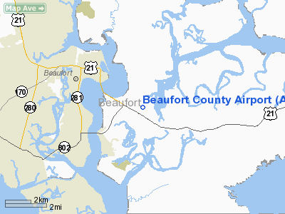
Beaufort County Airport (IATA: BFT, ICAO: KARW, FAA LID: ARW, formerly 73J) is a county-owned public-use airport in Beaufort County, South Carolina, United States. The airport is located on Lady's Island, three nautical miles (6 km) southeast of the central business district of Beaufort, South Carolina. It is also known as Frogmore Island Airport or Frogmore Intranational Airport.
Although most U.S. airports use the same three-letter location identifier for the FAA and IATA, this airport is assigned ARW by the FAA and BFT by the IATA (which assigned ARW to Arad Airport in Arad, Romania.).
Facilities and aircraft
Beaufort County Airport covers an area of 110 acres (45 ha) at an elevation of 10 feet (3 m) above mean sea level. It has one runway designated 7/25 with an asphalt surface measuring 3,434 by 75 feet (1,047 x 23 m).
For the 12-month period ending April 8, 2009, the airport had 36,400 aircraft operations, an average of 99 per day: 96% general aviation and 4% air taxi. At that time there were 57 aircraft based at this airport: 89.5% single-engine, 7% multi-engine and 3.5% helicopter.
The above content comes from Wikipedia and is published under free licenses – click here to read more.
Location & QuickFacts
| FAA Information Effective: | 2008-09-25 |
| Airport Identifier: | ARW |
| Airport Status: | Operational |
| Longitude/Latitude: | 080-38-03.6750W/32-24-43.7800N
-80.634354/32.412161 (Estimated) |
| Elevation: | 10 ft / 3.05 m (Surveyed) |
| Land: | 110 acres |
| From nearest city: | 3 nautical miles SE of Beaufort, SC |
| Location: | Beaufort County, SC |
| Magnetic Variation: | 07W (2005) |
Owner & Manager
| Ownership: | Publicly owned |
| Owner: | County Of Beaufort |
| Address: | Po Drawer 1228
Beaufort, SC 29901 |
| Phone number: | 843-525-7151 |
| Manager: | Paul Andres, Manager |
| Address: | Po Box 23739
Hilton Head, SC 29925 |
| Phone number: | 843-689-5400 |
Airport Operations and Facilities
| Airport Use: | Open to public |
| Wind indicator: | Yes |
| Segmented Circle: | Yes |
| Control Tower: | No |
| Lighting Schedule: | DUSK-DAWN
MIRL RY 07/25 PRESET LOW INTST; TO INCR INTST - CTAF. |
| Beacon Color: | Clear-Green (lighted land airport) |
| Landing fee charge: | No |
| Sectional chart: | Charlotte |
| Region: | ASO - Southern |
| Traffic Pattern Alt: | 1000 ft |
| Boundary ARTCC: | ZJX - Jacksonville |
| Tie-in FSS: | AND - Anderson |
| FSS on Airport: | No |
| FSS Toll Free: | 1-800-WX-BRIEF |
| NOTAMs Facility: | AND (NOTAM-d service avaliable) |
| Federal Agreements: | NGY |
Airport Communications
| CTAF: | 122.700 |
| Unicom: | 122.700 |
Airport Services
| Fuel available: | 100LLA
SELF-SERVICE FUEL AVBL 24 HRS. |
| Bottled Oxygen: | NONE |
| Bulk Oxygen: | NONE |
Runway Information
Runway 07/25
| Dimension: | 3434 x 75 ft / 1046.7 x 22.9 m |
| Surface: | ASPH, Good Condition |
| Weight Limit: | Single wheel: 12500 lbs. |
| Edge Lights: | Medium |
| |
Runway 07 |
Runway 25 |
| Longitude: | 080-38-21.0900W | 080-37-46.2600W |
| Latitude: | 32-24-35.3900N | 32-24-52.1700N |
| Elevation: | 10.00 ft | 8.00 ft |
| Alignment: | 60 | 127 |
| Traffic Pattern: | Right | Left |
| Markings: | Non-precision instrument, Good Condition | Non-precision instrument, Good Condition |
| Crossing Height: | 29.00 ft | 21.00 ft |
| VASI: | 2-light PAPI on left side | 2-light PAPI on left side |
| Visual Glide Angle: | 3.45° | 3.00° |
| Runway End Identifier: | No | Yes |
| Centerline Lights: | No | No |
| Touchdown Lights: | No | No |
| Obstruction: | 77 ft trees, 1300.0 ft from runway, 255 ft right of centerline, 14:1 slope to clear | , 50:1 slope to clear |
|
Radio Navigation Aids
| ID |
Type |
Name |
Ch |
Freq |
Var |
Dist |
| RBW | NDB | Walterboro | | 221.00 | 05W | 30.9 nm |
| JZI | NDB | Johns Island | | 283.00 | 05W | 36.3 nm |
| DYB | NDB | Dorchester County | | 365.00 | 05W | 43.0 nm |
| CH | NDB | Ashly | | 329.00 | 05W | 43.4 nm |
| NBC | TACAN | Beaufort | 042X | | 05W | 5.8 nm |
| ALD | VOR | Allendale | | 116.70 | 01W | 49.1 nm |
| SVN | VOR/DME | Hunter | 53X | 111.60 | 02W | 35.2 nm |
| SAV | VORTAC | Savannah | 106Y | 115.95 | 06W | 32.8 nm |
| CHS | VORTAC | Charleston | 082X | 113.50 | 05W | 41.8 nm |
| SAV | VOT | Savannah Travis Fld | | 111.00 | | 33.5 nm |
| CHS | VOT | Charleston | | 111.00 | | 42.2 nm |
Remarks
- DEER, SEAGULLS & GEESE ON & INVOF ARPT.
- RY 25 HAS 5 FT BUSHES 100 FT FM THLD.
- ARPT EXISTED PRIOR TO 1958.
Images and information placed above are from
http://www.airport-data.com/airport/ARW/
We thank them for the data!
|
|


