 |
|
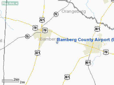
Location & QuickFacts
| FAA Information Effective: | 2008-09-25 |
| Airport Identifier: | 99N |
| Airport Status: | Operational |
| Longitude/Latitude: | 081-06-30.3000W/33-18-16.3000N
-81.108417/33.304528 (Estimated) |
| Elevation: | 231 ft / 70.41 m (Estimated) |
| Land: | 94 acres |
| From nearest city: | 5 nautical miles W of Bamberg, SC |
| Location: | Bamberg County, SC |
| Magnetic Variation: | 04W (1985) |
Owner & Manager
| Ownership: | Publicly owned |
| Owner: | Bamberg County |
| Address: | Po Box 149
Bamberg, SC 29003 |
| Phone number: | 803-245-5191 |
| Manager: | Rose D. Elliott
COUNTY ADMINISTRATOR. |
| Address: | Po Box 149
Bamberg, SC 29003 |
| Phone number: | 803-245-5191 |
Airport Operations and Facilities
| Airport Use: | Open to public |
| Wind indicator: | Yes |
| Segmented Circle: | Yes |
| Control Tower: | No |
| Lighting Schedule: | DUSK-DAWN
AFTER 2200, ACTVT MIRL AND PAPI RY 05/23 - CTAF. |
| Beacon Color: | Clear-Green (lighted land airport) |
| Landing fee charge: | No |
| Sectional chart: | Atlanta |
| Region: | ASO - Southern |
| Boundary ARTCC: | ZJX - Jacksonville |
| Tie-in FSS: | AND - Anderson |
| FSS on Airport: | No |
| FSS Toll Free: | 1-800-WX-BRIEF |
| NOTAMs Facility: | AND (NOTAM-d service avaliable) |
| Federal Agreements: | N |
Airport Communications
| CTAF: | 122.800 |
| Unicom: | 122.800 |
Airport Services
| Bottled Oxygen: | NONE |
| Bulk Oxygen: | NONE |
Runway Information
Runway 05/23
| Dimension: | 3603 x 60 ft / 1098.2 x 18.3 m |
| Surface: | ASPH, Good Condition |
| Weight Limit: | Single wheel: 30000 lbs.
Dual wheel: 60000 lbs. |
| Edge Lights: | Medium |
| |
Runway 05 |
Runway 23 |
| Longitude: | 081-06-44.9147W | 081-06-15.6241W |
| Latitude: | 33-18-03.4185N | 33-18-29.2119N |
| Elevation: | 208.00 ft | 231.00 ft |
| Alignment: | 44 | 127 |
| Traffic Pattern: | Left | Left |
| Markings: | Basic, Good Condition | Basic, Good Condition |
| Crossing Height: | 40.00 ft | 40.00 ft |
| VASI: | 2-light PAPI on left side | 2-light PAPI on left side |
| Visual Glide Angle: | 3.00° | 3.00° |
| Obstruction: | 88 ft tree, 2606.0 ft from runway, 115 ft right of centerline, 27:1 slope to clear | 37 ft pole, 1102.0 ft from runway, 21 ft right of centerline, 24:1 slope to clear |
|
Radio Navigation Aids
| ID |
Type |
Name |
Ch |
Freq |
Var |
Dist |
| OYI | NDB | Orangeburg | | 226.00 | 05W | 12.3 nm |
| BKO | NDB | Barnwell | | 392.00 | 06W | 16.1 nm |
| RBW | NDB | Walterboro | | 221.00 | 05W | 32.8 nm |
| AIK | NDB | Aiken | | 347.00 | 04W | 35.3 nm |
| MMT | NDB | Mc Entire | | 427.00 | 05W | 41.0 nm |
| DYB | NDB | Dorchester County | | 365.00 | 05W | 44.3 nm |
| EMR | NDB | Emory | | 385.00 | 04W | 45.6 nm |
| JYL | NDB | Sylvania | | 245.00 | 04W | 46.4 nm |
| BXG | NDB | Burke County | | 356.00 | 04W | 47.8 nm |
| MNI | NDB | Manning | | 381.00 | 06W | 48.4 nm |
| LNH | NDB | Millen | | 205.00 | 05W | 49.8 nm |
| ALD | VOR | Allendale | | 116.70 | 01W | 19.8 nm |
| EDS | VOR/DME | Edisto | 051X | 111.40 | 05W | 15.5 nm |
| CAE | VORTAC | Columbia | 094X | 114.70 | 02W | 33.3 nm |
| VAN | VORTAC | Vance | 041X | 110.40 | 06W | 34.7 nm |
| MMT | VORTAC | Mc Entire | 079X | 113.20 | 05W | 40.3 nm |
Remarks
Images and information placed above are from
http://www.airport-data.com/airport/99N/
We thank them for the data!
| General Info
|
| Country |
United States
|
| State |
SOUTH CAROLINA
|
| FAA ID |
99N
|
| Latitude |
33-18-16.300N
|
| Longitude |
081-06-30.300W
|
| Elevation |
231 feet
|
| Near City |
BAMBERG
|
We don't guarantee the information is fresh and accurate. The data may
be wrong or outdated.
For more up-to-date information please refer to other sources.
|
|


