 |
|
Location & QuickFacts
| FAA Information Effective: | 2008-09-25 |
| Airport Identifier: | SC70 |
| Airport Status: | Operational |
| Longitude/Latitude: | 083-05-06.0000W/34-43-30.0000N
-83.085000/34.725000 (Estimated) |
| Elevation: | 930 ft / 283.46 m (Estimated) |
| Land: | 10 acres |
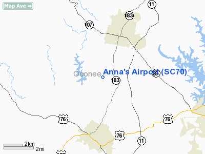
| From nearest city: | 3 nautical miles NE of Walhalla, SC |
| Location: | Oconee County, SC |
| Magnetic Variation: | 04W (1995) |
Owner & Manager
| Ownership: | Privately owned |
| Owner: | Nettie H. Keys |
| Address: | 503 South Church Street
Walhalla, SC 29691 |
| Phone number: | 638-3643 |
| Manager: | Nettie H. Keys |
| Address: | 503 South Church Street
Walhalla, SC 29691 |
| Phone number: | 638-3643 |
Airport Operations and Facilities
| Airport Use: | Private |
| Wind indicator: | Yes |
| Segmented Circle: | No |
| Control Tower: | No |
| Sectional chart: | Atlanta |
| Region: | ASO - Southern |
| Boundary ARTCC: | ZTL - Atlanta |
| Tie-in FSS: | AND - Anderson |
| FSS on Airport: | No |
| FSS Toll Free: | 1-800-WX-BRIEF |
Runway Information
Runway N/S
| Dimension: | 1300 x 80 ft / 396.2 x 24.4 m |
| Surface: | TURF, |
| |
Runway N |
Runway S |
| Traffic Pattern: | Left | Left |
|
Radio Navigation Aids
| ID |
Type |
Name |
Ch |
Freq |
Var |
Dist |
| CEU | NDB | Clemson | | 257.00 | 05W | 10.3 nm |
| LQK | NDB | Lake Keowee | | 408.00 | 04W | 19.5 nm |
| AND | NDB | Anderson County | | 230.00 | 04W | 23.1 nm |
| AJR | NDB | Habersham | | 347.00 | 03W | 26.6 nm |
| GY | NDB | Dyana | | 338.00 | 03W | 31.8 nm |
| BRA | NDB | Broad River | | 379.00 | 04W | 44.7 nm |
| DDA | NDB | Commerce | | 244.00 | 03W | 45.3 nm |
| BJT | NDB | Bulldog | | 221.00 | 03W | 47.0 nm |
| TTQ | NDB | Tomotla | | 335.00 | 01W | 49.0 nm |
| ODF | VORTAC | Foothills | 081X | 113.40 | 00E | 10.7 nm |
| ELW | VORTAC | Electric City | 023X | 108.60 | 00E | 23.6 nm |
| HRS | VORTAC | Harris | 035X | 109.80 | 00E | 43.0 nm |
| AHN | VORTAC | Athens | 33 | 109.60 | 00E | 48.2 nm |
Remarks
- PRVDD VFR/PVT USE; YOU ARE AWARE OF THE MILITARY TRAINING ROUTE IN YOUR VICINITY.
Images and information placed above are from
http://www.airport-data.com/airport/SC70/
We thank them for the data!
| General Info
|
| Country |
United States
|
| State |
SOUTH CAROLINA
|
| FAA ID |
SC70
|
| Latitude |
34-43-30.000N
|
| Longitude |
083-05-06.000W
|
| Elevation |
930 feet
|
| Near City |
WALHALLA
|
We don't guarantee the information is fresh and accurate. The data may
be wrong or outdated.
For more up-to-date information please refer to other sources.
|
|


