 |
|
| Anderson Regional Airport |
| IATA: AND – ICAO: KAND |
| Summary |
| Airport type |
Public |
| Operator |
County of Anderson |
| Serves |
Anderson, South Carolina |
| Elevation AMSL |
782 ft / 238.4 m |
| Coordinates |
34°29′41.8″N 82°42′32.5″W / 34.494944°N 82.709028°W / 34.494944; -82.709028 |
| Runways |
| Direction |
Length |
Surface |
| ft |
m |
| 5/23 |
6,001 |
1,524 |
Asphalt |
| 17/35 |
4,996 |
1,523 |
Asphalt |
| Helipads |
| Number |
Length |
Surface |
| ft |
m |
| H1 |
|
|
Concrete |
| H2 |
|
|
Concrete |
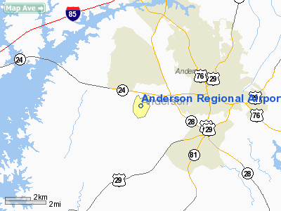
Anderson Regional Airport (IATA: AND, ICAO: KAND) is a public airport located 3 miles (5 km) southwest of the city of Anderson, in Anderson County, South Carolina. Anderson Regional Airport has been growing since it opened. In 2007 one runway was paved an extra 1,000 ft (300 m). Anderson Regional Airport does not have any commercial destinations or concourses for gates and there is no control tower, but the airport now can handle more and larger regional jets and aircraft than before. It is one of the busiest airports in the upstate of South Carolina.
Facilities
Anderson Regional Airport covers 704 acres (2.85 km) and has two runways and two helipads:
- Runway 5/23: 5,001 x 150 ft (1,524 x 46 m), Surface: Asphalt
- Runway 17/35: 4,996 x 150 ft (1,523 x 46 m), Surface: Asphalt
- Helipad H1: 50 x 50 ft (15 x 15 m), Surface: Concrete
- Helipad H2: 50 x 50 ft (15 x 15 m), Surface: Concrete
Inflight Catering and support services- FBO Foods, Anderson SC. www.fbofoods.com
Trivia New Prospect Elementary School is located right across from the airport. The school mascot is the Jets because airplanes can be heard taking off from the airport. It is the headquarters of the Anderson County Civil Air Patrol.
The above content comes from Wikipedia and is published under free licenses – click here to read more.
Location & QuickFacts
| FAA Information Effective: | 2008-09-25 |
| Airport Identifier: | AND |
| Airport Status: | Operational |
| Longitude/Latitude: | 082-42-33.8000W/34-29-40.5000N
-82.709389/34.494583 (Estimated) |
| Elevation: | 782 ft / 238.35 m (Surveyed) |
| Land: | 704 acres |
| From nearest city: | 3 nautical miles SW of Anderson, SC |
| Location: | Anderson County, SC |
| Magnetic Variation: | 05W (2005) |
Owner & Manager
| Ownership: | Publicly owned |
| Owner: | County Of Anderson |
| Address: | 5805 Airport Road
Anderson, SC 29626 |
| Phone number: | 864-260-4163 |
| Manager: | John M. Ferguson |
| Address: | 5805 Airport Rd.
Anderson, SC 29626 |
| Phone number: | 864-260-4163 |
Airport Operations and Facilities
| Airport Use: | Open to public |
| Wind indicator: | Yes |
| Segmented Circle: | Yes |
| Control Tower: | No |
| Lighting Schedule: | DUSK-DAWN
ACTVT HIRL RY 05/23, MALSR RY 05 AND PERIMETER LGTS HELIPADS H1 & H2 - CTAF. |
| Beacon Color: | Clear-Green (lighted land airport) |
| Landing fee charge: | No |
| Sectional chart: | Atlanta |
| Region: | ASO - Southern |
| Boundary ARTCC: | ZTL - Atlanta |
| Tie-in FSS: | AND - Anderson
CTC ANDERSON RADIO FOR AIRPORT ADVISORY SERVICE ON 123.6. |
| FSS on Airport: | No |
| FSS Toll Free: | 1-800-WX-BRIEF |
| NOTAMs Facility: | AND (NOTAM-d service avaliable) |
| Certification type/date: | I A U 12/1992
CLSD TO UNSKED ACR OPNS WITH MORE THAN 30 PSGR SEATS EXCP 24 HR PPR CALL AMGR 864-260-4163. |
| Federal Agreements: | NGY3 |
Airport Communications
| CTAF: | 123.600 |
| Unicom: | 122.950 |
Airport Services
| Fuel available: | 100LLA
AFTER HOURS, 100LL FUEL AVAILABLE BY SELF-SERVICE. |
| Airframe Repair: | MAJOR |
| Power Plant Repair: | MAJOR |
| Bottled Oxygen: | LOW |
Runway Information
Runway 05/23
| Dimension: | 6002 x 150 ft / 1829.4 x 45.7 m |
| Surface: | ASPH, Good Condition
WIDESPREAD CRACKS |
| Weight Limit: | Single wheel: 50500 lbs.
Dual wheel: 67500 lbs. |
| Edge Lights: | High |
| |
Runway 05 |
Runway 23 |
| Longitude: | 082-42-57.2924W | 082-42-05.8101W |
| Latitude: | 34-29-18.9297N | 34-30-00.2454N |
| Elevation: | 751.00 ft | 747.00 ft |
| Alignment: | 46 | 127 |
| ILS Type: | ILS
| |
| Traffic Pattern: | Left | Left |
| Markings: | Precision instrument, Good Condition
MARKINGS FADED | Precision instrument, Good Condition
MARKINGS OBSCURED |
| Crossing Height: | 0.00 ft | 30.00 ft |
| VASI: | 4-light PAPI on left side | 2-box SAVASI on left side |
| Visual Glide Angle: | 0.00° | 3.00° |
| Approach lights: | MALSR | |
| Obstruction: | 57 ft trees, 2330.0 ft from runway, 800 ft left of centerline, 37:1 slope to clear | 38 ft trees, 1700.0 ft from runway, 400 ft right of centerline, 40:1 slope to clear |
|
Runway 17/35
| Dimension: | 4996 x 150 ft / 1522.8 x 45.7 m |
| Surface: | ASPH, Poor Condition
WIDESPREAD CRACKS |
| Weight Limit: | Single wheel: 16500 lbs.
Dual wheel: 23000 lbs. |
| |
Runway 17 |
Runway 35 |
| Longitude: | 082-42-43.7092W | 082-42-29.1727W |
| Latitude: | 34-30-05.5835N | 34-29-17.6608N |
| Elevation: | 782.00 ft | 736.00 ft |
| Alignment: | 127 | 127 |
| Traffic Pattern: | Left | Left |
| Markings: | Non-precision instrument, Fair Condition | Non-precision instrument, Fair Condition |
| Obstruction: | 40 ft trees, 1200.0 ft from runway, 100 ft right of centerline, 25:1 slope to clear | 60 ft trees, 1700.0 ft from runway, 75 ft right of centerline, 25:1 slope to clear |
|
Helipad H1
| Dimension: | 50 x 50 ft / 15.2 x 15.2 m |
| Surface: | CONC, Good Condition
WIDESPREAD CRACKS |
| Weight Limit: | Single wheel: 30000 lbs. |
| |
Runway H1 |
Runway |
| Traffic Pattern: | Left | Left |
|
Helipad H2
| Dimension: | 50 x 50 ft / 15.2 x 15.2 m |
| Surface: | CONC, Good Condition
WIDESPREAD CRACKS |
| Weight Limit: | Single wheel: 30000 lbs. |
| |
Runway H2 |
Runway |
| Traffic Pattern: | Left | Left |
|
Radio Navigation Aids
| ID |
Type |
Name |
Ch |
Freq |
Var |
Dist |
| AND | NDB | Anderson County | | 230.00 | 04W | 0.2 nm |
| CEU | NDB | Clemson | | 257.00 | 05W | 13.9 nm |
| GY | NDB | Dyana | | 338.00 | 03W | 17.7 nm |
| LQK | NDB | Lake Keowee | | 408.00 | 04W | 19.0 nm |
| GIW | NDB | Coronaca | | 239.00 | 04W | 34.1 nm |
| LUX | NDB | Laurens | | 307.00 | 04W | 37.6 nm |
| BJT | NDB | Bulldog | | 221.00 | 03W | 41.3 nm |
| AJR | NDB | Habersham | | 347.00 | 03W | 41.6 nm |
| FRT | NDB | Fairmont | | 248.00 | 05W | 43.4 nm |
| IIY | NDB | Washington/wilkes County | | 435.00 | 03W | 43.6 nm |
| DDA | NDB | Commerce | | 244.00 | 03W | 48.0 nm |
| BRA | NDB | Broad River | | 379.00 | 04W | 48.2 nm |
| ELW | VORTAC | Electric City | 023X | 108.60 | 00E | 5.9 nm |
| GRD | VORTAC | Greenwood | 102X | 115.50 | 01W | 31.2 nm |
| ODF | VORTAC | Foothills | 081X | 113.40 | 00E | 31.5 nm |
| AHN | VORTAC | Athens | 33 | 109.60 | 00E | 44.9 nm |
Remarks
- HELICOPTERS WITH SKIDS ARE RESTRICTED TO LAND ON HELIPADS OR GRASSED AREAS.
- PROFILE OF RY 05/23 RESTRICTS VIS FROM THLD RY 05 TO THLD RY 23.
- WILDLIFE ON & INVOF ARPT; MORE ACTIVE AT DUSK & DAWN.
- EXISTED PRIOR TO 1958.
Images and information placed above are from
http://www.airport-data.com/airport/AND/
We thank them for the data!
| General Info
|
| Country |
United States
|
| State |
SOUTH CAROLINA
|
| FAA ID |
AND
|
| Latitude |
34-29-41.800N
|
| Longitude |
082-42-32.500W
|
| Elevation |
782 feet
|
| Near City |
ANDERSON
|
We don't guarantee the information is fresh and accurate. The data may
be wrong or outdated.
For more up-to-date information please refer to other sources.
|
|


