 |
|
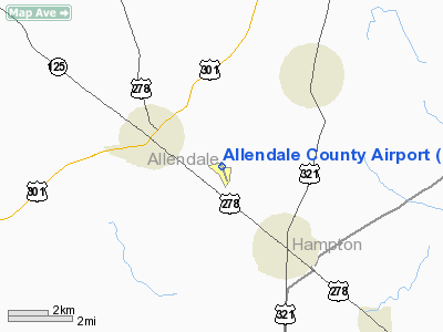
Location & QuickFacts
| FAA Information Effective: | 2008-09-25 |
| Airport Identifier: | 88J |
| Airport Status: | Operational |
| Longitude/Latitude: | 081-16-12.8850W/32-59-42.4660N
-81.270246/32.995129 (Estimated) |
| Elevation: | 161 ft / 49.07 m (Surveyed) |
| Land: | 95 acres |
| From nearest city: | 2 nautical miles SE of Allendale, SC |
| Location: | Allendale County, SC |
| Magnetic Variation: | 06W (2000) |
Owner & Manager
| Ownership: | Publicly owned |
| Owner: | Allendale County |
| Address: | Po Box 677
Allendale, SC 29810 |
| Phone number: | 803-584-3438 |
| Manager: | Ben Oswald |
| Address: | 467 Airport Loop
Fairfax, SC 29827 |
| Phone number: | 803-584-3801 |
Airport Operations and Facilities
| Airport Use: | Open to public |
| Wind indicator: | Yes |
| Segmented Circle: | Yes |
| Control Tower: | No |
| Lighting Schedule: | DUSK-DAWN
MIRL RY 17/35 PRESET LOW INTST DUSK-DAWN; INCR INTST AND ACTVT OTR TIMES - CTAF. ACTVT PAPI RYS 17 AND 35 - CTAF. |
| Beacon Color: | Clear-Green (lighted land airport) |
| Landing fee charge: | No |
| Sectional chart: | Atlanta |
| Region: | ASO - Southern |
| Boundary ARTCC: | ZJX - Jacksonville |
| Tie-in FSS: | AND - Anderson |
| FSS on Airport: | No |
| FSS Toll Free: | 1-800-WX-BRIEF |
| NOTAMs Facility: | AND (NOTAM-d service avaliable) |
| Federal Agreements: | NGY |
Airport Communications
| CTAF: | 122.800 |
| Unicom: | 122.800 |
Airport Services
| Fuel available: | 100LLA
FOR FUEL OR SVC AFT HRS CALL 803-584-2060. |
| Bottled Oxygen: | NONE |
| Bulk Oxygen: | NONE |
Runway Information
Runway 17/35
| Dimension: | 5005 x 75 ft / 1525.5 x 22.9 m |
| Surface: | ASPH, Good Condition |
| Weight Limit: | Single wheel: 26000 lbs.
Dual wheel: 34000 lbs. |
| Edge Lights: | Medium |
| |
Runway 17 |
Runway 35 |
| Longitude: | 081-16-21.8600W | 081-16-03.8400W |
| Latitude: | 33-00-05.9800N | 32-59-18.8400N |
| Elevation: | 162.00 ft | 156.00 ft |
| Alignment: | 127 | 127 |
| Traffic Pattern: | Left | Left |
| Markings: | Non-precision instrument, Fair Condition | Non-precision instrument, Fair Condition |
| Crossing Height: | 26.00 ft | 26.00 ft |
| VASI: | 2-light PAPI on left side | 2-light PAPI on left side |
| Visual Glide Angle: | 3.00° | 3.00° |
| Runway End Identifier: | No | No |
| Centerline Lights: | No | No |
| Touchdown Lights: | No | No |
| Obstruction: | 119 ft tree, 4069.0 ft from runway, 603 ft right of centerline, 32:1 slope to clear | 68 ft tree, 2658.0 ft from runway, 14 ft right of centerline, 36:1 slope to clear |
|
Radio Navigation Aids
| ID |
Type |
Name |
Ch |
Freq |
Var |
Dist |
| BKO | NDB | Barnwell | | 392.00 | 06W | 22.5 nm |
| JYL | NDB | Sylvania | | 245.00 | 04W | 26.5 nm |
| OYI | NDB | Orangeburg | | 226.00 | 05W | 31.3 nm |
| RBW | NDB | Walterboro | | 221.00 | 05W | 32.0 nm |
| LNH | NDB | Millen | | 205.00 | 05W | 35.7 nm |
| BXG | NDB | Burke County | | 356.00 | 04W | 37.1 nm |
| BZ | NDB | Bullo | | 407.00 | 05W | 40.1 nm |
| AIK | NDB | Aiken | | 347.00 | 04W | 44.4 nm |
| EMR | NDB | Emory | | 385.00 | 04W | 46.1 nm |
| NBC | TACAN | Beaufort | 042X | | 05W | 41.8 nm |
| ALD | VOR | Allendale | | 116.70 | 01W | 1.5 nm |
| EDS | VOR/DME | Edisto | 051X | 111.40 | 05W | 34.6 nm |
Remarks
- 5 FT DRAINAGE STRUCTURE LCTD 1220 FT FROM RY 17 THLD & 75 FT L.
- VFR OPNS ONLY
Images and information placed above are from
http://www.airport-data.com/airport/88J/
We thank them for the data!
| General Info
|
| Country |
United States
|
| State |
SOUTH CAROLINA
|
| FAA ID |
88J
|
| Latitude |
32-59-42.466N
|
| Longitude |
081-16-12.885W
|
| Elevation |
161 feet
|
| Near City |
ALLENDALE
|
We don't guarantee the information is fresh and accurate. The data may
be wrong or outdated.
For more up-to-date information please refer to other sources.
|
|


