 |
|
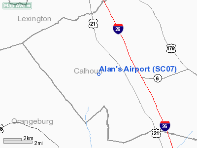
Location & QuickFacts
| FAA Information Effective: | 2008-09-25 |
| Airport Identifier: | SC07 |
| Airport Status: | Operational |
| Longitude/Latitude: | 080-56-59.0000W/33-40-33.0000N
-80.949722/33.675833 (Estimated) |
| Elevation: | 369 ft / 112.47 m (Estimated) |
| Land: | 15 acres |
| From nearest city: | 9 nautical miles W of St Matthews, SC |
| Location: | Calhoun County, SC |
| Magnetic Variation: | 04W (1985) |
Owner & Manager
| Ownership: | Privately owned |
| Owner: | Robert A. Smoak |
| Address: | 450 Bull Swamp Rd
St Matthews, SC 29135 |
| Phone number: | 803-655-7163 |
| Manager: | Robert A. Smoak |
| Address: | 450 Bull Swamp Rd
St Matthews, SC 29135 |
| Phone number: | 803-655-7163 |
Airport Operations and Facilities
| Airport Use: | Private |
| Wind indicator: | Yes |
| Segmented Circle: | No |
| Control Tower: | No |
| Lighting Schedule: | PHONE REQ
FOR LIRL RY 13/31 CALL 803-655-7179. |
| Sectional chart: | Charlotte |
| Region: | ASO - Southern |
| Boundary ARTCC: | ZJX - Jacksonville |
| Tie-in FSS: | AND - Anderson |
| FSS Toll Free: | 1-800-WX-BRIEF |
Airport Communications
Runway Information
Runway 13/31
| Dimension: | 2600 x 125 ft / 792.5 x 38.1 m |
| Surface: | ASPH-TURF,
CENTER 25' ASPH ENTIRE LENGTH OF RY. |
| Edge Lights: | Low |
| |
Runway 13 |
Runway 31 |
| Traffic Pattern: | Right | Left |
| Obstruction: | | 17 ft road |
|
Radio Navigation Aids
| ID |
Type |
Name |
Ch |
Freq |
Var |
Dist |
| OYI | NDB | Orangeburg | | 226.00 | 05W | 15.6 nm |
| MMT | NDB | Mc Entire | | 427.00 | 05W | 17.3 nm |
| BKO | NDB | Barnwell | | 392.00 | 06W | 30.9 nm |
| SMS | NDB | Sumter | | 252.00 | 04W | 35.0 nm |
| AIK | NDB | Aiken | | 347.00 | 04W | 36.4 nm |
| MNI | NDB | Manning | | 381.00 | 06W | 37.6 nm |
| FDW | NDB | Winnsboro | | 414.00 | 05W | 39.2 nm |
| CDN | NDB | Camden | | 263.00 | 05W | 41.3 nm |
| RBW | NDB | Walterboro | | 221.00 | 05W | 47.7 nm |
| SSC | TACAN | Shaw | 038X | | 05W | 30.2 nm |
| ALD | VOR | Allendale | | 116.70 | 01W | 43.4 nm |
| EDS | VOR/DME | Edisto | 051X | 111.40 | 05W | 14.0 nm |
| CAE | VORTAC | Columbia | 094X | 114.70 | 02W | 12.1 nm |
| MMT | VORTAC | Mc Entire | 079X | 113.20 | 05W | 16.6 nm |
| VAN | VORTAC | Vance | 041X | 110.40 | 06W | 27.9 nm |
Remarks
Images and information placed above are from
http://www.airport-data.com/airport/SC07/
We thank them for the data!
| General Info
|
| Country |
United States
|
| State |
SOUTH CAROLINA
|
| FAA ID |
SC07
|
| Latitude |
33-40-33.000N
|
| Longitude |
080-56-59.000W
|
| Elevation |
369 feet
|
| Near City |
ST MATTHEWS
|
We don't guarantee the information is fresh and accurate. The data may
be wrong or outdated.
For more up-to-date information please refer to other sources.
|
|


