 |
|
Location & QuickFacts
| FAA Information Effective: | 2008-09-25 |
| Airport Identifier: | 29RI |
| Airport Status: | Operational |
| Longitude/Latitude: | 071-14-10.0000W/41-32-32.0000N
-71.236111/41.542222 (Estimated) |
| Elevation: | 40 ft / 12.19 m (Estimated) |
| Land: | 0 acres |
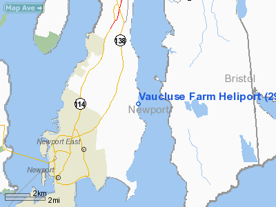
| From nearest city: | 4 nautical miles S of Portsmouth, RI |
| Location: | Newport County, RI |
| Magnetic Variation: | () |
Owner & Manager
| Ownership: | Privately owned |
| Owner: | Heliflite Shares Llc |
| Address: | 15 Brewster Road North
Newark, NJ 07114 |
| Phone number: | 817-455-5312 |
| Manager: | Donald Ray Purcell |
| Address: | 15 Brewster Road North
Newark, NJ 07114 |
| Phone number: | 817-455-5312 |
Airport Operations and Facilities
| Airport Use: | Private |
| Control Tower: | No |
| Sectional chart: | New York |
| Region: | ANE - New England |
| Boundary ARTCC: | ZBW - Boston |
| Tie-in FSS: | BDR - Bridgeport |
| FSS Toll Free: | 1-800-WX-BRIEF |
Runway Information
Helipad H1
| Dimension: | 30 x 30 ft / 9.1 x 9.1 m |
| Surface: | TURF, |
| |
Runway H1 |
Runway |
| Traffic Pattern: | Left | Left |
|
Radio Navigation Aids
| ID |
Type |
Name |
Ch |
Freq |
Var |
Dist |
| ORW | FAN MARKER | Canton | | | 15W | 37.2 nm |
| TAN | NDB | Taunton | | 227.00 | 16W | 22.4 nm |
| SFZ | NDB | Central | | 241.00 | 15W | 25.3 nm |
| FFF | NDB | Plymouth | | 257.00 | 16W | 26.7 nm |
| IHM | NDB | Mansfield | | 220.00 | 16W | 27.7 nm |
| IMR | NDB | Marshfield | | 368.00 | 16W | 41.8 nm |
| FMH | TACAN | Otis | 105X | | 15W | 33.2 nm |
| NZW | TACAN | South Weymouth | 061X | | 15W | 38.8 nm |
| SEY | VOR/DME | Sandy Point | 125X | 117.80 | 15W | 27.3 nm |
| MVY | VOR/DME | Marthas Vineyard | 092X | 114.50 | 15W | 29.4 nm |
| ORW | VOR/DME | Norwich | 037X | 110.00 | 14W | 34.3 nm |
| PUT | VOR/DME | Putnam | 121X | 117.40 | 14W | 36.9 nm |
| GON | VOR/DME | Groton | 45Y | 110.85 | 14W | 38.9 nm |
| PVD | VORTAC | Providence | 103X | 115.60 | 14W | 14.0 nm |
| PVD | VOT | Providence | | 108.20 | | 13.9 nm |
| GON | VOT | Groton | | 110.25 | | 39.0 nm |
Remarks
- OWNER DESIRES HELIPORT NOT BE CHARTED.
- PRVDD RESOLVE TRAFFIC PATTERN INGRESS/EGRESS WITH NEWPORT STATE ARPT & ANY PRIVATE ARPTS WITHIN 5 NM; PRIVATE USE ONLY; VFR OPNS.
Images and information placed above are from
http://www.airport-data.com/airport/29RI/
We thank them for the data!
|
|


