 |
|
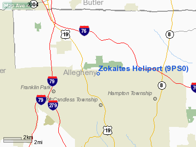
Location & QuickFacts
| FAA Information Effective: | 2008-09-25 |
| Airport Identifier: | 9PS0 |
| Airport Status: | Operational |
| Longitude/Latitude: | 080-01-58.9050W/40-36-32.2420N
-80.033029/40.608956 (Estimated) |
| Elevation: | 1268 ft / 386.49 m (Estimated) |
| Land: | 1 acres |
| From nearest city: | 1 nautical miles W of Wexford, PA |
| Location: | Allegheny County, PA |
| Magnetic Variation: | 08W (1985) |
Owner & Manager
| Ownership: | Privately owned |
| Owner: | Frank R. Zokaites |
| Address: | 375 Golfside Dr
Wexford, PA 15090 |
| Phone number: | 412-935-5257 |
| Address: |
|
Airport Operations and Facilities
| Airport Use: | Private |
| Wind indicator: | Yes |
| Segmented Circle: | No |
| Control Tower: | No |
| Sectional chart: | Detroit |
| Region: | AEA - Eastern |
| Boundary ARTCC: | ZOB - Cleveland |
| Tie-in FSS: | AOO - Altoona |
| FSS Toll Free: | 1-800-WX-BRIEF |
Runway Information
Helipad H1
| Dimension: | 60 x 60 ft / 18.3 x 18.3 m |
| Surface: | TURF, |
| |
Runway H1 |
Runway |
| Traffic Pattern: | Left | Left |
|
Radio Navigation Aids
| ID |
Type |
Name |
Ch |
Freq |
Var |
Dist |
| MKP | NDB | Mc Keesport | | 287.00 | 07W | 19.1 nm |
| PNU | NDB | Washington County | | 255.00 | 08W | 28.5 nm |
| UCP | NDB | Castle | | 272.00 | 09W | 30.4 nm |
| BHU | NDB | Benje | | 382.00 | 07W | 37.5 nm |
| HBD | NDB | Hubbard | | 408.00 | 08W | 39.8 nm |
| INP | NDB | Indiana | | 242.00 | 08W | 44.1 nm |
| VV | NDB | Camor | | 299.00 | 08W | 45.6 nm |
| TSO | NDB | Tolson | | 395.00 | 07W | 47.8 nm |
| AGC | VOR/DME | Allegheny | 037X | 110.00 | 09W | 19.9 nm |
| HLG | VOR/DME | Wheeling | 059X | 112.20 | 07W | 32.3 nm |
| CIP | VOR/DME | Clarion | 076X | 112.90 | 06W | 41.5 nm |
| MMJ | VORTAC | Montour | 057X | 112.00 | 08W | 10.3 nm |
| EWC | VORTAC | Ellwood City | 105X | 115.80 | 08W | 15.3 nm |
| IHD | VORTAC | Indian Head | 019X | 108.20 | 06W | 49.1 nm |
Remarks
- PROVIDED OPS LIMITED TO ROTORCRAFT OF LESS THAN 12,500 LBS
Images and information placed above are from
http://www.airport-data.com/airport/9PS0/
We thank them for the data!
| General Info
|
| Country |
United States
|
| State |
PENNSYLVANIA
|
| FAA ID |
9PS0
|
| Latitude |
40-36-32.242N
|
| Longitude |
080-01-58.905W
|
| Elevation |
1268 feet
|
| Near City |
WEXFORD
|
We don't guarantee the information is fresh and accurate. The data may
be wrong or outdated.
For more up-to-date information please refer to other sources.
|
|


