 |
|
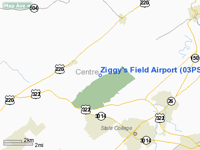
Location & QuickFacts
| FAA Information Effective: | 2008-09-25 |
| Airport Identifier: | 03PS |
| Airport Status: | Operational |
| Longitude/Latitude: | 077-54-20.0000W/40-51-00.0000N
-77.905556/40.850000 (Estimated) |
| Elevation: | 1050 ft / 320.04 m (Estimated) |
| Land: | 17 acres |
| From nearest city: | 8 nautical miles NE of Bellefonte, PA |
| Location: | Centre County, PA |
| Magnetic Variation: | 10W (1995) |
Owner & Manager
| Ownership: | Privately owned |
| Owner: | David A Bauchspies & Doris M Coyle |
| Address: | 3341 Buffalo Run Rd
Bellefonte, PA 16823 |
| Phone number: | 814-355-3553 |
| Manager: | David A Bauchspies |
| Address: | 3341 Buffalo Run Rd
Bellefonte, PA 16823 |
| Phone number: | 814-355-3553 |
Airport Operations and Facilities
| Airport Use: | Private |
| Wind indicator: | Yes |
| Segmented Circle: | No |
| Control Tower: | No |
| Sectional chart: | Detroit |
| Region: | AEA - Eastern |
| Boundary ARTCC: | ZNY - New York |
| Tie-in FSS: | AOO - Altoona |
| FSS Toll Free: | 1-800-WX-BRIEF |
Runway Information
Runway 14/32
| Dimension: | 675 x 90 ft / 205.7 x 27.4 m |
| Surface: | TURF, Good Condition |
| |
Runway 14 |
Runway 32 |
| Traffic Pattern: | Left | Left |
| Displaced threshold: | 0.00 ft | 150.00 ft |
| Obstruction: | | 22 ft bldgs, 200.0 ft from runway |
|
Runway 16/34
| Dimension: | 925 x 90 ft / 281.9 x 27.4 m |
| Surface: | TURF, Good Condition |
| |
Runway 16 |
Runway 34 |
| Traffic Pattern: | Left | Left |
| Displaced threshold: | 0.00 ft | 150.00 ft |
| Obstruction: | | 22 ft bldg, 200.0 ft from runway |
|
Runway 18/36
| Dimension: | 1130 x 90 ft / 344.4 x 27.4 m |
| Surface: | TURF, Good Condition |
| |
Runway 18 |
Runway 36 |
| Traffic Pattern: | Left | Left |
| Displaced threshold: | 0.00 ft | 300.00 ft |
| Obstruction: | | 25 ft trees, 100.0 ft from runway |
|
Radio Navigation Aids
| ID |
Type |
Name |
Ch |
Freq |
Var |
Dist |
| RV | NDB | Stroh | | 407.00 | 10W | 16.5 nm |
| AOO | VOR | Altoona | | 108.80 | 07W | 36.4 nm |
| REC | VOR/DME | Revloc | 043X | 110.60 | 09W | 42.5 nm |
| PSB | VORTAC | Philipsburg | 102X | 115.50 | 10W | 5.6 nm |
| TON | VORTAC | Tyrone | 096X | 114.90 | 07W | 20.6 nm |
| ETG | VORTAC | Keating | 107X | 116.00 | 10W | 24.4 nm |
| SLT | VORTAC | Slate Run | 086X | 113.90 | 08W | 39.9 nm |
| SEG | VORTAC | Selinsgrove | 041X | 110.40 | 08W | 46.6 nm |
Remarks
- PRVDD VRF ONLY, CLEAR 20:1 APCH/DEP PATH EACH RY, CLEAR PROMARY SFC OF 125 FT EACH SIDE RY, & OPERATE TO MIMNIMIZE NOISE.
Images and information placed above are from
http://www.airport-data.com/airport/03PS/
We thank them for the data!
| General Info
|
| Country |
United States
|
| State |
PENNSYLVANIA
|
| FAA ID |
03PS
|
| Latitude |
40-51-00.000N
|
| Longitude |
077-54-20.000W
|
| Elevation |
1050 feet
|
| Near City |
BELLEFONTE
|
We don't guarantee the information is fresh and accurate. The data may
be wrong or outdated.
For more up-to-date information please refer to other sources.
|
|


