|
|
| York Airport |
| IATA: THV – ICAO: KTHV |
| Summary |
| Airport type |
Public |
| Owner |
York Bldg Products Inc |
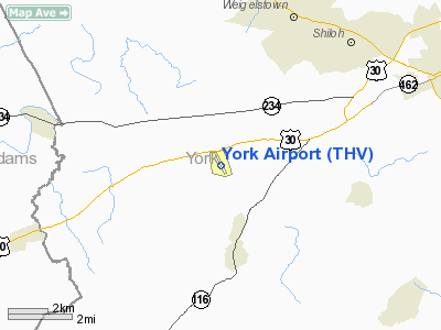
| Location |
York, Pennsylvania |
| Elevation AMSL |
480 ft / 146.3 m |
| Coordinates |
39°55′01.18″N 76°52′22.89″W / 39.9169944°N 76.873025°W / 39.9169944; -76.873025 |
| Website |
http://www.yorkairport.info |
| Runways |
| Direction |
Length |
Surface |
| ft |
m |
| 17/35 |
5,188 |
1,581 |
Asphalt |
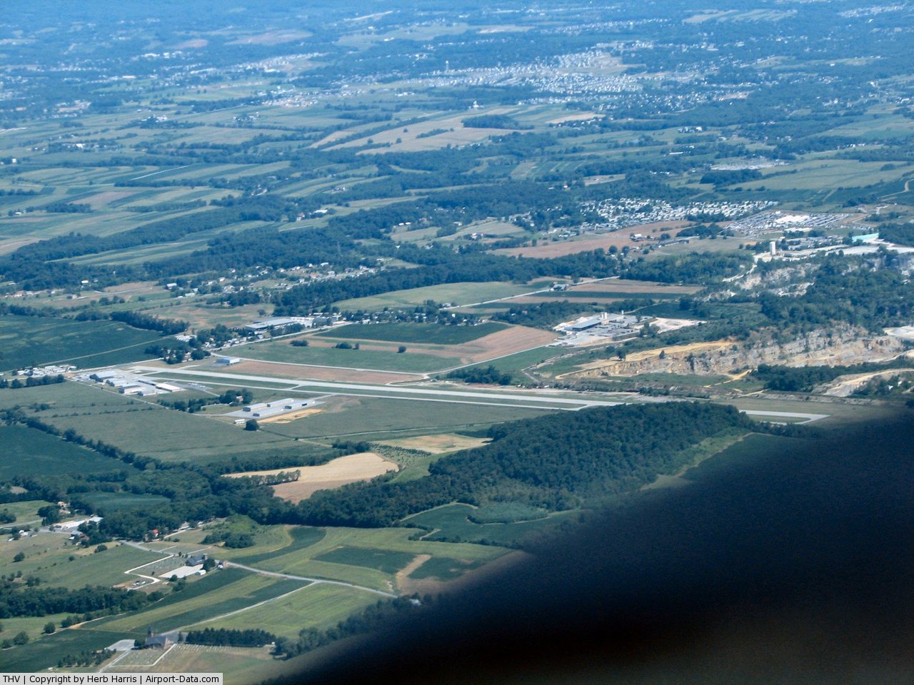
York Airport (IATA: THV, ICAO: KTHV) is a public airport located seven miles (11 km) southwest of the city of York in York County, Pennsylvania, USA.
It is the second airport to bear the name. The first one, which this one replaced when it closed sometime between 1953 and 1957, was located near the intersection of Roosevelt Ave and Wood Street in York, PA.
Facilities
York Airport covers 66 acres (270,000 m) and has one runway:
- Runway 17/35: 5,188 x 100 ft. (1,581 x 30 m), Surface: Asphalt
The airport has several instrument approaches, including a GPS approach to each runway.
A restaurant named Orville's operated on the field until November, 2008 when it was closed.
Since then a new restaurant, named Kitty Hawk, has taken Orville's place and caters to both airborne (fly in) and terrestrial (drive up) patrons.
York Airport offers flight lessons which are operated by York Flight Training LLC with 4 IFR equipped Cessna 172 aircraft.
The above content comes from Wikipedia and is published under free licenses – click here to read more.
 |
(Click on the photo to enlarge) |
Location & QuickFacts
| FAA Information Effective: | 2008-09-25 |
| Airport Identifier: | THV |
| Airport Status: | Operational |
| Longitude/Latitude: | 076-52-22.8940W/39-55-01.1820N
-76.873026/39.916995 (Estimated) |
| Elevation: | 480 ft / 146.30 m (Surveyed) |
| Land: | 66 acres |
| From nearest city: | 7 nautical miles SW of York, PA |
| Location: | York County, PA |
| Magnetic Variation: | 11W (2000) |
Owner & Manager
| Ownership: | Privately owned |
| Owner: | York Bldg Products Inc |
| Address: | Po Box 2587
York, PA 17405 |
| Phone number: | 717-792-5566 |
| Manager: | Rich Fuess |
| Address: | Po Box 2587
York, PA 17405 |
| Phone number: | 717-792-5566 |
Airport Operations and Facilities
| Airport Use: | Open to public |
| Wind indicator: | Yes |
| Segmented Circle: | No |
| Control Tower: | No |
| Lighting Schedule: | DUSK-DAWN |
| Beacon Color: | Clear-Green (lighted land airport) |
| Landing fee charge: | Yes |
| Sectional chart: | Washington |
| Region: | AEA - Eastern |
| Boundary ARTCC: | ZNY - New York |
| Tie-in FSS: | IPT - Williamsport |
| FSS on Airport: | No |
| FSS Toll Free: | 1-800-WX-BRIEF |
| NOTAMs Facility: | THV (NOTAM-d service avaliable) |
| Federal Agreements: | N |
Airport Communications
| CTAF: | 123.000 |
| Unicom: | 123.000 |
Airport Services
| Fuel available: | 100LLA |
| Airframe Repair: | MAJOR |
| Power Plant Repair: | MAJOR |
| Bottled Oxygen: | HIGH |
| Bulk Oxygen: | NONE |
Runway Information
Runway 17/35
| Dimension: | 5188 x 100 ft / 1581.3 x 30.5 m |
| Surface: | ASPH, Good Condition |
| Weight Limit: | Single wheel: 20000 lbs.
Dual wheel: 20000 lbs.
Dual tandem wheel: 20000 lbs. |
| Edge Lights: | Medium |
| |
Runway 17 |
Runway 35 |
| Longitude: | 076-52-36.7800W | 076-52-09.0080W |
| Latitude: | 39-55-24.4900N | 39-54-37.8820N |
| Elevation: | 480.00 ft | 480.00 ft |
| Alignment: | 127 | 127 |
| Traffic Pattern: | Left | Left |
| Markings: | Non-precision instrument, Good Condition
RY 17 MKGS FADED MAY NOT BE RETROFLECTIVE AT NIGHT. | Non-precision instrument, Good Condition
RY 35 MKGS FADED MAY NOT BE RETROFLECTIVE AT NIGHT. |
| Crossing Height: | 20.00 ft | 23.00 ft |
| Displaced threshold: | 800.00 ft | 740.00 ft |
| VASI: | 4-light PAPI on left side | 4-light PAPI on left side |
| Visual Glide Angle: | 4.50° | 3.75° |
| Runway End Identifier: | Yes | Yes |
| Obstruction: | 41 ft pole, 238.0 ft from runway, 195 ft right of centerline
RWY 17 25:1 TO DSPLCD THLD
RY 17 HAS +15 FT ROAD 10-200 FT FM THLD 250 FT L & R. 15+ BLAST FENCE | 29 ft pole, 363.0 ft from runway, 141 ft left of centerline, 5:1 slope to clear
RY 35 APCH SLOPE 38:1 TO DSPLCD THLD.
RY 35 HAS +6 FT FENCE 48 FT FM THLD L/R OF CNTRLN. |
|
Radio Navigation Aids
| ID |
Type |
Name |
Ch |
Freq |
Var |
Dist |
| EUD | NDB | York | | 254.00 | 11W | 0.3 nm |
| BZJ | NDB | Bellgrove | | 328.00 | 10W | 34.5 nm |
| FND | NDB | Ellicott | | 371.00 | 11W | 38.1 nm |
| IUB | NDB | Institute | | 404.00 | 08W | 39.6 nm |
| APG | NDB | Aberdeen | | 349.00 | 11W | 42.2 nm |
| MTN | NDB | Martin | | 342.00 | 11W | 43.6 nm |
| GAI | NDB | Gaithersburg | | 385.00 | 09W | 46.9 nm |
| MTN | TACAN | Martin | 068X | | 11W | 41.2 nm |
| FDK | VOR | Frederick | | 109.00 | 08W | 38.2 nm |
| HGR | VOR | Hagerstown | | 109.80 | 07W | 47.3 nm |
| PPM | VOR/DME | Phillips | 021X | 108.40 | 09W | 42.3 nm |
| HAR | VORTAC | Harrisburg | 072X | 112.50 | 10W | 24.9 nm |
| EMI | VORTAC | Westminster | 126X | 117.90 | 08W | 25.8 nm |
| LRP | VORTAC | Lancaster | 120X | 117.30 | 09W | 29.4 nm |
| RAV | VORTAC | Ravine | 093X | 114.60 | 11W | 40.3 nm |
| BAL | VORTAC | Baltimore | 098X | 115.10 | 11W | 45.9 nm |
| THS | VORTAC | St Thomas | 097X | 115.00 | 07W | 49.7 nm |
| MDT | VOT | Harrisburg International | | 110.00 | | 17.6 nm |
Remarks
- TREES WI PRIM SFC 83 FT IN FM THLD & 221 FT L OF RY 17 CNTRLN; RAMP TIE-DOWN AREA & TWY WI PRIM SFC ON R SIDE.
- TWY CLSD TO ACFT WITH WINGSPAN OVER 60 FT.
- RY 35 LGTD OBSTN POLE WITHIN 60 FT OF CTLG OBSTN.
Images and information placed above are from
http://www.airport-data.com/airport/THV/
We thank them for the data!
| General Info
|
| Country |
United States
|
| State |
PENNSYLVANIA
|
| FAA ID |
THV
|
| Latitude |
39-55-01.182N
|
| Longitude |
076-52-22.894W
|
| Elevation |
480 feet
|
| Near City |
YORK
|
We don't guarantee the information is fresh and accurate. The data may
be wrong or outdated.
For more up-to-date information please refer to other sources.
|
|