 |
|
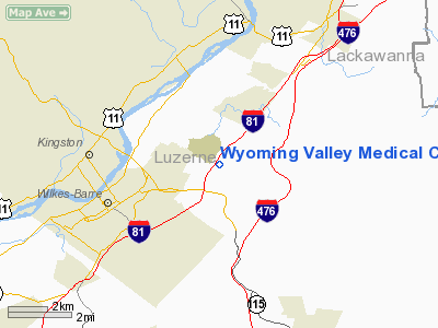
Wyoming Valley Medical Center Heliport |
Location & QuickFacts
| FAA Information Effective: | 2008-09-25 |
| Airport Identifier: | PN45 |
| Airport Status: | Operational |
| Longitude/Latitude: | 075-48-40.0000W/41-15-45.0000N
-75.811111/41.262500 (Estimated) |
| Elevation: | 947 ft / 288.65 m () |
| Land: | 1 acres |
| From nearest city: | 0 nautical miles of Wilkes-barre, PA |
| Location: | Luzerne County, PA |
| Magnetic Variation: | 12W (2000) |
Owner & Manager
| Ownership: | Privately owned |
| Address: | 1000 E. Mountain Blvd
Wilkes-barre, PA 18711 |
| Phone number: | 570-826-7733 |
| Manager: | Stephen W Varonka |
| Address: | 1000 E. Mountain Blvd
Wilkes-barre, PA 18711 |
| Phone number: | 570-826-7733 |
Airport Operations and Facilities
| Airport Use: | Private |
| Wind indicator: | Yes |
| Segmented Circle: | No |
| Control Tower: | No |
| Lighting Schedule: | DUSK-DAWN |
| Sectional chart: | New York |
| Region: | AEA - Eastern |
| Boundary ARTCC: | ZNY - New York |
| Tie-in FSS: | IPT - Williamsport |
| FSS Toll Free: | 1-800-WX-BRIEF |
Runway Information
Helipad H1
| Dimension: | 100 x 70 ft / 30.5 x 21.3 m |
| Surface: | CONC, |
| |
Runway H1 |
Runway |
| Traffic Pattern: | Left | Left |
|
Radio Navigation Aids
| ID |
Type |
Name |
Ch |
Freq |
Var |
Dist |
| CYE | NDB | Crystal Lake | | 410.00 | 11W | 3.3 nm |
| HXM | NDB | Humbolt | | 366.00 | 10W | 18.5 nm |
| LQX | NDB | Carbon | | 339.00 | 12W | 27.2 nm |
| PIX | NDB | Picture Rocks | | 344.00 | 09W | 40.6 nm |
| HZL | VOR | Hazleton | | 109.40 | 09W | 22.4 nm |
| ETX | VOR/DME | East Texas | 039X | 110.20 | 09W | 41.4 nm |
| FQM | VOR/DME | Williamsport | 091X | 114.40 | 09W | 43.8 nm |
| STW | VOR/DME | Stillwater | 033X | 109.60 | 11W | 45.6 nm |
| LVZ | VORTAC | Wilkes-barre | 053X | 111.60 | 10W | 5.5 nm |
| LHY | VORTAC | Lake Henry | 045X | 110.80 | 10W | 19.6 nm |
| FJC | VORTAC | Allentown | 122X | 117.50 | 10W | 36.0 nm |
| MIP | VORTAC | Milton | 029X | 109.20 | 09W | 41.2 nm |
Remarks
- PRVDD ACCURATE INGRESS/EGRESS & CLEAR 8:1 SLOPE, APPROPRIATE INGRESS/EGRESS MKGS ON H1 & LGTD WINDSOCK FOR NIGHT OPNS, VEHICLE TFC CONTROLLED DURING OPNS.
Images and information placed above are from
http://www.airport-data.com/airport/PN45/
We thank them for the data!
| General Info
|
| Country |
United States
|
| State |
PENNSYLVANIA
|
| FAA ID |
PN45
|
| Latitude |
41-15-45.000N
|
| Longitude |
075-48-40.000W
|
| Elevation |
947 feet
|
| Near City |
WILKES-BARRE
|
We don't guarantee the information is fresh and accurate. The data may
be wrong or outdated.
For more up-to-date information please refer to other sources.
|
|


