 |
|
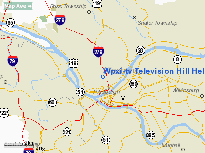
Wpxi-tv Television Hill Heliport |
Location & QuickFacts
| FAA Information Effective: | 2008-09-25 |
| Airport Identifier: | 83PN |
| Airport Status: | Operational |
| Longitude/Latitude: | 080-00-16.6920W/40-27-47.9480N
-80.004637/40.463319 (Estimated) |
| Elevation: | 1182 ft / 360.27 m (Estimated) |
| Land: | 1 acres |
| From nearest city: | 2 nautical miles NW of Pittsburgh, PA |
| Location: | Allegheny County, PA |
| Magnetic Variation: | 08W (1985) |
Owner & Manager
| Ownership: | Privately owned |
| Owner: | Wpxi-tv Inc |
| Address: | 11 Television Hill
Pittsburgh, PA 15230 |
| Phone number: | 412-237-1100 |
| Manager: | Annette Parks |
| Address: | 4145 Evergreen Road
Pittsburgh, PA 15214 |
| Phone number: | 412-237-1100 |
Airport Operations and Facilities
| Airport Use: | Private |
| Wind indicator: | Yes |
| Segmented Circle: | No |
| Control Tower: | No |
| Landing fee charge: | No |
| Sectional chart: | Detroit |
| Region: | AEA - Eastern |
| Boundary ARTCC: | ZOB - Cleveland |
| Tie-in FSS: | AOO - Altoona |
| FSS on Airport: | No |
| FSS Toll Free: | 1-800-WX-BRIEF |
Runway Information
Helipad H1
| Dimension: | 56 x 48 ft / 17.1 x 14.6 m |
| Surface: | ASPH, |
| |
Runway H1 |
Runway |
| Traffic Pattern: | Left | Left |
|
Radio Navigation Aids
| ID |
Type |
Name |
Ch |
Freq |
Var |
Dist |
| MKP | NDB | Mc Keesport | | 287.00 | 07W | 12.1 nm |
| PNU | NDB | Washington County | | 255.00 | 08W | 20.5 nm |
| BHU | NDB | Benje | | 382.00 | 07W | 34.0 nm |
| VV | NDB | Camor | | 299.00 | 08W | 36.9 nm |
| UCP | NDB | Castle | | 272.00 | 09W | 38.5 nm |
| INP | NDB | Indiana | | 242.00 | 08W | 44.1 nm |
| HBD | NDB | Hubbard | | 408.00 | 08W | 47.9 nm |
| CFX | NDB | Cadiz | | 239.00 | 07W | 48.2 nm |
| TSO | NDB | Tolson | | 395.00 | 07W | 49.4 nm |
| AGC | VOR/DME | Allegheny | 037X | 110.00 | 09W | 11.2 nm |
| HLG | VOR/DME | Wheeling | 059X | 112.20 | 07W | 28.6 nm |
| AIR | VOR/DME | Bellaire | 118X | 117.10 | 07W | 45.9 nm |
| CIP | VOR/DME | Clarion | 076X | 112.90 | 06W | 48.0 nm |
| MMJ | VORTAC | Montour | 057X | 112.00 | 08W | 8.8 nm |
| EWC | VORTAC | Ellwood City | 105X | 115.80 | 08W | 23.7 nm |
| IHD | VORTAC | Indian Head | 019X | 108.20 | 06W | 41.8 nm |
Remarks
- PROVIDED OPERATIONS ARE CONDUCTED WITHIN THE RESTRICTIONS IMPOSED BY THE PITTSBURGH ATCT.
Images and information placed above are from
http://www.airport-data.com/airport/83PN/
We thank them for the data!
| General Info
|
| Country |
United States
|
| State |
PENNSYLVANIA
|
| FAA ID |
83PN
|
| Latitude |
40-27-47.948N
|
| Longitude |
080-00-16.692W
|
| Elevation |
1182 feet
|
| Near City |
PITTSBURGH
|
We don't guarantee the information is fresh and accurate. The data may
be wrong or outdated.
For more up-to-date information please refer to other sources.
|
|


