|
|
Coordinates: 40°08′15″N 075°15′54″W / 40.1375°N 75.265°W / 40.1375; -75.265
| Wings Field |
| IATA: BBX – ICAO: KLOM – FAA LID: LOM |
| Summary |
| Airport type |
Public |
| Owner |
Wings Field Preservation Assoc. |
| Serves |
Philadelphia |
| Location |
Blue Bell, Pennsylvania |
| Elevation AMSL |
302 ft / 92 m |
| Website |
www.WingsField.com |
| Runways |
| Direction |
Length |
Surface |
| ft |
m |
| 6/24 |
3,700 |
1,128 |
Asphalt |
| Statistics (2007) |
| Aircraft operations |
35,130 |
| Based aircraft |
115 |
| Source: Federal Aviation Administration |
Wings Field (IATA: BBX, ICAO: KLOM, FAA LID: LOM) is a general aviation airport located in Blue Bell which is in Whitpain Township in Montgomery County, Pennsylvania, United States. The airport was founded in 1930 and is approximately three miles (5 km) northwest of Philadelphia. Facilities and aircraft
Wings Field covers an area of 217 acres (88 ha) which contains one asphalt paved runway designated 6/24 and measuring: 3,700 x 75 ft (1,128 x 23 m). For the 12-month period ending January 4, 2007, the airport had 35,130 aircraft operations, an average of 96 per day: 83% general aviation, 17% air taxi and <1% military. There are 115 aircraft based at this airport: 90% single-engine, 9% multi-engine, <1% jet and <1% helicopter.
The above content comes from Wikipedia and is published under free licenses – click here to read more.

 |
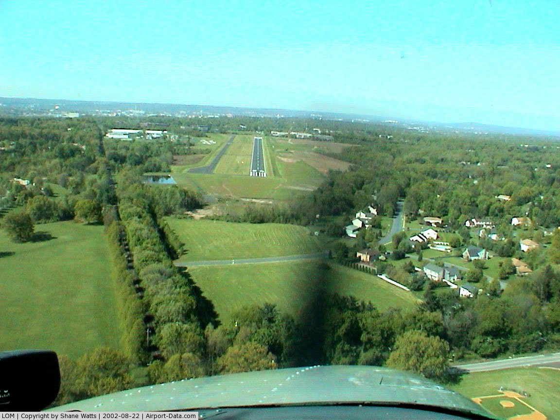
(Click on the photo to enlarge) |
Location & QuickFacts
| FAA Information Effective: | 2008-09-25 |
| Airport Identifier: | LOM |
| Airport Status: | Operational |
| Longitude/Latitude: | 075-15-54.4940W/40-08-15.1730N
-75.265137/40.137548 (Estimated) |
| Elevation: | 302 ft / 92.05 m (Estimated) |
| Land: | 217 acres |
| From nearest city: | 3 nautical miles NW of Philadelphia, PA |
| Location: | Montgomery County, PA |
| Magnetic Variation: | 12W (2005) |
Owner & Manager
| Ownership: | Privately owned |
| Owner: | Wings Field Preservation Assoc. |
| Address: | Wings Fld/1501 Narcissa Rd
Blue Bell, PA 19422 |
| Phone number: | 215-646-0400
X28. |
| Manager: | Jay Kontra |
| Address: | Wings Fld/1501 Narcissa Rd
Blue Bell, PA 19422 |
| Phone number: | 215-646-0400 |
Airport Operations and Facilities
| Airport Use: | Open to public |
| Wind indicator: | Yes |
| Segmented Circle: | No |
| Control Tower: | No |
| Lighting Schedule: | DUSK DAWN
ACTIVATE MIRL RYS 06/24, PAPI & REIL RYS 06 & 24 - CTAF |
| Beacon Color: | Clear-Green (lighted land airport) |
| Landing fee charge: | No |
| Sectional chart: | New York |
| Region: | AEA - Eastern |
| Traffic Pattern Alt: | 1200 ft |
| Boundary ARTCC: | ZNY - New York |
| Tie-in FSS: | IPT - Williamsport |
| FSS on Airport: | No |
| FSS Toll Free: | 1-800-WX-BRIEF |
| NOTAMs Facility: | LOM (NOTAM-d service avaliable) |
| Federal Agreements: | N |
Airport Communications
| CTAF: | 123.000 |
| Unicom: | 123.000 |
Airport Services
| Fuel available: | 100LLA |
| Airframe Repair: | MAJOR |
| Power Plant Repair: | MAJOR |
| Bulk Oxygen: | HIGH/LOW |
Runway Information
Runway 06/24
| Dimension: | 3700 x 75 ft / 1127.8 x 22.9 m |
| Surface: | ASPH, Good Condition |
| Edge Lights: | Medium |
| |
Runway 06 |
Runway 24 |
| Longitude: | 075-16-13.5300W | 075-15-35.4300W |
| Latitude: | 40-08-04.2500N | 40-08-26.2100N |
| Elevation: | 302.00 ft | 280.00 ft |
| Alignment: | 53 | 127 |
| Traffic Pattern: | Left | Left |
| Markings: | Non-precision instrument, Good Condition | Non-precision instrument, Good Condition |
| Crossing Height: | 40.00 ft | 40.00 ft |
| Displaced threshold: | 170.00 ft | 0.00 ft |
| VASI: | 2-light PAPI on left side | 2-light PAPI on left side |
| Visual Glide Angle: | 3.00° | 3.00° |
| Runway End Identifier: | Yes | Yes |
| Obstruction: | 24 ft trees, 228.0 ft from runway, 127 ft right of centerline, 1:1 slope to clear
APCH SLOPE 16:1 TO DSPLCD THLD.
RY 06 HAS +27 FT TREES 147 FT OUT 226 FT RIGHT. | 50 ft tree, 705.0 ft from runway, 257 ft right of centerline, 10:1 slope to clear |
|
Radio Navigation Aids
| ID |
Type |
Name |
Ch |
Freq |
Var |
Dist |
| ING | NDB | Ambler | | 275.00 | 11W | 1.2 nm |
| NXX | NDB | Willow Grove | | 388.00 | 12W | 6.3 nm |
| DYL | NDB | Doylestown | | 237.00 | 10W | 13.6 nm |
| UKT | NDB | Quakertown | | 208.00 | 12W | 17.3 nm |
| NEL | NDB | Lakehurst | | 396.00 | 13W | 43.1 nm |
| RNB | NDB | Rainbow | | 363.00 | 11W | 43.6 nm |
| LQX | NDB | Carbon | | 339.00 | 12W | 46.4 nm |
| NXX | TACAN | Willow Grove | 061X | | 10W | 6.4 nm |
| NEL | TACAN | Lakehurst | 055X | | 11W | 42.4 nm |
| NEL | UHF/NDB | Lakehurst | | 274.80 | 13W | 43.1 nm |
| PNE | VOR | North Philadelphia | | 112.00 | 10W | 12.2 nm |
| CKZ | VOR/DME | Pennridge | 025Y | 108.85 | 12W | 15.3 nm |
| ARD | VOR/DME | Yardley | 019X | 108.20 | 10W | 17.8 nm |
| ETX | VOR/DME | East Texas | 039X | 110.20 | 09W | 32.8 nm |
| SBJ | VOR/DME | Solberg | 076X | 112.90 | 10W | 35.9 nm |
| BWZ | VOR/DME | Broadway | 089X | 114.20 | 11W | 44.6 nm |
| PTW | VORTAC | Pottstown | 112X | 116.50 | 09W | 14.5 nm |
| MXE | VORTAC | Modena | 079X | 113.20 | 09W | 22.9 nm |
| OOD | VORTAC | Woodstown | 075X | 112.80 | 10W | 30.2 nm |
| GXU | VORTAC | Mc Guire | 043X | 110.60 | 11W | 31.7 nm |
| DQO | VORTAC | Dupont | 087X | 114.00 | 10W | 31.8 nm |
| RBV | VORTAC | Robbinsville | 085X | 113.80 | 10W | 35.6 nm |
| FJC | VORTAC | Allentown | 122X | 117.50 | 10W | 36.5 nm |
| VCN | VORTAC | Cedar Lake | 099X | 115.20 | 10W | 38.6 nm |
| CYN | VORTAC | Coyle | 081X | 113.40 | 10W | 42.9 nm |
| LRP | VORTAC | Lancaster | 120X | 117.30 | 09W | 47.2 nm |
| PHL | VOT | Philadelphia Intl | | 109.80 | | 16.1 nm |
Remarks
- NOISE ABATEMENT RYS 06 & 24 - NO TURNS AFTER TKOF BEFORE 1000 FT AGL. AVOID OVERFLIGHT OF SCHOOLS EAST & WEST OF ARPT.
- LARGE FLOCKS OF GEESE ON & INVOF ARPT.
- DEER ON & INVOF ARPT.
- RY 24 RUNUP OPNS AT TY C.
- EXISTED PRIOR TO 1959.
Images and information placed above are from
http://www.airport-data.com/airport/LOM/
We thank them for the data!
| General Info
|
| Country |
United States
|
| State |
PENNSYLVANIA
|
| FAA ID |
LOM
|
| Time |
UTC-5(-4DT)
|
| Latitude |
40.137547
40° 08' 15.17" N
|
| Longitude |
-75.265136
075° 15' 54.49" W
|
| Elevation |
302 feet
92 meters
|
| Type |
Civil
|
| Magnetic Variation |
012° W (01/06)
|
| Beacon |
Yes
|
| Operating Agency |
U.S.CIVIL AIRPORT WHEREIN PERMIT COVERS USE BY TRANSIT MILITARY AIRCRAFT
|
| Near City |
Philadelphia
|
| Operating Hours |
SEE REMARKS FOR OPERATING HOURS OR COMMUNICATIONS FOR POSSIBLE HOURS
|
| Daylight Saving Time |
Second Sunday in March at 0200 to first Sunday in November at 0200 local time (Exception Arizona and that portion of Indiana in the Eastern Time Zone)
|
We don't guarantee the information is fresh and accurate. The data may
be wrong or outdated.
For more up-to-date information please refer to other sources.
|
|