|
|
Williamsport Rgnl Airport |
| Williamsport Regional Airport |
 |
| IATA: IPT – ICAO: KIPT |
| Summary |
| Airport type |
Public |
| Owner |
Williamsport Municipal Airport Authority |
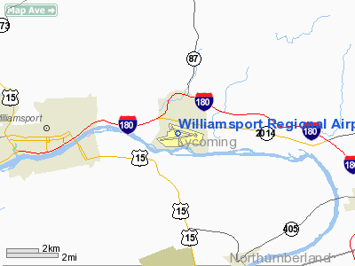
| Location |
Williamsport, Pennsylvania |
| Elevation AMSL |
529 ft / 161.2 m |
| Coordinates |
41°14′31″N 76°55′16″W / 41.24194°N 76.92111°W / 41.24194; -76.92111 |
| Runways |
| Direction |
Length |
Surface |
| ft |
m |
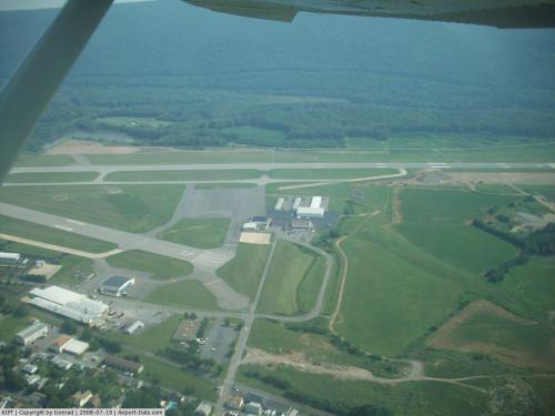
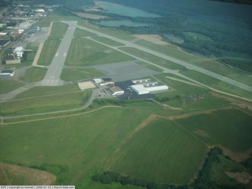
| 9/27 |
6,474 |
1,973 |
Asphalt |
| 12/30 |
4,280 |
1,305 |
Asphalt |
Williamsport Regional Airport (IATA: IPT, ICAO: KIPT) is a public towered airport located 4 miles (6 km) east of the central business district (CBD) of Williamsport, a city in Lycoming County, Pennsylvania, USA. IPT is actually located closer to Montoursville, at the foot of the northern end of the Bald Eagle Mountain ridge, along the West Branch Susquehanna River, in the West Branch Susquehanna Valley. Events
Williamsport Regional holds an annual balloon fest in mid-September.
The Williamsport Regional Association of Pilots holds a Fly-In every June.
Airlines and destinations
The airport used to have almost 23 flights a day to every major city in the Northeast United States, and to the major midwest cities of Pittsburgh, and Cleveland. It slimmed down in the 1980's, 1990's, and in 2004 cutting from 10 to 5 flights a day when US Airways cut flights to Pittsburgh International Airport.
| Airlines |
Destinations |
| US Airways Express operated by Piedmont Airlines |
Philadelphia |
Future
- Runway 9/27 is currently undergoing an extension project.
- A new direct connect to Interstate 180 is in the final stages of research and design before construction starts, which will have an exit specifically for the airport. A new train/auto bridge will be built, and the deteriorating Lycoming Valley Railroad bridge over Loyalsock Creek will be razed.
- The runway extension and new bridge are being built so the airport can attract new airlines to eliminate US Airways high priced monopoly for commercial air travel at the airport.
Related facts
- On April 25, 1993, Thomas L. Knauff set an FAI world record flying a glider on an out-and-return course of 1646.68 km (1023 miles), releasing from tow over this airport, then flying along the Appalachian Mountains to Corryton, Tennessee, and returning for a landing 10 hours later. This world record stood for almost 20 years, and was only recently broken in Argentina, but still stands as a U.S. national record.[1]
The above content comes from Wikipedia and is published under free licenses – click here to read more.
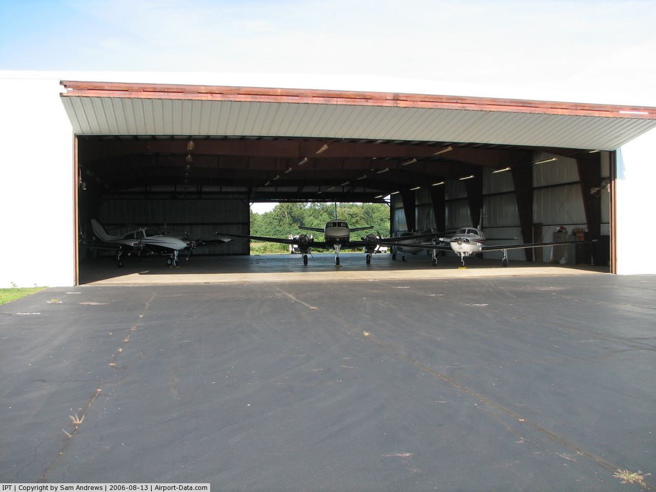
 |
(Click on the photo to enlarge) |
 |
(Click on the photo to enlarge) |
 |
(Click on the photo to enlarge) |
 |
(Click on the photo to enlarge) |
 |
(Click on the photo to enlarge) |
 |
(Click on the photo to enlarge) |
 |
(Click on the photo to enlarge) |
 |
(Click on the photo to enlarge) |
 |
(Click on the photo to enlarge) |
 |
(Click on the photo to enlarge) |
 |
(Click on the photo to enlarge) |
Location & QuickFacts
| FAA Information Effective: | 2008-09-25 |
| Airport Identifier: | IPT |
| Airport Status: | Operational |
| Longitude/Latitude: | 076-55-15.9440W/41-14-30.6090N
-76.921096/41.241836 (Estimated) |
| Elevation: | 529 ft / 161.24 m (Surveyed) |
| Land: | 535 acres |
| From nearest city: | 4 nautical miles E of Williamsport, PA |
| Location: | Lycoming County, PA |
| Magnetic Variation: | 10W (1980) |
Owner & Manager
| Ownership: | Publicly owned |
| Owner: | Williamsport Muni Arpt Auth |
| Address: | 700 Airport Rd
Montoursville, PA 17754 |
| Phone number: | 570-368-2444 |
| Manager: | Thomas J. Hart |
| Address: | 700 Airport Rd
Montoursville, PA 17754 |
| Phone number: | 570-368-2444 |
Airport Operations and Facilities
| Airport Use: | Open to public |
| Wind indicator: | Yes |
| Segmented Circle: | Yes |
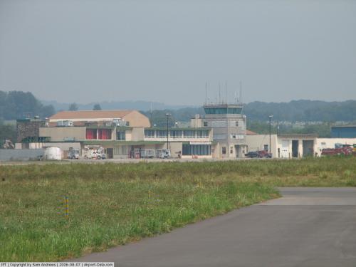
| Control Tower: | Yes |
| Lighting Schedule: | DUSK-DAWN
WHEN ATCT CLSD ACTVT MALSR RY 27; HIRL RY 09/27; REIL RY 09 & TWY LGTS - CTAF; MIRL RY 12/30 OFF. |
| Beacon Color: | Clear-Green (lighted land airport) |
| Landing fee charge: | Yes |
| Sectional chart: | New York |
| Region: | AEA - Eastern |
| Boundary ARTCC: | ZNY - New York |
| Tie-in FSS: | IPT - Williamsport |
| FSS on Airport: | No |
| FSS Toll Free: | 1-800-WX-BRIEF |
| NOTAMs Facility: | IPT (NOTAM-d service avaliable) |
| Certification type/date: | I A S 05/1973
PPR 12 HRS FOR UNSKED ACR OPNS WITH MORE THAN 30 PSGR SEATS2300-0600 LCL DLY CALL AMGR 570-368-2444 OR 2446. |
| Federal Agreements: | NGY3H |
Airport Communications
| CTAF: | 119.100 |
| Unicom: | 122.950 |
Airport Services
| Fuel available: | 100LLA
FUEL & SVCS AVBL 0530-2200 DAILY; AFTER HRS BY PRIOR COORDINATION CALL 570-368-2651. |
| Airframe Repair: | MAJOR |
| Power Plant Repair: | MAJOR |
| Bottled Oxygen: | NONE |
| Bulk Oxygen: | HIGH |
Runway Information
Runway 09/27
| Dimension: | 6474 x 150 ft / 1973.3 x 45.7 m |
| Surface: | ASPH, Good Condition |
| Surface Treatment: | Saw-cut or plastic Grooved |
| Weight Limit: | Single wheel: 65000 lbs.
Dual wheel: 100000 lbs.
Dual tandem wheel: 190000 lbs. |
| Edge Lights: | High |
| |
Runway 09 |
Runway 27 |
| Longitude: | 076-56-03.8740W | 076-54-41.3110W |
| Latitude: | 41-14-19.1580N | 41-14-33.5820N |
| Elevation: | 514.00 ft | 525.00 ft |
| Alignment: | 77 | 127 |
| ILS Type: | | ILS
|
| Traffic Pattern: | Left | Right |
| Markings: | Precision instrument, Good Condition | Precision instrument, Good Condition |
| Crossing Height: | 58.00 ft | 0.00 ft |
| VASI: | 4-box on left side | |
| Visual Glide Angle: | 3.00° | 0.00° |
| Approach lights: | | MALSR |
| Runway End Identifier: | Yes | |
| Obstruction: | 57 ft trees, 225.0 ft from runway, 300 ft left of centerline | 28 ft rr, 234.0 ft from runway, 403 ft right of centerline, 3:1 slope to clear |
|
Runway 12/30
| Dimension: | 4280 x 150 ft / 1304.5 x 45.7 m |
| Surface: | ASPH, Good Condition |
| Weight Limit: | Single wheel: 200000 lbs.
Dual wheel: 200000 lbs.
Dual tandem wheel: 400000 lbs. |
| Edge Lights: | Medium |
| |
Runway 12 |
Runway 30 |
| Longitude: | 076-55-35.3700W | 076-54-41.5060W |
| Latitude: | 41-14-42.1120N | 41-14-30.4760N |
| Elevation: | 523.00 ft | 525.00 ft |
| Alignment: | 106 | 127 |
| Traffic Pattern: | Left | Right |
| Markings: | Non-precision instrument, Good Condition | Non-precision instrument, Good Condition |
| Crossing Height: | 45.00 ft | 41.00 ft |
| VASI: | 2-light PAPI on left side | 2-light PAPI on left side |
| Visual Glide Angle: | 3.75° | 4.00°
RY 30 PAPI UNUSBL BYD 7 DEG LEFT SIDE OF COURSE. |
|
Radio Navigation Aids
| ID |
Type |
Name |
Ch |
Freq |
Var |
Dist |
| PIX | NDB | Picture Rocks | | 344.00 | 09W | 9.8 nm |
| HXM | NDB | Humbolt | | 366.00 | 10W | 44.5 nm |
| CYE | NDB | Crystal Lake | | 410.00 | 11W | 49.3 nm |
| HZL | VOR | Hazleton | | 109.40 | 09W | 39.4 nm |
| FQM | VOR/DME | Williamsport | 091X | 114.40 | 09W | 8.8 nm |
| SFK | VOR/DME | Stonyfork | 023X | 108.60 | 08W | 35.3 nm |
| MIP | VORTAC | Milton | 029X | 109.20 | 09W | 17.5 nm |
| SEG | VORTAC | Selinsgrove | 041X | 110.40 | 08W | 27.2 nm |
| RAV | VORTAC | Ravine | 093X | 114.60 | 11W | 43.9 nm |
Remarks
- BIRDS ON & INVOF ARPT SPCLY AER 27.
- TWY 'J' CLSD TO ACFT WITH WING SPAN OVER 78 FT.
- FOR LANDSIDE ACCESS FM ARPT AFTER HRS USE COMPUTERIZED GATE SYSTEM AT EAST END OR FBO APRON.
- UNLGTD CRANE 90 FT AGL .5 MI SE AER 30 PERMLY.
- ARPT CLSD TO BANNER TOWING OPNS.
- ESTAB PRIOR TO RQMT
Images and information placed above are from
http://www.airport-data.com/airport/IPT/
We thank them for the data!
| General Info
|
| Country |
United States
|
| State |
PENNSYLVANIA
|
| FAA ID |
IPT
|
| Latitude |
41-14-30.609N
|
| Longitude |
076-55-15.944W
|
| Elevation |
529 feet
|
| Near City |
WILLIAMSPORT
|
We don't guarantee the information is fresh and accurate. The data may
be wrong or outdated.
For more up-to-date information please refer to other sources.
|
|