 |
|
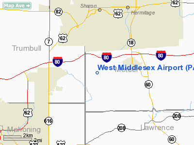
Location & QuickFacts
| FAA Information Effective: | 2008-09-25 |
| Airport Identifier: | PA21 |
| Airport Status: | Operational |
| Longitude/Latitude: | 080-30-09.2520W/41-09-55.2050N
-80.502570/41.165335 (Estimated) |
| Elevation: | 1100 ft / 335.28 m (Estimated) |
| Land: | 60 acres |
| From nearest city: | 3 nautical miles W of West Middlesex, PA |
| Location: | Mercer County, PA |
| Magnetic Variation: | 07W (1985) |
Owner & Manager
| Ownership: | Privately owned |
| Owner: | Nicholas J. Dyda |
| Address: | 3685 Hubbard-middlesex Road
West Middlesex, PA 16159 |
| Phone number: | 412-528-3777 |
| Manager: | N. J. Dyda |
| Address: | 3685 Hubbard-middlesex Road
West Middlesex, PA 16159 |
| Phone number: | 412-528-3777 |
Airport Operations and Facilities
| Airport Use: | Private |
| Wind indicator: | Yes |
| Segmented Circle: | No |
| Control Tower: | No |
| Landing fee charge: | No |
| Sectional chart: | Detroit |
| Region: | AEA - Eastern |
| Boundary ARTCC: | ZOB - Cleveland |
| Tie-in FSS: | AOO - Altoona |
| FSS on Airport: | No |
| FSS Toll Free: | 1-800-WX-BRIEF |
Airport Services
| Airframe Repair: | MAJOR |
| Power Plant Repair: | MAJOR |
| Bottled Oxygen: | NONE |
| Bulk Oxygen: | NONE |
Runway Information
Runway 18/36
| Dimension: | 2300 x 220 ft / 701.0 x 67.1 m |
| Surface: | TURF, Fair Condition |
| |
Runway 18 |
Runway 36 |
| Traffic Pattern: | Left | Left |
| Displaced threshold: | 200.00 ft | 0.00 ft |
| Obstruction: | 55 ft trees, 730.0 ft from runway, 64 ft right of centerline, 13:1 slope to clear
APCH SLOPE 16:1 AT DSPLCD THR. | 70 ft trees, 236.0 ft from runway, 131 ft left of centerline, 3:1 slope to clear |
|
Radio Navigation Aids
| ID |
Type |
Name |
Ch |
Freq |
Var |
Dist |
| HBD | NDB | Hubbard | | 408.00 | 08W | 1.5 nm |
| UCP | NDB | Castle | | 272.00 | 09W | 9.4 nm |
| AK | NDB | Akron | | 362.00 | 07W | 40.5 nm |
| TSO | NDB | Tolson | | 395.00 | 07W | 44.7 nm |
| FKL | VOR | Franklin | | 109.60 | 06W | 33.5 nm |
| ACO | VOR/DME | Akron | 091X | 114.40 | 04W | 31.8 nm |
| CXR | VOR/DME | Chardon | 074X | 112.70 | 05W | 36.5 nm |
| JFN | VOR/DME | Jefferson | 099X | 115.20 | 05W | 37.4 nm |
| CIP | VOR/DME | Clarion | 076X | 112.90 | 06W | 47.3 nm |
| BSV | VOR/DME | Briggs | 071X | 112.40 | 04W | 49.3 nm |
| YNG | VORTAC | Youngstown | 027X | 109.00 | 05W | 12.6 nm |
| EWC | VORTAC | Ellwood City | 105X | 115.80 | 08W | 24.3 nm |
| MMJ | VORTAC | Montour | 057X | 112.00 | 08W | 43.1 nm |
| CAK | VOT | Akron/canton Regional | | 110.60 | | 45.1 nm |
Remarks
- ARPT FAIR TURF, SOFT WHEN THAWING AND WET.
- FIRST 1250' RY 18 GRADE 1/2% RISING TO 4%.
- IN EXISTENCE PRIOR TO 1959.
Images and information placed above are from
http://www.airport-data.com/airport/PA21/
We thank them for the data!
| General Info
|
| Country |
United States
|
| State |
PENNSYLVANIA
|
| FAA ID |
PA21
|
| Latitude |
41-09-55.205N
|
| Longitude |
080-30-09.252W
|
| Elevation |
1100 feet
|
| Near City |
WEST MIDDLESEX
|
We don't guarantee the information is fresh and accurate. The data may
be wrong or outdated.
For more up-to-date information please refer to other sources.
|
|


