 |
|
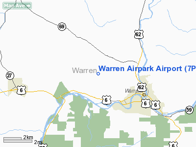
Location & QuickFacts
| FAA Information Effective: | 2008-09-25 |
| Airport Identifier: | 7PA1 |
| Airport Status: | Operational |
| Longitude/Latitude: | 079-12-22.1680W/41-51-57.2120N
-79.206158/41.865892 (Estimated) |
| Elevation: | 1790 ft / 545.59 m (Estimated) |
| Land: | 65 acres |
| From nearest city: | 3 nautical miles SE of Warren, PA |
| Location: | Warren County, PA |
| Magnetic Variation: | 09W (1985) |
Owner & Manager
| Ownership: | Privately owned |
| Owner: | Emory J. Mahan |
| Address: | 2776 Penna Ave West
Warren, PA 16365 |
| Phone number: | 814-726-2900 |
| Manager: | Emory J. Mahan |
| Address: | 2776 Penna Ave West
Warren, PA 16365 |
| Phone number: | 814-726-2900 |
Airport Operations and Facilities
| Airport Use: | Private |
| Wind indicator: | Yes |
| Segmented Circle: | Yes |
| Control Tower: | No |
| Lighting Schedule: | RDO-CTL
ACTVT LIRL RY 06/24 - 122.9. |
| Sectional chart: | Detroit |
| Region: | AEA - Eastern |
| Boundary ARTCC: | ZOB - Cleveland |
| Tie-in FSS: | AOO - Altoona |
| FSS on Airport: | No |
| FSS Toll Free: | 1-800-WX-BRIEF |
Runway Information
Runway 06/24
| Dimension: | 1900 x 100 ft / 579.1 x 30.5 m |
| Surface: | TURF, Good Condition |
| Edge Lights: | Low |
| |
Runway 06 |
Runway 24 |
| Traffic Pattern: | Left | Left |
| Displaced threshold: | 100.00 ft | 200.00 ft |
| Obstruction: | | 51 ft pline, 850.0 ft from runway |
|
Radio Navigation Aids
| ID |
Type |
Name |
Ch |
Freq |
Var |
Dist |
| ORJ | NDB | Corry | | 258.00 | 09W | 20.0 nm |
| CQD | NDB | Cascade | | 372.00 | 08W | 42.9 nm |
| LYS | NDB | Olean | | 360.00 | 09W | 46.3 nm |
| FKL | VOR | Franklin | | 109.60 | 06W | 38.9 nm |
| JHW | VOR/DME | Jamestown | 094X | 114.70 | 07W | 19.8 nm |
| BFD | VOR/DME | Bradford | 113X | 116.60 | 07W | 26.7 nm |
| CIP | VOR/DME | Clarion | 076X | 112.90 | 06W | 44.7 nm |
| TDT | VORTAC | Tidioute | 123X | 117.60 | 09W | 13.2 nm |
| DKK | VORTAC | Dunkirk | 109X | 116.20 | 07W | 37.7 nm |
| ERI | VORTAC | Erie | 031X | 109.40 | 06W | 49.4 nm |
Remarks
- PRVDD THAT A PROPERTY LINE LIES OFF THE NORTHEAST END OF THE RY; VFR; THE PLINES OFF THE NORTHEAST END OF RY SHOULD BE MKD & LGTD.
Images and information placed above are from
http://www.airport-data.com/airport/7PA1/
We thank them for the data!
| General Info
|
| Country |
United States
|
| State |
PENNSYLVANIA
|
| FAA ID |
7PA1
|
| Latitude |
41-51-57.212N
|
| Longitude |
079-12-22.168W
|
| Elevation |
1790 feet
|
| Near City |
WARREN
|
We don't guarantee the information is fresh and accurate. The data may
be wrong or outdated.
For more up-to-date information please refer to other sources.
|
|


