 |
|
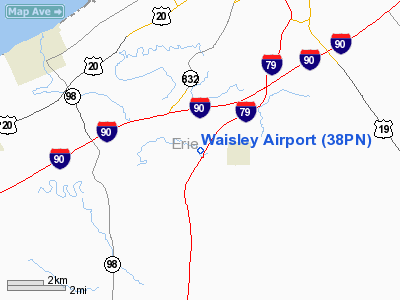
Location & QuickFacts
| FAA Information Effective: | 2008-09-25 |
| Airport Identifier: | 38PN |
| Airport Status: | Operational |
| Longitude/Latitude: | 080-09-59.2080W/42-00-00.1990N
-80.166447/42.000055 (Estimated) |
| Elevation: | 950 ft / 289.56 m (Estimated) |
| Land: | 10 acres |
| From nearest city: | 2 nautical miles W of Mc Kean, PA |
| Location: | Erie County, PA |
| Magnetic Variation: | 08W (1985) |
Owner & Manager
| Ownership: | Privately owned |
| Owner: | Theodore E Waisley |
| Address: | P.o. Box 303, 8552 Rick Road
Mc Kean, PA 16426 |
| Phone number: | 814-476-1502 |
| Manager: | Theodore E Waisley |
| Address: | P.o. Box 303, 8552 Rick Road
Mc Kean, PA 16426 |
| Phone number: | 814-476-1502 |
Airport Operations and Facilities
| Airport Use: | Private |
| Wind indicator: | Yes |
| Segmented Circle: | No |
| Control Tower: | No |
| Landing fee charge: | No |
| Sectional chart: | Detroit |
| Region: | AEA - Eastern |
| Boundary ARTCC: | ZOB - Cleveland |
| Tie-in FSS: | AOO - Altoona |
| FSS on Airport: | No |
| FSS Toll Free: | 1-800-WX-BRIEF |
Runway Information
Runway E/W
| Dimension: | 2000 x 150 ft / 609.6 x 45.7 m |
| Surface: | TURF, |
| |
Runway E |
Runway W |
| Traffic Pattern: | Left | Left |
| Obstruction: | 50 ft trees, 300.0 ft from runway | |
|
Radio Navigation Aids
| ID |
Type |
Name |
Ch |
Freq |
Var |
Dist |
| CQD | NDB | Cascade | | 372.00 | 08W | 7.7 nm |
| ORJ | NDB | Corry | | 258.00 | 09W | 23.7 nm |
| FKL | VOR | Franklin | | 109.60 | 06W | 36.5 nm |
| JFN | VOR/DME | Jefferson | 099X | 115.20 | 05W | 29.8 nm |
| JHW | VOR/DME | Jamestown | 094X | 114.70 | 07W | 48.0 nm |
| ERI | VORTAC | Erie | 031X | 109.40 | 06W | 5.7 nm |
| TDT | VORTAC | Tidioute | 123X | 117.60 | 09W | 37.7 nm |
| YNG | VORTAC | Youngstown | 027X | 109.00 | 05W | 46.2 nm |
| DKK | VORTAC | Dunkirk | 109X | 116.20 | 07W | 49.5 nm |
Remarks
- E111 PRVDD CTC IS MADE WITH ERIE ATCT TO DISCUSS AN ADJUSTMENT IN TFC PATS.
Images and information placed above are from
http://www.airport-data.com/airport/38PN/
We thank them for the data!
| General Info
|
| Country |
United States
|
| State |
PENNSYLVANIA
|
| FAA ID |
38PN
|
| Latitude |
42-00-00.199N
|
| Longitude |
080-09-59.208W
|
| Elevation |
950 feet
|
| Near City |
MC KEAN
|
We don't guarantee the information is fresh and accurate. The data may
be wrong or outdated.
For more up-to-date information please refer to other sources.
|
|


