 |
|
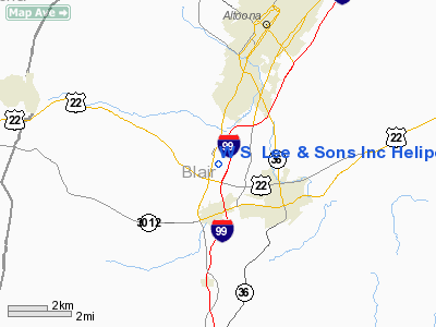
W S Lee & Sons Inc Heliport |
Location & QuickFacts
| FAA Information Effective: | 2008-09-25 |
| Airport Identifier: | 9PS7 |
| Airport Status: | Operational |
| Longitude/Latitude: | 078-25-44.0000W/40-26-50.0000N
-78.428889/40.447222 (Estimated) |
| Elevation: | 1104 ft / 336.50 m (Estimated) |
| Land: | 0 acres |
| From nearest city: | 2 nautical miles S of Duncansville, PA |
| Location: | Blair County, PA |
| Magnetic Variation: | 10W (1995) |
Owner & Manager
| Ownership: | Privately owned |
| Owner: | W S Lee & Sons Inc |
| Address: | Po Box 1631
Altoona, PA 16603 |
| Phone number: | 814-696-3538 |
| Manager: | W James Lee Iii |
| Address: | Po Box 1631
Altoona, PA 16603 |
| Phone number: | 814-696-3538 |
Airport Operations and Facilities
| Airport Use: | Private |
| Wind indicator: | Yes |
| Segmented Circle: | No |
| Control Tower: | No |
| Lighting Schedule: | RDO-CTL
ACTVT PERIMETER LGTS - 123.05. |
| Sectional chart: | Detroit |
| Region: | AEA - Eastern |
| Boundary ARTCC: | ZOB - Cleveland |
| Tie-in FSS: | AOO - Altoona |
| FSS on Airport: | No |
| FSS Toll Free: | 1-800-WX-BRIEF |
Airport Communications
Runway Information
Helipad H1
| Dimension: | 85 x 85 ft / 25.9 x 25.9 m |
| Surface: | TURF, Good Condition |
| |
Runway H1 |
Runway |
| Traffic Pattern: | Left | Left |
|
Radio Navigation Aids
| ID |
Type |
Name |
Ch |
Freq |
Var |
Dist |
| INP | NDB | Indiana | | 242.00 | 08W | 31.1 nm |
| SYS | NDB | Stoystown | | 209.00 | 08W | 31.2 nm |
| RV | NDB | Stroh | | 407.00 | 10W | 34.0 nm |
| BHU | NDB | Benje | | 382.00 | 07W | 38.8 nm |
| AOO | VOR | Altoona | | 108.80 | 07W | 9.3 nm |
| REC | VOR/DME | Revloc | 043X | 110.60 | 09W | 15.7 nm |
| TON | VORTAC | Tyrone | 096X | 114.90 | 07W | 17.9 nm |
| JST | VORTAC | Johnstown | 077X | 113.00 | 06W | 20.1 nm |
| PSB | VORTAC | Philipsburg | 102X | 115.50 | 10W | 34.5 nm |
| THS | VORTAC | St Thomas | 097X | 115.00 | 07W | 37.9 nm |
| ETG | VORTAC | Keating | 107X | 116.00 | 10W | 47.9 nm |
Remarks
- PRVDD VFR OPNS ONLY; CLEAR 8:1 APCH; APPROPRIATE MARKINGS; INSTALL WINDSOCK.
Images and information placed above are from
http://www.airport-data.com/airport/9PS7/
We thank them for the data!
| General Info
|
| Country |
United States
|
| State |
PENNSYLVANIA
|
| FAA ID |
9PS7
|
| Latitude |
40-26-50.000N
|
| Longitude |
078-25-44.000W
|
| Elevation |
1104 feet
|
| Near City |
DUNCANSVILLE
|
We don't guarantee the information is fresh and accurate. The data may
be wrong or outdated.
For more up-to-date information please refer to other sources.
|
|


