 |
|
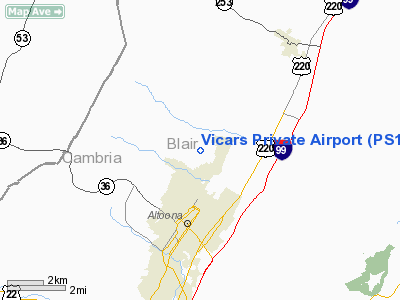
Location & QuickFacts
| FAA Information Effective: | 2008-09-25 |
| Airport Identifier: | PS15 |
| Airport Status: | Operational |
| Longitude/Latitude: | 078-23-30.0510W/40-32-51.2470N
-78.391681/40.547569 (Estimated) |
| Elevation: | 1370 ft / 417.58 m (Estimated) |
| Land: | 10 acres |
| From nearest city: | 1 nautical miles N of Altoona, PA |
| Location: | Blair County, PA |
| Magnetic Variation: | 09W (1990) |
Owner & Manager
| Ownership: | Privately owned |
| Owner: | John Vicars |
| Address: | Rd 4, Box 570
Altoona, PA 16601 |
| Phone number: | 814-942-1563 |
| Manager: | John Vicars |
| Address: | Rd 4, Box 570
Altoona, PA 16601 |
| Phone number: | 814-942-1563 |
Airport Operations and Facilities
| Airport Use: | Private |
| Wind indicator: | Yes |
| Segmented Circle: | No |
| Control Tower: | No |
| Sectional chart: | Washington |
| Region: | AEA - Eastern |
| Boundary ARTCC: | ZOB - Cleveland |
| Tie-in FSS: | AOO - Altoona |
| FSS Toll Free: | 1-800-WX-BRIEF |
Runway Information
Runway 08/26
| Dimension: | 1200 x 100 ft / 365.8 x 30.5 m |
| Surface: | TURF, |
| |
Runway 08 |
Runway 26 |
| Traffic Pattern: | Left | Left |
|
Radio Navigation Aids
| ID |
Type |
Name |
Ch |
Freq |
Var |
Dist |
| RV | NDB | Stroh | | 407.00 | 10W | 31.0 nm |
| INP | NDB | Indiana | | 242.00 | 08W | 31.2 nm |
| SYS | NDB | Stoystown | | 209.00 | 08W | 36.7 nm |
| BHU | NDB | Benje | | 382.00 | 07W | 41.6 nm |
| AOO | VOR | Altoona | | 108.80 | 07W | 13.9 nm |
| REC | VOR/DME | Revloc | 043X | 110.60 | 09W | 16.2 nm |
| TON | VORTAC | Tyrone | 096X | 114.90 | 07W | 11.6 nm |
| JST | VORTAC | Johnstown | 077X | 113.00 | 06W | 24.5 nm |
| PSB | VORTAC | Philipsburg | 102X | 115.50 | 10W | 28.7 nm |
| ETG | VORTAC | Keating | 107X | 116.00 | 10W | 41.7 nm |
| THS | VORTAC | St Thomas | 097X | 115.00 | 07W | 42.1 nm |
Remarks
- PRVDD YOU ADVISE ALTOONA HOSPITAL HELIPORT OF YOUR TFC PATTERN AND RESOLVE INGRESS/EGRESS CONFLICTION; ALL OPNS ARE RESTRICTED TO DAYLIGHT VFR.
Images and information placed above are from
http://www.airport-data.com/airport/PS15/
We thank them for the data!
| General Info
|
| Country |
United States
|
| State |
PENNSYLVANIA
|
| FAA ID |
PS15
|
| Latitude |
40-32-51.247N
|
| Longitude |
078-23-30.051W
|
| Elevation |
1380 feet
|
| Near City |
ALTOONA
|
We don't guarantee the information is fresh and accurate. The data may
be wrong or outdated.
For more up-to-date information please refer to other sources.
|
|


