 |
|
Coordinates: 41°22′40″N 079°51′37″W / 41.37778°N 79.86028°W / 41.37778; -79.86028
Venango Regional Airport
Chess Lamberton Field |
| IATA: FKL – ICAO: KFKL – FAA LID: FKL |
| Summary |
| Airport type |
Public |
| Owner |
Venango County |
| Location |
Franklin, Pennsylvania |
| Elevation AMSL |
1,540 ft / 469 m |
| Website |
co.venango.pa.us/Airport/ |
| Runways |
| Direction |
Length |
Surface |
| ft |
m |
| 3/21 |
5,200 |
1,585 |
Asphalt |
| 12/30 |
3,698 |
1,127 |
Asphalt |
| Statistics (2006) |
| Passenger boardings |
1,978 |
| Aircraft operations |
23,593 |
| Source: Federal Aviation Administration |
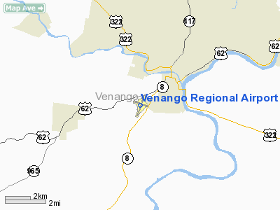
Venango Regional Airport (IATA: FKL, ICAO: KFKL, FAA LID: FKL), also known as Chess Lamberton Field, is a public airport in western Pennsylvania, two miles (3 km) southwest of the central business district of Franklin and about 10 miles (16 km) southwest of Oil City. Both cities are located in Venango County, which operates the airport. The airport covers 420 acres (1.7 km) and has two runways. It offers limited commercial service, subsidized by the Essential Air Service program.
As per Federal Aviation Administration records, the airport had 3,066 passenger boardings (enplanements) in calendar year 2004 and 2,939 in 2005. In the FAA's National Plan of Integrated Airport Systems (2007-2011) it was a categorized as a commercial service airport, which requires at least 2,500 passenger boardings per year. However, enplanements for 2006 declined to 1,978 which caused it to be categorized as a general aviation airport. History
Aviation in Franklin area originated in 1929 when two local businessmen, Wayne W. Bleakley and Joseph McElhinney, Jr. became interested in aviation and went on to construct the first airport in what was then Sugarcreek Township. The airport was supported by local businessmen who formed a corporation some time later, under their stewardship the airport continued in existence until its abandonment in 1938. Thereafter, local aviators flew from the Splane Memorial Airport in Oil City from 1941 until 1950.
The construction of Chess Lamberton Airport as it was originally known, commenced in 1950. The airport was named after the grandson of the honourable Judge Robert Lamberton of Franklin, Pa., founder of the first bank in Venago County and later reformed as The Lamberton Savings Bank in 1887.
Airline and destinations
| Airlines |
Destinations |
| Continental Connection operated by Gulfstream International Airlines |
Cleveland, DuBois |
Facilities and aircraft
Venango Regional Airport covers an area of 420 acres (170 ha) which contains two asphalt paved runways: 3/21 measuring 5,200 x 150 ft (1,585 x 46 m) and 12/30 measuring 3,698 x 100 ft (1,127 x 30 m). For the 12-month period ending December 31, 2006, the airport had 23,593 aircraft operations, an average of 64 per day: 93% general aviation and 7% air taxi.
The above content comes from Wikipedia and is published under free licenses – click here to read more.
Location & QuickFacts
| FAA Information Effective: | 2008-09-25 |
| Airport Identifier: | FKL |
| Airport Status: | Operational |
| Longitude/Latitude: | 079-51-37.3020W/41-22-40.3450N
-79.860362/41.377874 (Estimated) |
| Elevation: | 1540 ft / 469.39 m (Surveyed) |
| Land: | 420 acres |
| From nearest city: | 2 nautical miles SW of Franklin, PA |
| Location: | Venango County, PA |
| Magnetic Variation: | 10W (2005) |
Owner & Manager
| Ownership: | Publicly owned |
| Owner: | Venango County |
| Address: | Venango County Court House
Franklin, PA 16323 |
| Phone number: | 814-432-9500 |
| Manager: | Otho C. Bell |
| Address: | 1560 Airport Rd
Franklin, PA 16323 |
| Phone number: | 814-432-5333 |
Airport Operations and Facilities
| Airport Use: | Open to public |
| Wind indicator: | Yes |
| Segmented Circle: | No |
| Control Tower: | No |
| Lighting Schedule: | DUSK-DAWN
ACTVT HIRL RY 03/21& MALSR RY 21 & MIRL RY 12/30 & TWY LGTS; & PAPI RY 03 & 21 & 30 - CTAF. |
| Beacon Color: | Clear-Green (lighted land airport) |
| Landing fee charge: | Yes
LANDING FEE FOR ACFT OVER 6000 LBS GROSS WEIGHT. |
| Sectional chart: | Detroit |
| Region: | AEA - Eastern |
| Boundary ARTCC: | ZOB - Cleveland |
| Tie-in FSS: | AOO - Altoona |
| FSS on Airport: | No |
| FSS Toll Free: | 1-800-WX-BRIEF |
| NOTAMs Facility: | FKL (NOTAM-d service avaliable) |
| Certification type/date: | II A S 08/197
PPR 24 HRS FOR ACR OPNS WITH MORE THAN 30 PSGR SEATS CALL AMGR 814-432-5333. |
| Federal Agreements: | NGYH |
Airport Communications
| CTAF: | 122.700 |
| Unicom: | 122.700 |
Airport Services
| Fuel available: | 100LLA |
| Airframe Repair: | MAJOR |
| Power Plant Repair: | MAJOR |
| Bottled Oxygen: | NONE |
| Bulk Oxygen: | NONE |
Runway Information
Runway 03/21
| Dimension: | 5200 x 150 ft / 1585.0 x 45.7 m |
| Surface: | ASPH, Good Condition
NUMEROUS CRACKS IN PAVEMENT. |
| Surface Treatment: | Saw-cut or plastic Grooved |
| Weight Limit: | Single wheel: 40000 lbs.
Dual wheel: 70000 lbs. |
| Edge Lights: | High |
| |
Runway 03 |
Runway 21 |
| Longitude: | 079-51-49.1550W | 079-51-28.9110W |
| Latitude: | 41-22-09.4280N | 41-22-58.4890N |
| Elevation: | 1525.00 ft | 1534.00 ft |
| Alignment: | 17 | 127 |
| ILS Type: | | ILS
|
| Traffic Pattern: | Left | Left |
| Markings: | Precision instrument, Good Condition | Precision instrument, Good Condition |
| Crossing Height: | 45.00 ft | 57.00 ft |
| VASI: | 4-light PAPI on left side | 4-light PAPI on left side |
| Visual Glide Angle: | 3.00° | 3.00° |
| Approach lights: | | MALSR |
| Obstruction: | 16 ft bldg, 550.0 ft from runway, 150 ft left of centerline, 21:1 slope to clear | 23 ft pole, 375.0 ft from runway, 225 ft right of centerline, 7:1 slope to clear |
|
Runway 12/30
| Dimension: | 3698 x 100 ft / 1127.2 x 30.5 m |
| Surface: | ASPH, Poor Condition
NUMEROUS CRACKS IN PAVEMENT. |
| Weight Limit: | Single wheel: 67000 lbs.
Dual wheel: 105000 lbs. |
| Edge Lights: | Medium |
| |
Runway 12 |
Runway 30 |
| Longitude: | 079-51-59.8650W | 079-51-13.1540W |
| Latitude: | 41-22-50.2710N | 41-22-40.4210N |
| Elevation: | 1530.00 ft | 1532.00 ft |
| Alignment: | 106 | 127 |
| Traffic Pattern: | Left | Left |
| Markings: | Basic, Good Condition | Basic, Good Condition |
| Crossing Height: | 0.00 ft | 40.00 ft |
| VASI: | | 4-light PAPI on left side |
| Visual Glide Angle: | 0.00° | 3.00° |
| Obstruction: | 40 ft trees, 800.0 ft from runway, 200 ft left of centerline, 15:1 slope to clear | , 50:1 slope to clear |
|
Radio Navigation Aids
| ID |
Type |
Name |
Ch |
Freq |
Var |
Dist |
| UCP | NDB | Castle | | 272.00 | 09W | 33.0 nm |
| HBD | NDB | Hubbard | | 408.00 | 08W | 33.2 nm |
| ORJ | NDB | Corry | | 258.00 | 09W | 33.5 nm |
| CQD | NDB | Cascade | | 372.00 | 08W | 45.9 nm |
| FKL | VOR | Franklin | | 109.60 | 06W | 3.7 nm |
| CIP | VOR/DME | Clarion | 076X | 112.90 | 06W | 22.9 nm |
| JFN | VOR/DME | Jefferson | 099X | 115.20 | 05W | 46.1 nm |
| TDT | VORTAC | Tidioute | 123X | 117.60 | 09W | 28.3 nm |
| EWC | VORTAC | Ellwood City | 105X | 115.80 | 08W | 36.8 nm |
| YNG | VORTAC | Youngstown | 027X | 109.00 | 05W | 36.8 nm |
| ERI | VORTAC | Erie | 031X | 109.40 | 06W | 43.1 nm |
Remarks
- DEER AND BIRDS ON & INVOF ARPT.
- TWY H CLSD TO ACR ACFT.
Images and information placed above are from
http://www.airport-data.com/airport/FKL/
We thank them for the data!
| General Info
|
| Country |
United States
|
| State |
PENNSYLVANIA
|
| FAA ID |
FKL
|
| Latitude |
41-22-40.345N
|
| Longitude |
079-51-37.302W
|
| Elevation |
1540 feet
|
| Near City |
FRANKLIN
|
We don't guarantee the information is fresh and accurate. The data may
be wrong or outdated.
For more up-to-date information please refer to other sources.
|
|


