 |
|
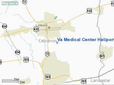
Va Medical Center Heliport |
Location & QuickFacts
| FAA Information Effective: | 2008-09-25 |
| Airport Identifier: | PS92 |
| Airport Status: | Operational |
| Longitude/Latitude: | 076-24-10.8580W/40-18-55.3310N
-76.403016/40.315370 (Estimated) |
| Elevation: | 510 ft / 155.45 m (Estimated) |
| Land: | 2 acres |
| From nearest city: | 1 nautical miles S of Lebanon, PA |
| Location: | Lebanon County, PA |
| Magnetic Variation: | 11W (1985) |
Owner & Manager
| Ownership: | Publicly owned |
| Owner: | Va Medical Center |
| Address: | Lincoln Avenue
Lebanon, PA 17042 |
| Phone number: | 717-272-6621 |
| Manager: | Leonard Washington, Jr |
| Address: | Lincoln Avenue
Lebanon, PA 17042 |
| Phone number: | 717-272-6621 |
Airport Operations and Facilities
| Airport Use: | Private
MEDICAL USE. |
| Segmented Circle: | Yes |
| Control Tower: | No |
| Landing fee charge: | No |
| Sectional chart: | New York |
| Region: | AEA - Eastern |
| Boundary ARTCC: | ZNY - New York |
| Tie-in FSS: | IPT - Williamsport |
| FSS on Airport: | No |
| FSS Toll Free: | 1-800-WX-BRIEF |
Runway Information
Helipad H1
| Dimension: | 60 x 60 ft / 18.3 x 18.3 m |
| Surface: | TURF, |
| |
Runway H1 |
Runway |
| Traffic Pattern: | Left | Left |
|
Radio Navigation Aids
| ID |
Type |
Name |
Ch |
Freq |
Var |
Dist |
| BZJ | NDB | Bellgrove | | 328.00 | 10W | 10.0 nm |
| EUD | NDB | York | | 254.00 | 11W | 32.3 nm |
| LQX | NDB | Carbon | | 339.00 | 12W | 41.9 nm |
| HXM | NDB | Humbolt | | 366.00 | 10W | 44.5 nm |
| APG | NDB | Aberdeen | | 349.00 | 11W | 48.9 nm |
| HZL | VOR | Hazleton | | 109.40 | 09W | 41.6 nm |
| ETX | VOR/DME | East Texas | 039X | 110.20 | 09W | 36.6 nm |
| LRP | VORTAC | Lancaster | 120X | 117.30 | 09W | 12.8 nm |
| RAV | VORTAC | Ravine | 093X | 114.60 | 11W | 16.9 nm |
| HAR | VORTAC | Harrisburg | 072X | 112.50 | 10W | 30.6 nm |
| SEG | VORTAC | Selinsgrove | 041X | 110.40 | 08W | 36.0 nm |
| PTW | VORTAC | Pottstown | 112X | 116.50 | 09W | 39.1 nm |
| MXE | VORTAC | Modena | 079X | 113.20 | 09W | 41.3 nm |
| MIP | VORTAC | Milton | 029X | 109.20 | 09W | 44.2 nm |
| FJC | VORTAC | Allentown | 122X | 117.50 | 10W | 49.9 nm |
| MDT | VOT | Harrisburg International | | 110.00 | | 18.0 nm |
Remarks
Images and information placed above are from
http://www.airport-data.com/airport/PS92/
We thank them for the data!
| General Info
|
| Country |
United States
|
| State |
PENNSYLVANIA
|
| FAA ID |
PS92
|
| Latitude |
40-18-55.331N
|
| Longitude |
076-24-10.858W
|
| Elevation |
510 feet
|
| Near City |
LEBANON
|
We don't guarantee the information is fresh and accurate. The data may
be wrong or outdated.
For more up-to-date information please refer to other sources.
|
|


